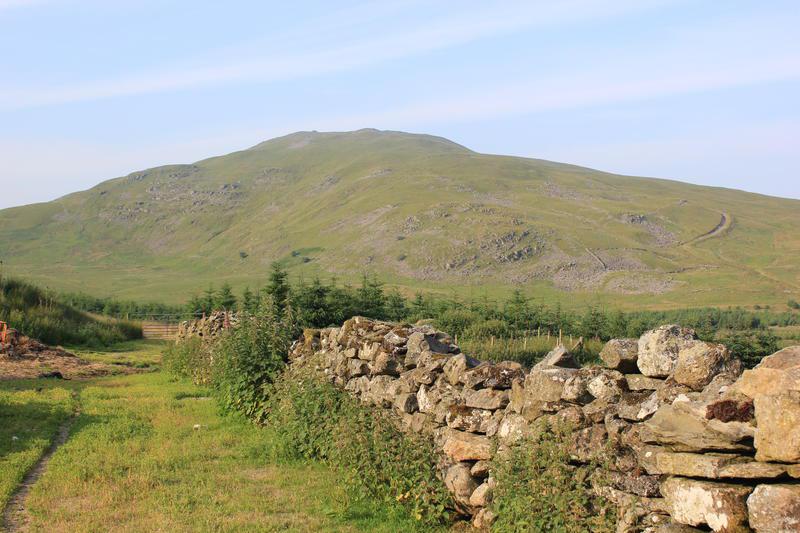
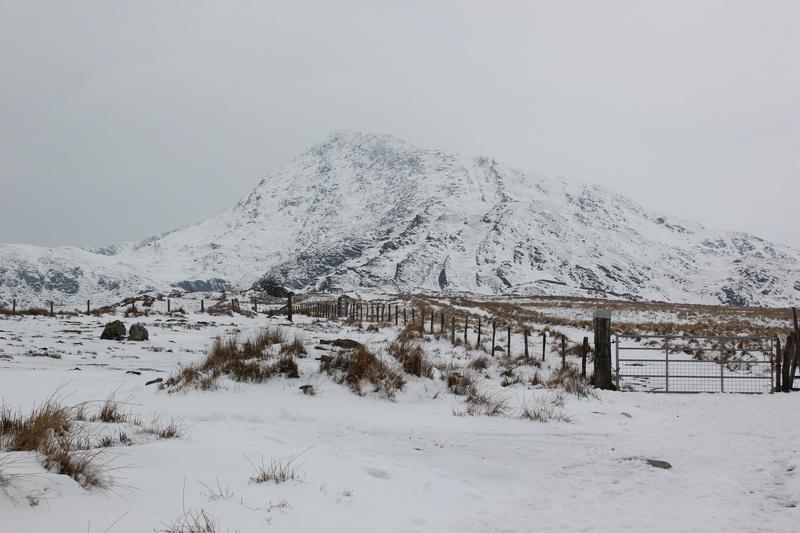
Tour Of Britain

#+BEGINHTML

Tour of Britain

As a keen cyclist I was pleased to hear that stage four of the Tour of Britain was passing within a couple of miles of where I lived. I decided that the best place to get a good view was outside the local pub, where the race had to negotiate a "T" junction. The race was due to pass the pub about 12:00pm, so I left home shortly after eleven on the 20 minute ride, to give my self plenty of time to find a good spot.

Even though we were in the depths of the Shropshire countryside there was a good turn out of spectators, many of whom arrived by cycle. I hadn't realized how much organization was involved in getting the Peleton safely along the route. Police motorycle outriders started arriving about 20 mins. before the riders. In all there must have been around 20 motorbikes ahead of the peleton.

Finally the lead breakaway group, which was about two and a half minutes ahead of the peleton arrived. I hadn't appreciated how fast the riders would be cycling. Even going round the T junction they were going so quickly that most of my photos were blurred. After the peleton zoomed past, I resumed my ride, getting in a very modest 20 mile round trip back home.

Arenigs Overnighter

Cotton grass on Arenig Fawr

Another short trip, starting late in the day to avoid the heat. I had done the same trip last year and enjoyed it so much, I decided to do it again! The original inspiration for this trip came from v-g excellent site.

Last time I had parked in the small pull in near to the start of the track leading up to Llyn Arenig Fawr. However, this left me with quite a bit of road walking on the second day. So I decided to park in the large area opposite the quarry at 830393, which meant I would get most of the road walking done at the start of the first day.

I left the car around 4:00pm and made my way to the start of the track. It is possible to follow the old railway track alongside the road, but you need to cut back to the road at one point and it seemed simpler to just walk along the road. The temperature was gradually cooling, but it was still very hot at around 25C. As I made my way up the track towards Llyn Arenig Fawr I met a couple of people descending. There was a group with a couple of tents just setting up, below the dam wall. I had a quick look in the bothy, as I had read that it had been vandalized recently. However, it seemed to have been repaired as it looked in good condition.

The cotton grass was out, making the large areas of grass look much more attractive. I also noticed what I know as "Cuckoo spit" - frothy white liquid attached to the blades of grass.

I filled my water bottle from the reservoir and began the plod up the slope leading to Arenig Fawr. Last time I had followed the path that contours all the way along the East face before finally gaining the ridge just below the summit of Arenig Fawr. This time I wanted to gain the ridge earlier by climbing directly up the grass slope on the right. This would give me god views both to the East and West as I climbed towards the summit. On my first attempt I left the path too early and ended up regaining it a bit higher up. However, I could now see the ridge line and on my second attempt got up onto the ridge. The heat had made the distant views hazy, but there was still a fine prospect of almost every peak in Snowdonia.

Summit camp on Moel Llyfnant

Reaching the summit of Arenig Fawr, I sat down next to the memorial to the crew of the B17 Flying Fortress, which had crashed on the slopes. There were several small wooden crosses and poppies beneath the memorial, presumably placed there on Remembrance Day. I am not really a fan of memorials on mountains, but there are certain historic ones that have been there for many years. It was good that somebody had gone to the trouble of placing the poppies beneath the plaque. I wondered if any of the airmen's families had ever visited this spot.

Sunset over Snowdon

It was now 6:00pm and I wanted to get to Moel Llyfnant before sunset. I set off down the South ridge towards the area of small lakes and grassy knolls. I needed to stock up on water. However, I expected the small stream on the western slope leading down to the col would be dry. I scooped some water out of one of the lakes into a Platypus and it had a distinct green tinge. There were no obvious sources of running water and I knew there were none on Moel Llyfnant. Luckily I had brought my Travel Tap. I don't normally bother purifying water in the UK, as there are usually ample supplies of clean water. However, I had anticipated a problem because of the recent dry weather and so had brought my Travel Tap along with me. I filled up all three one litre Platypus bottles from the lake before walking over to the corner of the fence that marks the start of the descent to the col below Moel Llyfnant.

As I expected all the little streams were dry, as was the normally boggy section at the col. The ascent to Moel Llyfnant is steep and unremitting, but not too far. I sweated my way up the steep grass taking a direct line towards the summit, popping out on the ridge only a few yards away from the cairn.

I camped on a small sheltered area close to the summit. There was just enough of a breeze to keep the insects away. After taking on board lots of fluid and a Hot Cereal Start, I sat by the summit cairn and watched the sun setting over Snowdon.

It was a very warm night and I slept with the doors open. Sometime after it went dark, I emerged from the tent to look at the stars. Even in the middle of the night I was quite comfortable in just shirt sleeves. I woke again shortly after 4:00pm. It was already getting light and climbing out of the tent I could see the sky glowing red behind Arenig Fawr. I got out the camera and took photos as the sun climbed over the shoulder of Arenig Fawr.

Just before the sunrise over Arenig Fawr

I had packed up by 7:00am and began descending the North Ridge towards the abanodoned cottage of Amnod-bwll. Last time I had retraced my ascent route back to the col and had bushwacked through long tussocky wet bog to the edge of the plantation, which was really unpleasant. The North ridge was much nicer, with short grass and no boggy bits. There are traces of a path, intermingled with lots of misleading sheep tracks. However, if you just head on a bearing towards Amnodd-bwll you will emerge onto a farm track near to the bottom of the hill.

Moel Llyfnant from the forestry track

From Amnodd-bwll I followed the forestry road. There comes a point near to the ruined buildings of Amnodd-wen where the track divides. I couldn't remember which branch I should take and set off down the left hand one. After a few hundred yards I could see that this was the wrong way and would bring me out much too far up the road, so I back tracked. The right hand branch of the path soon leads to a very boggy section next to a wall. Whichever way you choose is wet, even in the current drought conditions. After a short distance I reached a style beyond which the splash fest became a farm track. I descended past the farm and onto a recently made track above the railway line. This emerged onto the road only about a kilometre from the car.

Moelwyns Cloud Inversion

Tremadoc Bay from Moelwyn Bach

My son was doing his D of E Bronze expedition over the weekend, starting from Llandegla. The weather forecast was for hot and sunny conditions over the next few days. I didn't want to waste the opportunity for an overnight trip, but has to be back home at midday on the Saturday morning. However, we wouldn't be arriving at Llandegla until about 7:00pm, which left very limited time for me to drive into Snowdonia and get up to a summit.

Sunset at this time of year was 9:37pm. The closest mountains, the Arans, only about 30mins drive away. I had completed an Arans circuit a couple of weeks ago and didn't want to go back so soon. Finally, I decided on the Mooelwyns, which were about an hour and fifteen minutes drive from Llandegla. I would be completing about half the walk after sunset, but navigation was simple, just follow the ridge and at this time of year it never goes properly dark.

Nantlle Ridge and Moelwyn Mawr

I arrived at the car park in Tanygrisiau shortly before 8:30pm. I had packed my rucksack before leaving home, so all I needed to do was get out of the car and start walking. My plan was to walk up the reservoir road to Llyn Stwlan, climb Moelwyn Bach, descend back to the col and then climb Moelwyn Mawr where I would camp on the summit. I had done this trip in April last year, when I experienced a hail storm on my ascent of Moelwyn Bach and the summit was misted out.

Wandering up the reservoir road munching a cheese and onion sandwich, I met two groups of two people descending. I soon reached the dam wall and crossed the stream below it. I couldn't remember if it was easy to access Llyn Stwlan from this side, so I collected water from the outfall pipe below the dam. Once I had climbed the concrete steps at the far side of the dam, I would see that I could easily have collected my water from the lake, something to remember for next time.

Tremadoc Bay from Moelwyn Bach

The route from Llyn Stwlan follows a fairly direct line over semi boggy ground to the col between Moelwyn Mawr and Moelwyn Bach. I reached the col at around 9:25pm in time to see the sun setting. I dumped my sack and managed to get to the summit of Moelwyn Bach before the sun disappeared completely. I sat on the summit cairn and watched it disappear over the summit of the Nantlle Ridge and Molewyn Mawr.After taking some photos I retraced my steps to the col. I had left my sack in plain view near to the path. There wasn't anyone else about at this time and I didn't want to lose sight of it in the gathering gloom.

Sunrise over Moel-yr-hydd

The ascent of Craigysgafn involves a pleasant scramble. Much better than my last visit when this section was more like a winter climb, with the rocks covered in verglas and hail. The ascent to Moelwyn Mawr was much longer than I remembered and it was 11:00pm when I arrived at the summit cairn. Even though the sun had disappeared nearly two hours before, it was still light enough to see without a head torch.

Mist drifting around Moel-yr-hydd

I set up the tent on a patch of grass close to the summit cairn. As I had been climbing towards the summit I had noticed the valleys below me starting to fill with cloud. I made a hot drink and some porridge and it was nearly midnight when I go into my sleeping bag. At around 4:00am an attack of cramp had me hopping about outside the tent. The sun was due to rise shortly after 4:30am, but already there was a red tinge in the Eastern sky. All the surrounding valleys were full of mist, with the odd sliver blowing over the summit. Only the tops of the mountains were visible.

I crawled back into the tent and watched the sun rising through the door. As the sun started to come up, the fragments of mist on the summit dispersed and I was treated to the best inversion I have seen in Wales. I sat outside the tent for a couple of hours watching as the heat of the rising sun made caused the mist in below to swirl and change shape.

Early morning light on Moelwyn Bach

I packed up around 7:00am and began to make my way downwards and over to Moel-yr-hydd. By the time I had reached the summit the heat of the sun had caused the mist to rise although, Moel-yr-hydd was still clear. I descended into the mist towards the old quarry workings. Eventually some old buildings appeared out of the mist and I followed a path. However, this ended on top of a steep slope of slate scree. Not wishing to scramble down, I back-tracked to the buildings and found the track that leads down through the various levels. I soon dropped below the mist and enjoyed a pleasant walk through Cwmorthin back to the road. I drove the short distance to the lakeside cafe for a second breakfast.

Arans

Craig Cywarch

Finally a period of sunny weather. I had wanted to get out for an overnight trip, but the weather had put paid to any trips so far this year. After dropping the children off at the school bus I set off for North Wales. I still hadn't decided exactly where I was going, but on my way over the A5104 made up my mind to have a go at the Arans traverse and camp on Glasgwm. This was a trip that I had been thinking about for some time, as I had never climbed Glasgwm. After several trips over the Arans in indifferent weather, I had wanted to save the circuit for a settled period of fine weather.

The plan was to park in Cwm Cowarch, then walk up Hengwm and over the summit of Aran Fawddwy followed by a crossing of the boggy along the boardwalks and then a final pull up Glasgwm, where I would camp next to Llyn y Fign. The next morning I would follow my route of ascent back to the path leading down into Cwm Cwyarch and so back to the car park.

Aran Fawddwy and Craiglyn Dyfi

I packed my rucksack and emptied a bottle of flavoured water into one of my Platypus bottles. I set off from the car park shortly after 11:00am heading for Hengwm. Just after I had crossed the stream a few hundred yards from the car park, I realized that I had left the Platypus with the flavoured water in the car. Rather than go back for it, I filled another Platypus up from the river. This wasn't really enough water for the whole day, but I thought I would be able to get more water higher up.

Memorial with Cadair Idris in the background

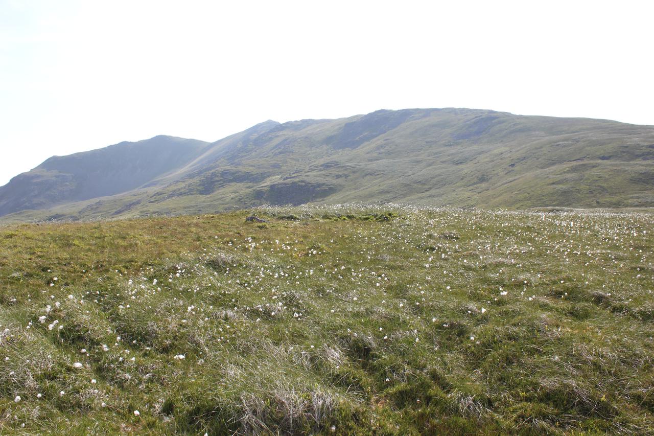
Walking up Hengwm I was in the shade, which made for pleasant walking 
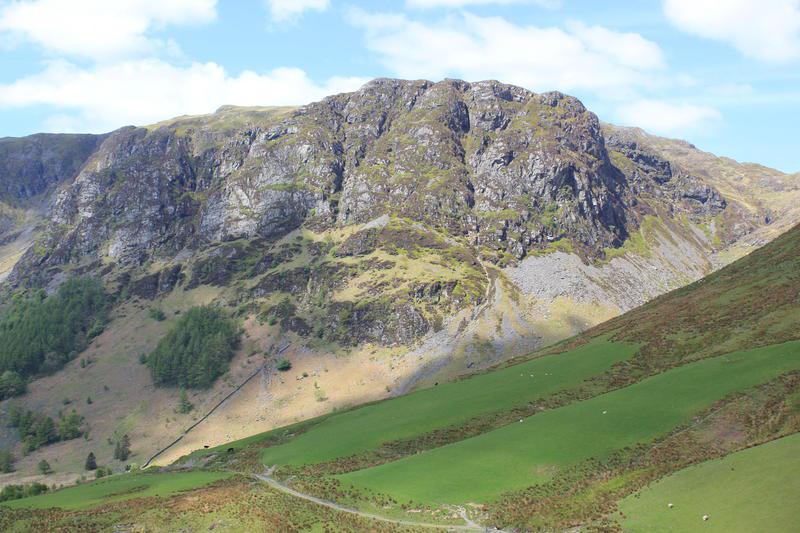
as it was very hot in the sun. On the far side of the valley I had a perfect view of Craig Cwyarch, with its great rock climbs like "Will o' the Wisp" and Acheron. Cresting the slope up to the col, I decided against plodding through the peat hags to visit the top of Waun Goch and struck out up the slope towards Drysgol. When I reached the memorial at Drws Bach I stopped for a drink and ate the slice of Victoria sponge I had brought with me. The summit ridge of Aran Fawddwy was completely clear and there were great views over the steep East face and down to Craiglyn Dyfi, where I had pitched the Voyager Superlite last year for the first time in pouring rain.

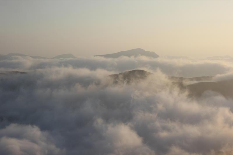
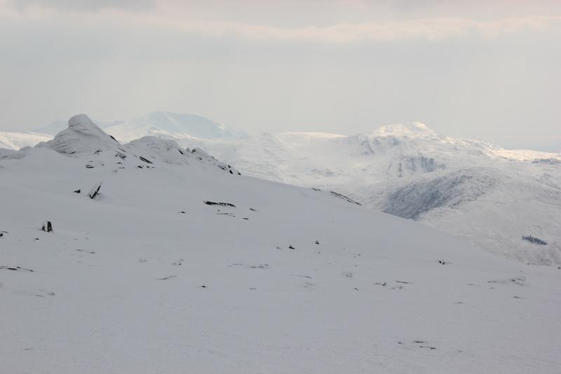
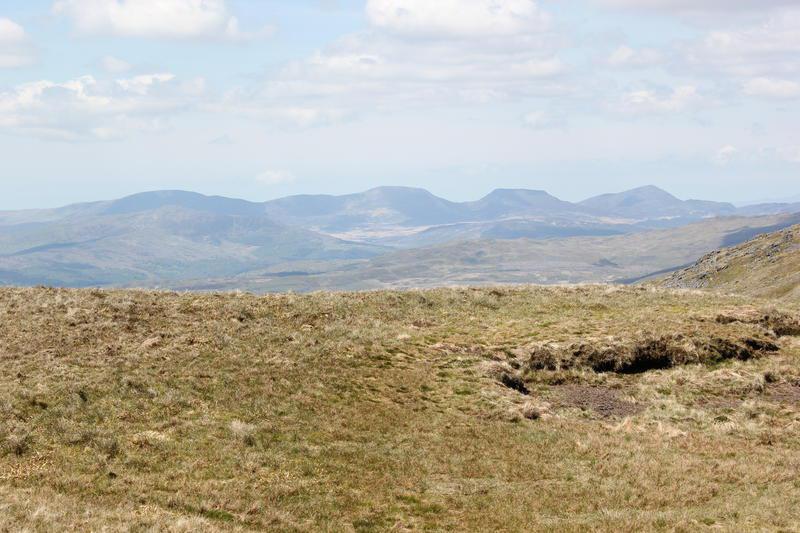
Rhinogs in the distance

After a short rest, I continued up towards the summit of Aran Fawddwy. On the way I crossed a ladder style and noticed a small plaque with the OS grid reference on it. On the rest of the walk I saw that every style now had one of these plaques. I can't help thinking that putting these everywhere is destroying the remoteness that many people seek in the mountains. There was someone resting near to the cairn who said that he was reccing a walk he was planning to lead at the wearing the weekend. After he left I got out my lunch and ate it with my feet dangling over the drop above Craiglyn Dyfi. I thought that there would be pools of water around the summit, but I could find any. I new that there were several big pools near to the summit of Aran Benllyn. However, I was too lazy to walk the extra distance to Aran Benllyn and thought I would be certain to find more water before my ascent of Glasgwm. This turned out to be a bad decision!

OS grid reference on a ladder style

When I had finished lunch I started to make my way back down the summit pyramid to join the fence that would take me to the bottom of Glasgwm. I could see the cairn on the summit clearly, but knew that it was a fair distance to walk before I reached the final slopes up to its summit. Just after I crossed the ladder style at the start of the fence, I met another man who was sitting admiring the view. In the whole day I only saw three people.

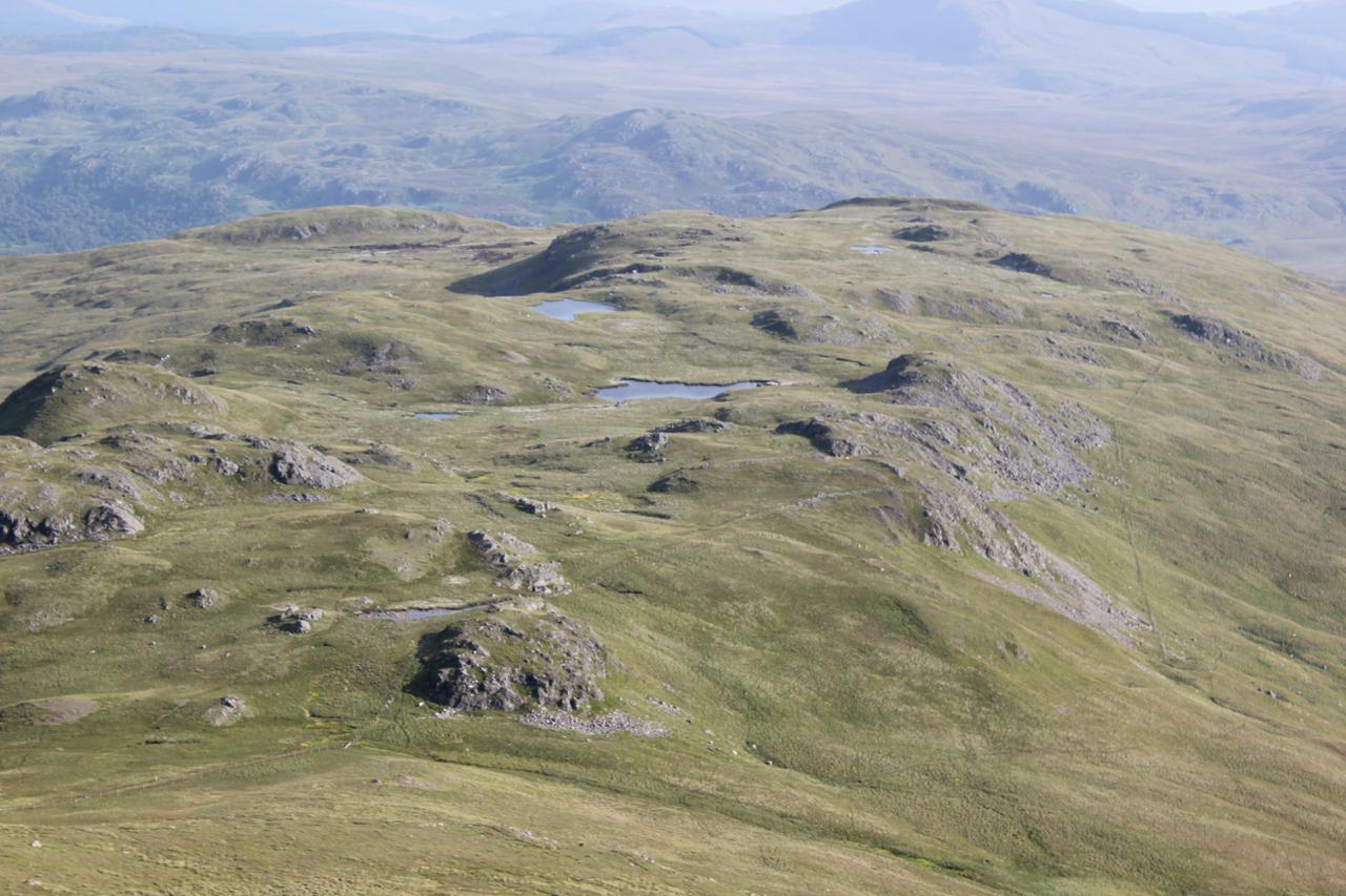
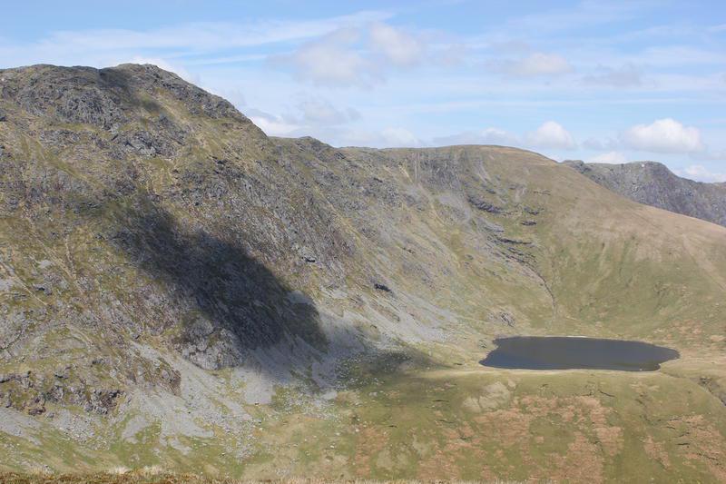
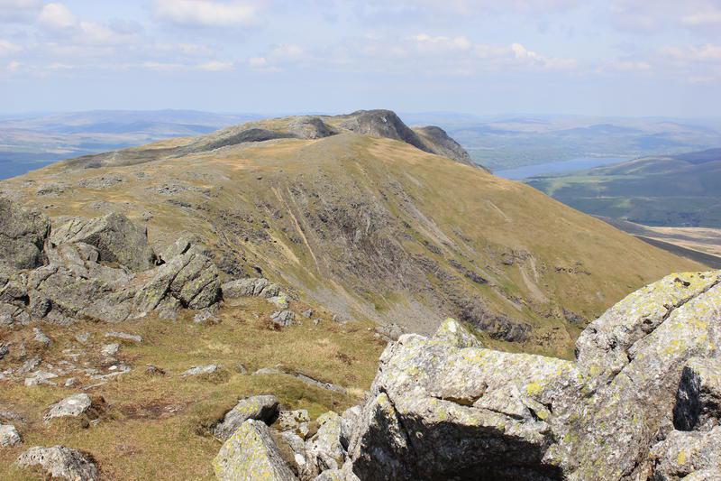
Aran Benllyn from Aran Fawddwy

Luckily the ground was fairly dry, with only a couple of the boarded sections over the bogs covering significantly wet sections. It seemed a long way to where the path met the one coming up from Cwm Cywarch and I didn't find any sources of water to replenish my supply. By the time I reached the slope that leads up to Glasgwm, I was feeling a bit dehydrated. Foolishly, I didn't walk the extra couple of hundred yards to find the start of the stream that flows down to Cwm Cywarch, but started off in the opposite direction to find the path that climbs up Glasgwm.

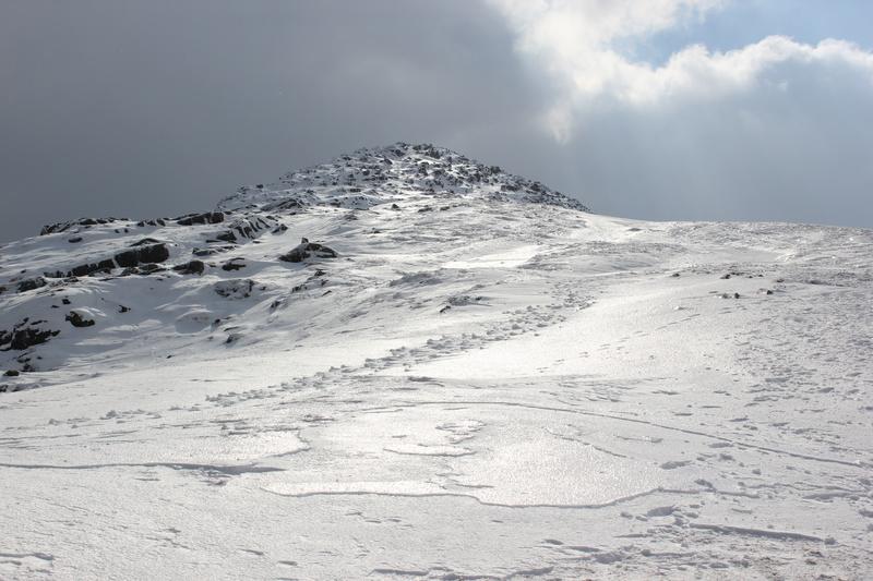
The ascent of Glasgwm was a steep pull. The path follows the fence almost all the way, with a steep scree section just below the 
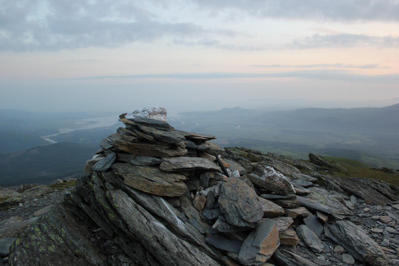
summit. Finally I saw Llyn Bach and the summit cairn. Sitting on the cairn I could see Llyn Figyn just below the summit.

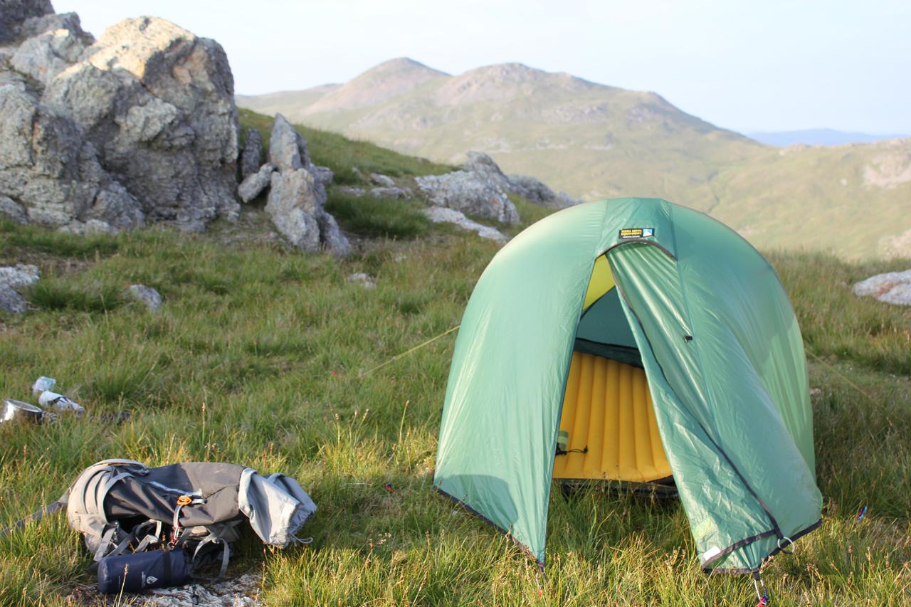
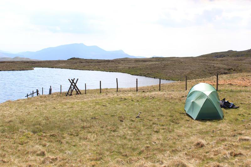
The first job was to go straight down to the lake and drink lots of water. Once I had rehydrated, I looked around for a camp site. There was a perfect flat grassy patch that was near to the ladder style. I soon had the tent pitched and lay down inside to escape from the sun for a few minutes and rest.

Tent near Llyn Figyn

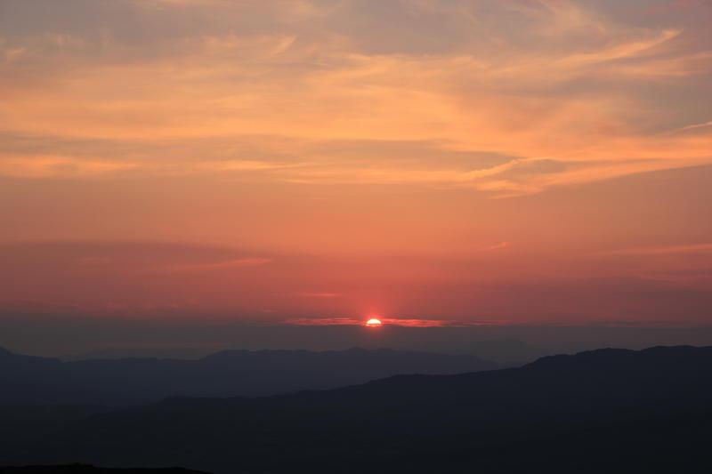
There was plenty of daylight left, so once I had eaten tea I set off around the summit to explore. Although it had been a warm day, there was very little haze. There was just enough breeze to keep the insects away. I was quite tired, but wanted to get some pictures of the sunset, which was around 9:30pm. Shortly after nine I got out of the tent and wandered around taking photos. Finally I sat next to the 
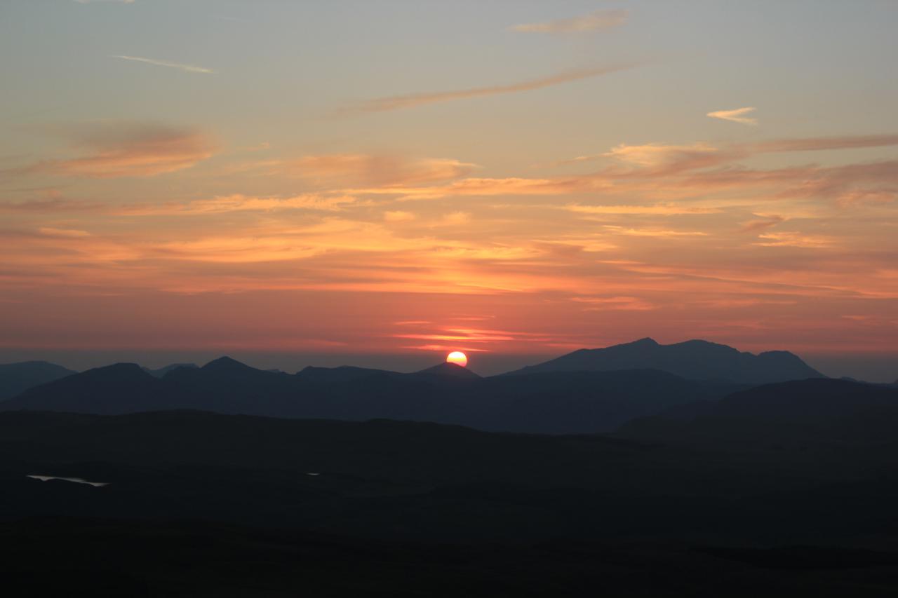
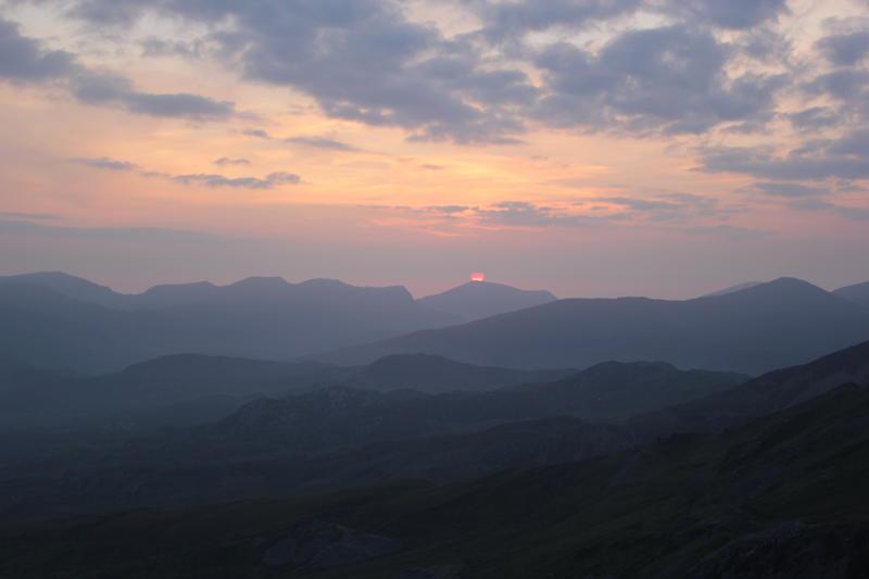
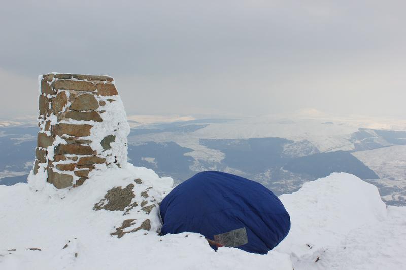
summit cairn and watched the sun drop below the horizon.

Sunset

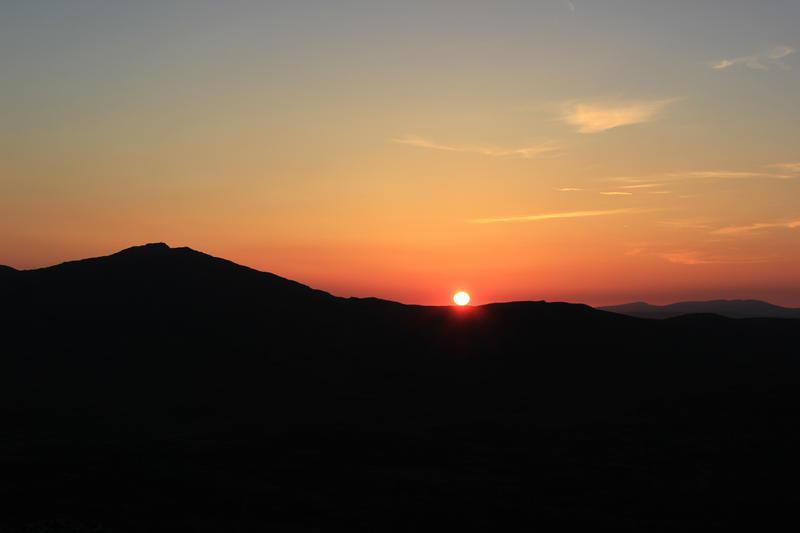
Crawling back into the tent, I fell asleep almost immediately. When I woke up it was light. Glancing at my watch it was shortly after 
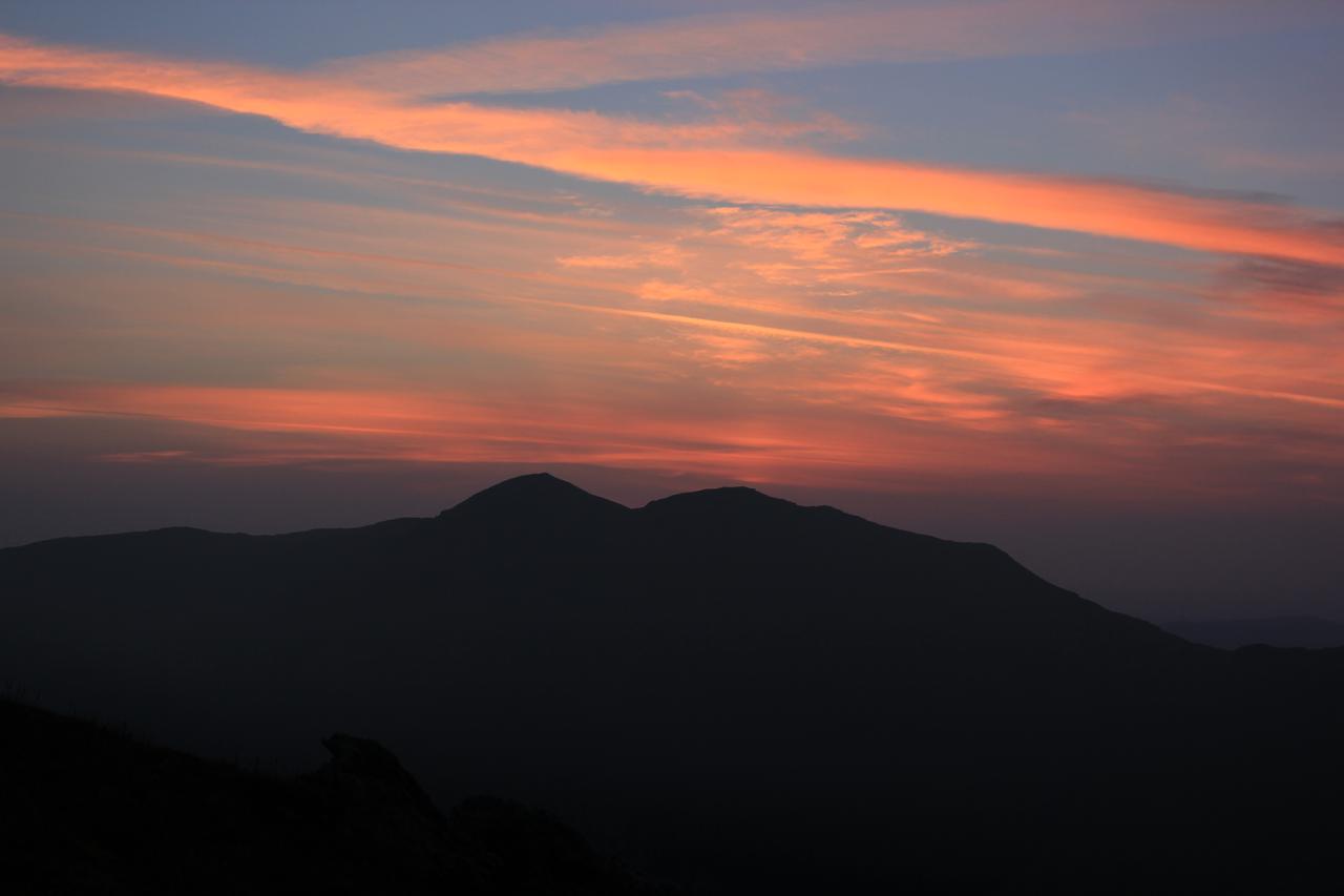
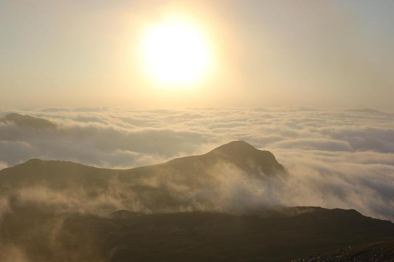
5:00am. I had wanted to get some pictures of the sunrise, which was just before 5:00am. Scrambling out of the tent I was just in time to get some photos of the sun rising over Aran Fawddwy.

I made some breakfast with Mountain Trails excellent porridge and began to pack up the tent. I didn't want to be late back and it was obviously going to be another hot day, so I was packed up and ready to descend shortly after 6:00am. Taking my time, so I could enjoy the 
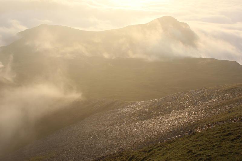
views I retraced my line of ascent along the fence. I enjoyed the steep descent into Cwm Cywarch. The sun was beginning to illuminate the valley and the shadows formed as it rose were making all sorts of interesting shapes over the valley. Lost in my own thoughts I walked straight past the car park, not realizing my mistake for about a quarter of a mile.

Sunrise over Aran Fawddwy

It had been a memorable trip. Perfect weather, a perfect wild camping spot and almost deserted mountains.

I made some porridge for breakfast and began to pack up the tent. I didn't want to be late back and it was obviously going to be another hot day, so I was packed up and ready to descend shortly after 6:00am. Taking my time, so I could enjoy the views I retraced my line of ascent along the fence.

Cross Fell

I was staying with the family near to Appleby for a few days. The cold clear weather of the last few weeks looked set to continue for a few more days at least. I wanted to get out and walk up something, but only had half a day to spare. I could see Cross Fell over the other side of the valley and I can't remember when I was last up there, so a return visit seemed in order.

I hadn't got a map, but my brother-in-law kindly lent me one. Also, as I hadn't planned on doing any high level walking, I didn't have any winter kit with me. From what I could see from down in the valley most of the snow had been scoured off the slopes by the wind, so I hope I could make my way round any patches of hard snow or ice. I drove over to Culgaith and looked at my map to see how I would get to Kirkland where the walk started. This was when I discovered that my brother-in-law had given me the wrong map! A quick trip to Penrith and a wait until 9:00am, when WH Smith opened, solved this problem. However, it meant that getting back by 2:00pm was going to be hard.

I parked up next to the church in Kirkland and consulted my new map about the fastest route to the summit. I had enough clothing to keep warm, but only my Inov8 Roclite's

Moel Siabod In Winter

I had wanted to do an overnight trip to North Wales for some time. I am not keen on camping in the Winter months, as there is so little daylight and I don't really want to spend 12-14hrs in the tent. However, it's now light until about 7:00pm and sunrise is around 6:00am. This spring has seen an unusually cold spell of weather with the tops returning to true winter conditions, as temperature remained below freezing for many days.

Moel Siabod from the Farm Track

I decided on a trip up Moel Siabod because I wanted to use our new DSLR to take some night time photos and do a series of time lapse sunset and sunrise pictures. The weather forecast seemed good with predictions of clouds above the summits, but temperatures around -6C at 800m.

I dropped my son off in Chester and continued round the A55 to Llanberis. Since my mountaineering boots have worn out and I only have crampons suitable for B3 boots, I needed to get something suitable for my Meindl walking boots. Rather than buy another pair of crampons I decided to get some Kahtoola Microspikes . These were duly purchased from V12 and after a quick sausage sandwich in Pete's Eats I set off for Capel Curig.

Final section up to the summit

There was a sign and barriers at the bottom of the Pass saying the road was closed. However, it looked fine to me and there as traffic coming down. The road was clear but either side of the top of the pass there were diggers clearing old drifts. I just followed the gritter and had no problem getting through.

Parking near the North London Club hut I began to sort out my rucksack. I had quite a bit of extra gear, including an ice axe the DSLR, a tripod and an extra lens. Luckily, everything just fitted into my POD black ice. It was above freezing in the car park, but once I walked up the track to the farm it was back below freezing. I had hoped to collect water from one of the lakes or a stream, but everything was frozen solid.

Looking towards the Moelwyns

Rather than climb the Ddear Ddu ridge, I had decided to climb the steep slope at the end of the farm track, which is my normal descent route. This has a couple of steep sections up onto the main ridge. I stopped half way up the first of the steep sections to put on the Microspikes. These turned out to be an excellent buy and coped with varied conditions I encountered including iron hard neve and water ice. After what seemed to be a long pull, I reached the ladder styles at the start of the summit ridge. There was a very cold wind blowing from the East, but the effort of dragging a heavy sack uphill had kept me warm. The easterly wind had deposited loads of snow in the lee of the ridge. There was a hard crust on top, but I broke through every few steps, which made for very slow going. I crabbed my way round the summit ridge until the summit trig point came into view. Just below the summit, I spoke to a few people who were descending and when I got to the trig point there was someone in a bothy bag next to it. I moved over to the stone shelter, which was slightly less exposed to the wind and ate some cake.

Looking back along the summit ridge

I had a quick look at my flat camping spot overlooking just t the north west of the summmit. The snow wasn't too deep there, but there was quite a bit of spindrift blowing about. Since I didn't have any water, I would have to melt snow and the nearest convenient big drifts would be some way from the tent. I hadn't felt too well on the ascent. Although the cloud was well above the summits there was no sunshine, which made for very flat contrast and there wouldn't any opportunity to photograph the stars. As it was only about 3:30pm I would have plenty of time to descend if I wanted to.

Sheltering in a bothy bag on the summit

After considering the options for a while, I made the decision to descend and began to retrace my tracks. Almost immediately I experienced a pain in my right hip, which was both sharp and nagging. Although I had fallen over a couple of times and my legs were suffering from the effects of keeping breaking through the crust, I couldn't recall anything specific that would cause the pain. As I ploughed on downwards I had to take frequent rests. The microspikes worked brilliantly on the steep descent and at no time did I feel insecure. I had another long rest when I reached the farm track and at increasingly frequent intervals on the way down. Finally I reached the car, where I made myself a hot drink.

The hip didn't hurt if I was stationary, but only when I walked. After a two hour drive home, I could barely hobble into the house. Luckily after a nights rest it seems to have improved, so I think it's probably just muscular.

Moel Famau

My son is doing the Duke of Edinburgh Bronze Award this year. He had a training day at Moel Famau, so I thought I would take the opportunity to go for a walk. The weather was looking good, with clear skies forecast all day.

We arrived at the car park around 9:45am and my son went off to join his group. I decided that I wanted to traverse the ridge to Moel Arthur and then make my way back along the valley to Cilcain and back over Moel Famau to the car park. However, I wasn't sure if I would have enough time, as I only had around 5hrs before I needed to be back.

Jubilee Tower Moel Famau

As I climbed up the track towards the monument, I could hear the wind blowing through the trees. There was an icy cold wind blowing around the monument and I went round to the lee side to shelter for a few minutes. I had a brief chat with someone while I sorted out my gear and found my gloves. As usual there was quite a crowd round the monument, one of the reasons I don't come here too often as I prefer to have the hills to myself. However, once I started off along the ridge I soon left the crowds behind.

View along the ridge

I could make out a snow covered mountain in the distance, but it was slightly hazy and I couldn't see any other mountains which would help me to identify it. This was a bit of a disappointment, as I had lugged the telephoto lens up with me in the hope of getting some decent long distance shots. I fell into conversation with a man whose son was currently doing the silver D of E award. We chatted for a while and then he set off down towards the pub in Cilcain. The wind varied in strength on different sections of the ridge and I was being really buffeted on certain parts. I reached the start of the drop down to the road around 11:30am, so I had plenty of time to go over to Moel Arthur, as I didn't have to be back until around 3:30pm.

Crossing the road, I took a direct line up to the summit Moel Arthur where there is a small pile of stones marking the top. I couldn't see any sign of the ancient hill fort. I decided to eat lunch on the summit event though it was windy and there was no shelter. I sat with my back to the wind, but one big gust blew the hot chocolate out of my cup.

Moel Arthur

I decided not to bother trying to return along the valley to Cilcain. The last time I had done this route the path was unclear in places and I had to negotiate a high sheep fence on the edge of a steep bank. Also, I much preferred being up on the ridge than down in the valley. In any case the views are always different if you do the walk the other way round!

Rather than follow my direct line of ascent on the way down, I stuck to the path that initially heads off NE and then contours back round the hill down to the road. Once back on the main ridge, I was walking directly into the wind. I stopped for another drink and Kit Kat by the cairn at SJ 1502963255. The wind was very strong on this part of the ridge and the cairn provided only partial shelter. I was soon back at the monument and retrace my route of ascent back to the car, arriving about 2:30pm in good time to meet my son.

Cairn: OSGB36 Grid ref: SJ 1502963255

Fire Steel Disappears Into A Pile Of Dust

After my walk over Moel Famau and Moel Arthur I was looking forward to making a hot drink. My brew kit lives permanently in the boot of the truck, so I don't forget to take it with me! I unpacked my Primus Gravity stove from its pouch and connected up a gas cylinder.

I use a Light My Fire Swedish Fire Steel rather than matches or a lighter. This will generate a spark under almost any conditions and doesn't run out of gas, or refuse to light when soggy, like lighters and, matches. I keep it in a small zipped section of the pouch that the stove lives in. I pulled it out, so I coud light the stove and noticed that the steel was now only about half an inch long! I thought that it must have somehow got broken, but looking inside the pouch there was nothing but a pile of grey dust. Luckily there was just enough left to generate a spark and light my stove.

When I got home I spent some time Googling and found that other people had had similar problems: here and there was a possible explanation . It would appear that contact with inorganic salts and water can make the fire steel, which is made from an alloy called Ferrocerium, can act as a battery. This results in the fire steel corroding away. The bag containing my steel may well have been slightly damp, but as far as I know it hadn't come into contact with any salt solutions unless something spilt on the bag had soaked through.

Anyway, lesson learned. Always check your fire steel before setting out. Even something you think couldn't possibly fail can do so in an unexpected way.

Connemara

The West coast of Ireland is great for cycling. The coastal scenery is spectacular and the roads are quiet. This circular route takes the ??? peninsula just south of Clifden. It's worth noting the wind direction before starting out, as it can often be quite breezy and a bit of advance planning will minimize the distance you are peddling into the wind. This was to be a family ride.

We parked in a layby just outside Ballyconneely, but there are numerous parking places all around the route. In fact you could easily start from Clifden. We decided to cycle anti-clockwise, which meant that on the day the first part of the ride was into the wind. As is often the case in Ireland, the weather was fickle and there were frequent sharp showers. We had planned to stop at one of the beaches before we reached Roundstone, but decided to press on. Shortly before Roundstone there is a bit of an ascent, followed by a nice long descent to the beach at Gurteen Bay.

The girls were getting fed up of peddling into the wind and getting soaked on a regular basis. We agreed that they would stop in Roundstone and I would continue around the rest of the loop and fetch the car. I set off only pausing in Roundstone to buy some chocolate. The town is in idyllic spot next to the sea.

I thought that the section of the ride from Roundstone was the highlight. After following the road along the coast you take a left turn and climb up over the moors of Roundstone Bog. There are great views of the Twelve Bens to the North. The ground either side of the road is very boggy and there are hundreds of small pools. This section of the ride is very exposed and wouldn't be a good place to be in really bad weather. The wind was now behind me, which only increased my enjoyment of this section of the ride.

Soon I reached the junction with the main road from Clifden. Shortly after you rejoin the road, you can follow a track up to the left, which takes you to the Alcock and Brown landing site. THey were the first people to fly over the Atlantic and given the nature of the terrain it's amazing that they weren't killed on landing. The track takes you up to the site of the old Marconi radio station and a large concrete obelisk commemorating the flight. The actual landing site is about 500m from the obelisk. If you want to visit it, be prepared for some bog trotting and wet feet.

I cycled back along the track to rejoin the main road and was soon back at Ballyconneely. By the time I had driven over to Roundstone the girls had set off and I caught up with them just as they turned off to Roundstone Bog.