C2c Day One

I left Chestnuts around 8:30am and cycled down into Whitehaven. I cycled down to the harbour, but didn't bother going all the way along to the C2C sign. The initial section out of Whitehaven is fairly grim. The cycling is easy, but the route goes through several housing estates and the path is littered with large collection of dog turds and broken glass. Luckily this section isn't too long and I was soon following the old railway line. The off road sections are almost all on tarmac so fine on a road bike. There was a short section of rather bumpy track just before Rowrah which would be unpleasant on a road bike if it was very wet.

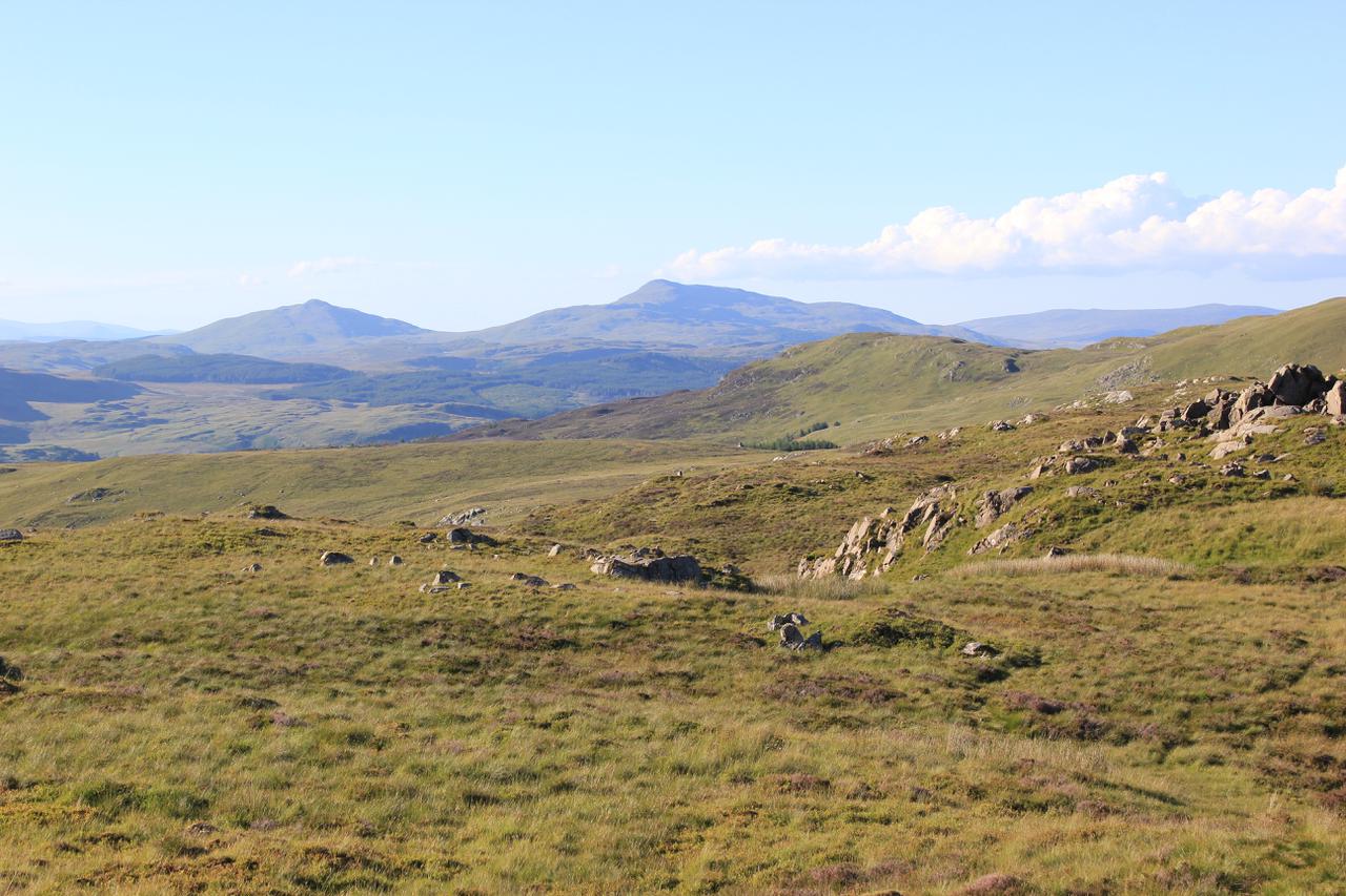
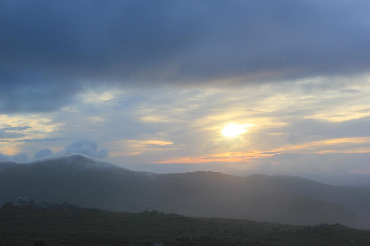
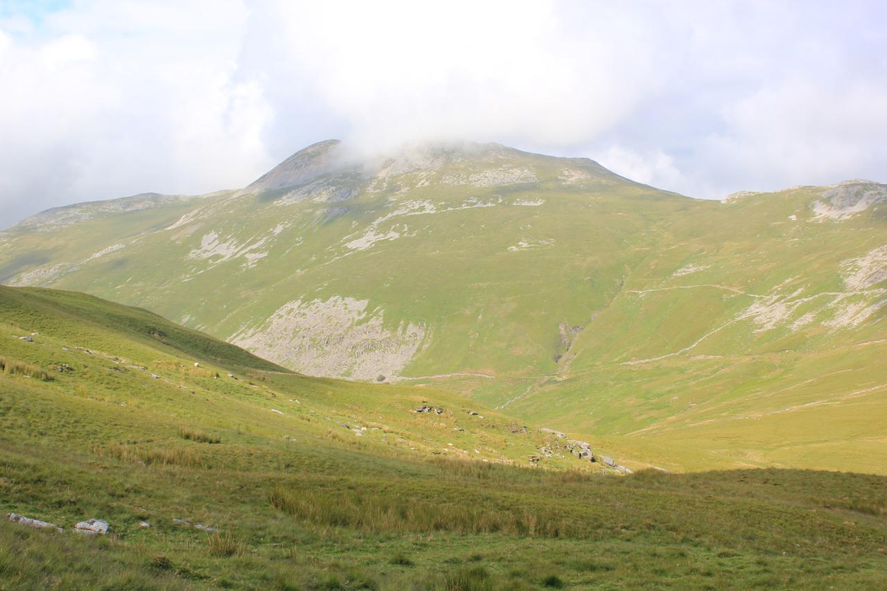
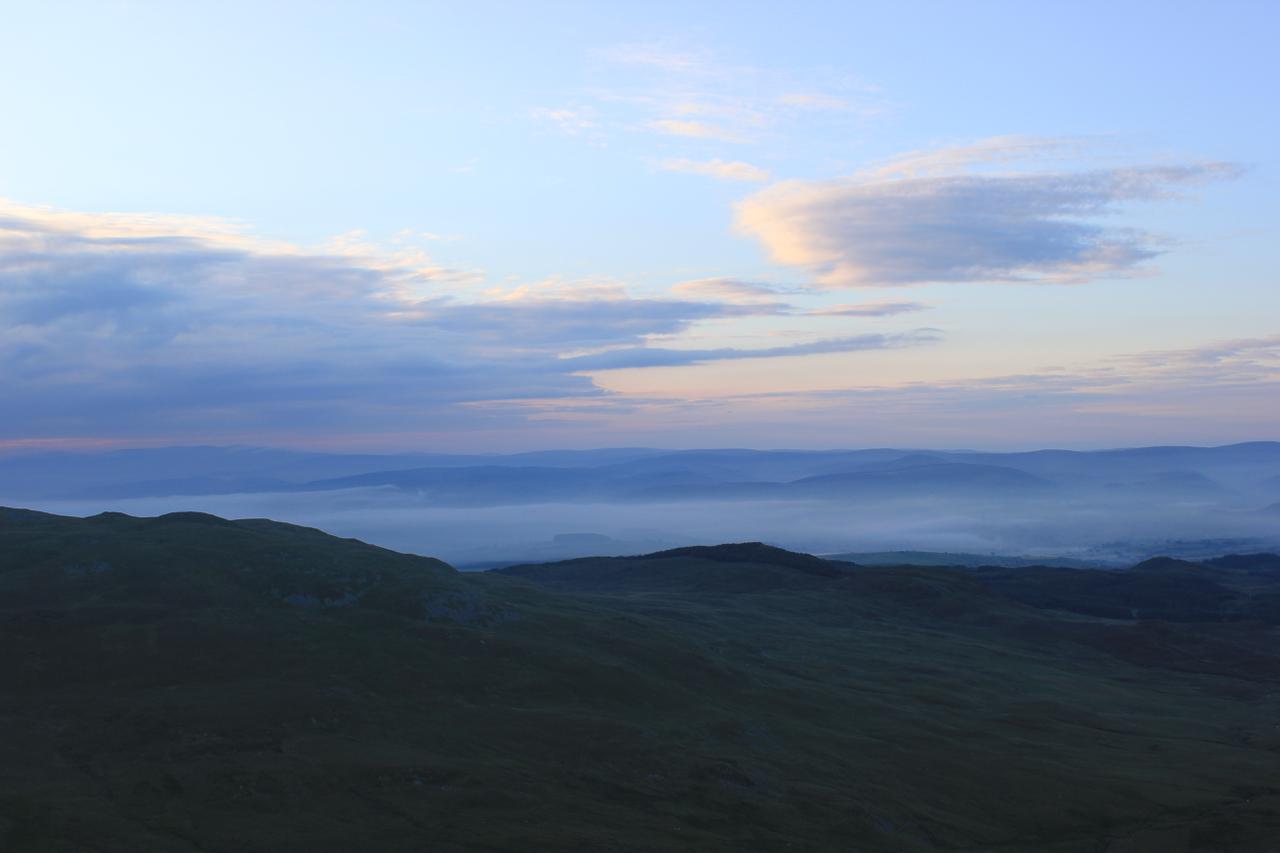
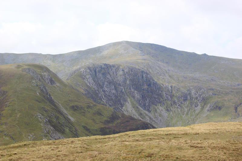
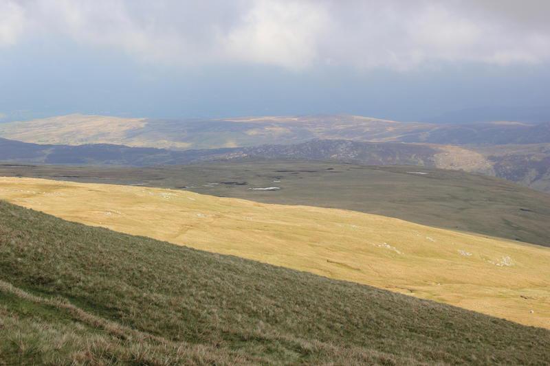
Bassenthwaite from near Cockermouth

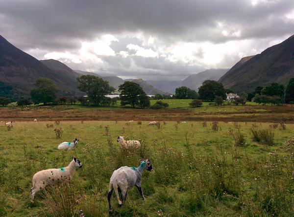
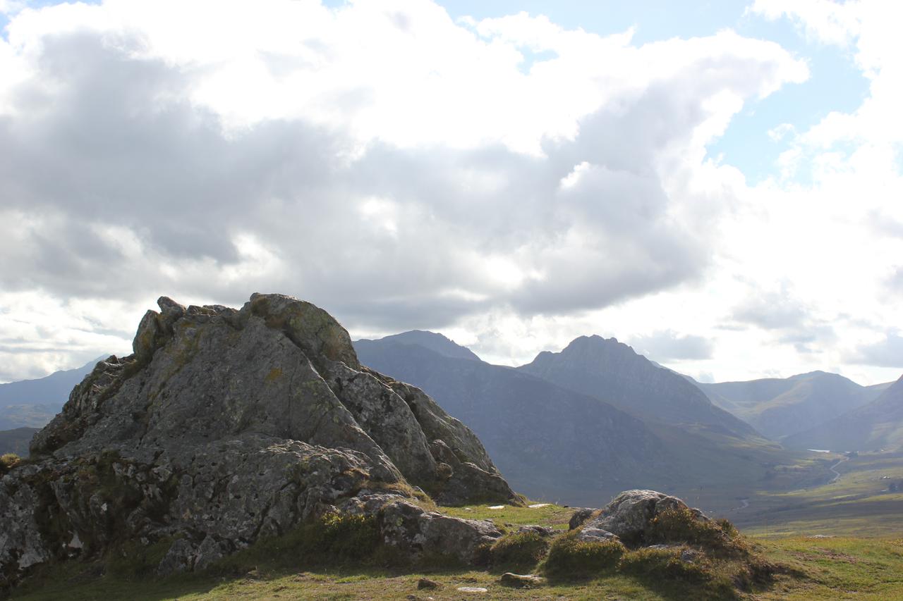
The weather, which had been fine for weeks looked decidedly dodgy. The day before the tail end of a hurricane had passed through. The fells in front were covered in cloud and there was a very strong wind. Luckily the wind was blowing from the west, so was in fact a big help!

There is a stiff climb out of Kirkland, but the extra altitude gives you great views over the surrounding countryside. There is a pleasant downhill section to Lamplugh, with a stiff climb at the end. I was headed towards Loweswater, but the view of the lake is obscured by Burnbank. After a downhill section to Waterend I could finally see the lake. The road follows Loweswater, with some minor ups and downs until you reach the village. I headed towards Brackenthwaite along a narrow road with plenty of ups and downs. At the village of Low Lorton there is a very steep section. Thankfully it's short and it deposits you at the bottom of the Whinlatter Pass.

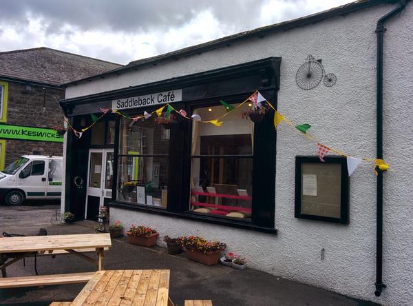
Saddleback Cafe Keswick

The climb up Whinlatter isn't to bad and there is a Visitor Centre at the top, which I didn't bother visiting. I stopped i one of the car parks to chew through an oat bar and have a drink. I realized how cold and windy it was, as in about five minutes I went from an overheated sweaty lump to a shivering lump! I can't really see the point of following the forestry track, which looks steep and loose. The road is fairly quiet. It is very steep in places, so you need to keep a check on your speed and make sure that you can make it round the next bend, without colliding with an oncoming car. At the bottom I crossed a small suspension bridge over the Derwent. A short section along a railway track emerged next to the A66. There is a good cycle track alongside the road. It was on this track that I experienced the only puncture of the trip. There was an explosive bang and the rear tyre went flat instantly. I couldn't find anything that might have caused this to happen and there was nothing stuck in the tyre. I had soon fitted a new tube and continued the short distance into Keswick.

Keswick reminded me why I don't visit the Lakes anymore. It took about five minutes before there was a break in the traffic, so I could cross the road. The town itself was absolutely ram packed full of people and almost every shop was some sort of outdoors emporium, with almost no real shops.

A proper doorstep sandwich

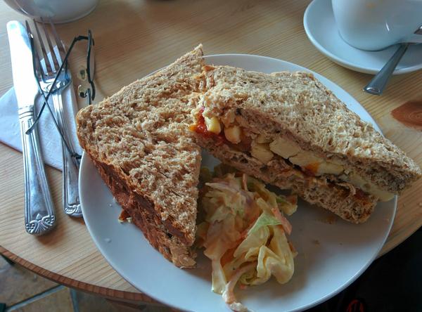
I still had one spare tube, but I bought another at KeswickBikes. While I was there I bought a Cateye rear light, as my son had commandeered mine for his bike. I wasn't expecting to be riding in the dark, but having some sort of highly visible light in case of heavy rain, or poor visibility is always a good idea. I settled into the Saddleback cafe, which is next to Keswick Bikes. I had a "proper" cheese and pickle doorstep wedge sandwich. While I was eating it, the heavens opened and rain poured down. Fortunately, by the time I had finished lunch the rain had blown over.

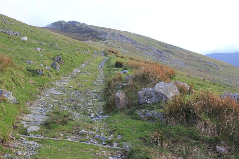
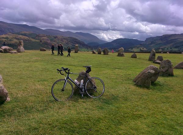
I made my way slowly through the centre of Keswick, which given the amount of traffic was probably the most dangerous part of the journey. I arrived at the bottom of the steep series of climbs up to Castle Rigg Stone Circle. On one section I was going so slowly that I was overtaken by a runner. Oh the shame and embarrassment! Finally I made it to the stone circle, where I stopped for a rest. A few years ago we had visited them with the children on a ride that went out of Keswick along the old railway track and returned past the stone circle.

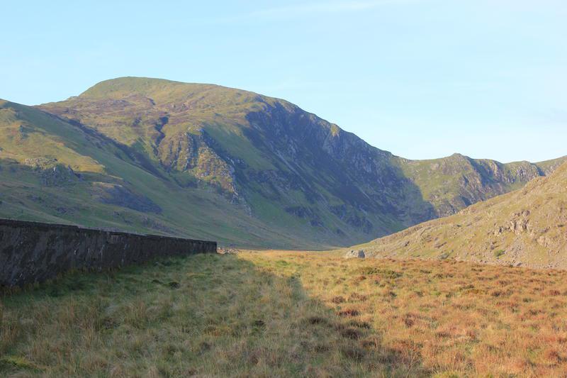
I made a mistake shortly after the stone circle and turned left too soon. This brought me out on the A66, with no option of avoiding cycling along it. Fortunately I didn't have to cycle back too far to get on the right route, which brought me out near Threlkeld. Past Scales the road turns north on a narrow lane leading to Mungrisdale. The lane had plenty of gates, so every time I got into a nice rhythm I had to get off to open and close a gate. Although Mungrisdale is a pleasant enough place, it seems as if the C2C deliberately chooses to meander about when a more direct route is possible. I kept seeing signs on the A66 telling me that Penrith was 10 miles away, but I ended up cycling nearer 20! After another long meander through Greystoke (home of Tarzan), it was finally time to drop down into Penrith.

I made straight for Morrisons, where I had a large Bakewell tart and a pot of tea. I received a text from my son, who is a lot fitter than me and had arrived some time before. I was staying in the Travelodge on the A66, where my wife was going to join me. I was a bit worried how I was going to get there, as I really didn't fancy cycling down the A66. Luckily, there is a cycle path that leads alongside the A66 directly to the Travelodge.

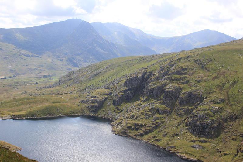
Castlerigg stone circle

The Travelodge had recently been refurbished and had decent size rooms, pleasantly decorated. Travelodges can be cheap to stay in, but recently seem to have been involved in a race to the bottom to cut facilities and maintenance to the minimum to save costs. However, I would be happy to stay in the Keswick one again! We had tea in the Little Chef next door - I thought these were extinct.

I was happy with my performance on day one. I hadn't found the ride hard and wasn't particularly tired.

Crimpiau

Path up to col above Llyn Crafnant

Two of my three children were away, so Anne and I decided to take our remaining daughter for a couple of days in North Wales. Neither of them like camping, so we stayed in the bunk room at the Bryn Tyrch in Capel Curig.

We arrived late afternoon and since it looked as though it was going to be a fine evening, so I decided to walk over Crimpiau. I did this walk with my son three years ago the last time we stayed at the hotel. However, I had forgotten to bring either my camera or phone, so wasn't able to take any photographs. This time I made sure that I had both of them with me!

Llyn Crafnant from Crimpiau

Anne and Hannah wanted to go to Joe Browns in Capel Curig. I walked up with them and then crossed the style to start up the path towards Llyn Crafnant. The last time I had done the walk the weather had been quite drizzly, but today there were large patches of blue sky and broken cloud. It was about 4:30pm and we had booked dinner at the hotel for 7:00pm. I couldn't remember how long the walk had taken last time, but thought I would be able to get back for seven. In the event this was a bit optimistic and it was about 7:20pm! As anyone who has walked with me can testify, I have never really planned how long a walk takes. My stock answer is always "It will take as long as it takes". I just have an overall plan of what I want to do. On multi-day walks I just continue until I find somewhere nice to camp, I am too tired or it goes dark.

It seemed a long way to the col above Llyn Crafnant. It's not possible to see the lake from the col, so I carried on to a high point on a small spur that overlooked part of the lake. There were good views over to Creigiau Gleision. The last time I had climbed it was about 30 years ago in driving rain. I can remember it had lots of false tops and was boggy and heathery. I keep meaning to go back and climb it in good weather, but somehow have always been distracted by its nearby neighbours.

Tryfan and Bristly Ridge from Crimpiau

I returned to the col and began the climb up Crimpiau. It's not possible to tell exactly where on the ridge the summit is from below, so I just followed the most obvious path hoping it would get me there. It seemed a long way before a final short steep pull landed me next to some rocks. These seemed to be the highest point on the ridge, although unlike most other Snowdonia peaks there was no cairn. From the top there were views along the Ogwen valley, over Capel Curig to Snowdon and to Cader Idris in the south. As is often the case the views from the smaller peaks are often better than from the high ones.

Ogwen Valley from Crimpiau

I dropped down from the summit and followed the ridge all the way down to the small Llyn Coren. It is normally very boggy here. I remember going past it with John on my last visit and following a path that kept to the rocks above the boggy part. Luckily for me, it was dry today. I had a bit of trouble finding the path beyond the lake that descends back to Capel, but found it eventually without having to consult the map.

Llyn Coren and Moel Siabod

At the bottom of the descent, I missed the short cut that goes directly down to the Bryn Tyrch, which I had taken with John last time and ended up back outside the cafe in Capel Curig. A final trot down the road into the bar, where a drink was waiting for me and I was only 20 minutes late.

A couple of wild ponies wanted their photo taken!

I had been lucky with the weather. The next day it poured down all day. Anne and Hannah went to visit Bounce Below in the Llechwedd Slate mines at Ffestiniog. As someone who hates "attractions", theme parks and queuing for anything I wandered around the old slate workings near Tanygrisiau.

Llynnau Mymbyr and Snowdon

Glasgwm

The Arenigs from the col below Glasgwm

I was going to visit a relative in Swansea and thought I could combine the journey with an overnighter on Glasgwm.

I had forgotten what a long haul it is from home to Dinas Mawddwy. I got to the small car park at the end of Cwm Cywarch about 5:30pm. Although the car park was nowhere near full, there were more cars than I had seen on my previous visits. Various people were returning from their day out and getting ready to depart for home. The weather forecast was for a clear night, so I wanted to try some astrophotography from the summit. A couple of years ago I bought a Yongnuo MC-36B intervalometer for my Canon DSLR. I have used it at home to create time lapse photos and take astro pictures. I have an Velbon tripod that belonged to my father, which I intended to lug up to the summit. I finished packing my rucksack and strapped the tripod to the outside.

Windfarm on

I set off along the track and ended up outside the Bryn Hafod hut. There were a couple of people sitting outside and I asked if the track behind the hut continued up to the col above. They didn't know and I don't remember passing the hut on my previous visits, so I guessed I had missed the start of the path. I continued along a feint path behind the hut for some way until it became obvious that I was way off route. I returned back to the track where the the style I should have climbed over was now obvious!

Aran Fawddwy from Glasgwm

It was very hot with hardly a cloud in the sky. Luckily after a few hundred feet most of the steep section of the route was in shade. I plodded up the path towards the col. Some way below it I came out of the shade. The sun was now low in the sky and shining almost directly in my face. Even wearing sun glasses it was difficult to see where I was going. I finally emerged at the col below Glasgwm drenched with sweat.

Summit cairn Glasgwm

The way to the summit was straightforward, albeit a bit of a slog. It was just a matter of following the fence which leads to within a few yards of the summit cairn. There were fine views to the West with very little heat haze. I could see the summit of Arenig Fawr, where I had been a couple of weeks ago, although Moel Llyfnant, where I had camped was hidden from sight. A final steep rise bought the summit cairn into view. Llyn Bach just below the summit was almost dry. I continued past the summit and climbed the stile at the end of Llyn y Fign. The llyn is in a magnificient position with good views in almost every direction. Even better for summit campers there was no need to carry up a heavy load of water. I made my way to the flat grassy area just to the north of the lake, where I had camped previously. There was a pleasant westerly breeze which soon evaporated all the sweat.

Cader at sunset

I soon had the tent pitched and there was still a couple of hours until sunset at around 8:45pm, I made a cup of hot chocolate and had some porridge and raisins. When I had finished eating, I grabbed the camera and began walking around the summit plateau. Looking towards Cader I could see it would be possible to take a high level route and continue over its summit to Dolgelleau. A future backpack. Over to the South West I could see the wind turbines on ???. As the sun sank towards the horizon a layer of cloud formed, so I didn't get the spectacular sunset that I saw last time. The top of Aran Fawddwy glowed pink as did the summit cairn of Glasgwm, as the sun sank below the clouds.

Sunrise over Aran Fawddwy

At this time of year it takes a long time for it to get really dark after the sun has set, so I got into my sleeping bag for a couple of hours to wait for the stars to appear. I woke up about 12:30am to see a clear sky outside. The stars of the plough were clearly visible over the top of my tent. I put the camera on the tripod and started taking some photographs. However, my attempt was thwarted by condensation forming on the lens. Not even leaving the camera for outside some time to adjust to the temperature outside the tent made any difference. Eventually I called it a night and went back to my sleeping bag. I woke again at 5:30am and made breakfast - porridge again! I got out of the tent and began to take photographs. However, soon a layer of early morning cloud obscured the summit. I packed up and began the descent back to the car. I dropped out of the mist some way above the col, but most of the surrounding summits were misted out. I had badly bruised my left big toe on my Carneddau trip a few weeks ago, so the descent was quite slow. Although th toe had stopped hurting, the nail had turned black and I didn't want to aggravate the injury.

Back at the car park a couple of cars had arrived and people were departing for their walk. I threw my rucksack into the back of the truck and got ready to resume my journey to Swansea. I drove back along the Cwm following the farmer with his sheep trailer. The road is very narrow with few passing places, so it was good to have an oncoming traffic detector in front of me!

The Arenigs from the col below Glasgwm

Aran Fawddwy from Glasgwm

Cwm Cowarch

I drove back along the Cwm following the farmer with his sheep trailer. The road is very narrow with few passing places, so it was good to have an oncoming traffic detector in front of me.

Craig Cowarch

Back at the car park a couple of cars had arrived and people were departing for their walk. I threw my rucksack into the back of the truck and got ready to resume my journey to Swansea. I drove back along the Cwm following the farmer with his sheep trailer. The road is very narrow with few passing places, so it was good to have an oncoming traffic detector in front of me!

Arenigs

Summit cairn and memorial Arenig Fawr

I have done this backpack a couple of times before. However, I had no hesitation in repeating it. The Arenigs are relatively unfrequented and have panoramic views over most of the mountains of North Wales. The summit of Moel Llyfnant seems to be rarely visited, as there are only vague signs of tracks leading up to the top.

After a long period of settled good weather the Mountain Weather Information Service was predicting an area of low pressure over Wales on Saturday with a great deal of uncertainty about conditions. The summits were going to be misted out early on and there was a possibility of heavy showers. However, the forecast for Sunday was much better.

Moel Llyfnant appears from the mist

Driving along the A55, I could see see clouds over the Carneddau, but it wasn't raining. I stopped at Y Caban in Deniolen for a cup of tea and lemon drizzle cake. It took the woman behindthe counter about five munutes to ask me what I wanted to order, as she was looking at photos on here phone, even though I was only standing a couple of feet away from her. I ended up buying a slice of Bakewell to take my bill over £5, so I could avoid a surcharge for paying by debit card.

As I drove thought the Llanberis Pass, only the tops of the peaks were covered by cloud. Continuing through Beddgelert I could see that the summit of Cnicht was clear. However, as I got close to Ffestiniog, I could see the Moelwyns submerged in cloud and this part of Wales seemed to be having much worse weather than further west. However, I decided to keep going as MWIS had promised an improvement in the weather as the day went on.

Small pools on the South ridge of Arenig Fawr

It was after 12:30pm when I arrived in the car park opposite the quarry at Clogwyn Maen Glogog. I could see the summit of Arenig Fach, but mist was drifting around the top of Arenig Fawr. The quarry was full of large concrete road sections. The electricity company were rewiring the overhead pylons that run through the valley and using the car park as an equipment dump. I sorted out my gear and set off on the longish walk along the road towards the track leading up to Llyn Arenig Fawr. Leaving the car opposite the quarry would greatly reduce the road walking on the second day.

The descent to the col below Moel Llyfnant

When I reached the start of the track there was a large red sign at the bottom saying it was closed. However, there was no work going on, so I decided to ignore the sign. A short way up the track I could see why it has been closed. The cables between the pylons ran right over the track, which would be a major hazard for anyone underneath when they were working on the pylons. Since it was Saturday there was no work going on, although all around the valley I could see where they had laid the temporary road surfaces under the pylons.

Cader Idris at dawn

When I reached the bothy I took off my rucksack and had a look round inside. It was clean and tidy. Written on an old biscuit tin lid was the email address ([email protected]) of one of the people who helps to maintain the bothy. I sat on one of the benches outside and ate the huge slice of Bakewell that I had bought from Y Caban. After lunch I walked the short distance up to the reservoir to fill my Travel Tap.

The mist was partially covering the crags at the far end of the lake as I began to make my way up the path. At the top of the first steep section I met a man descending who told me that the summit was misted out and there was a cold breeze. Last time I had climbed directly up on the North ridge to get better views. However, this time there wasn't any point, as I wouldn't be able to see anything. I just followed the main path that countours along the slope below the ridge before a final slog up to the summit.

Mist filled valleys at dawn

The mist cleared a few times, but had descended again just before I reached the summit. Just below the summit shelter I met a man and a woman descending. Not surprisingly there wasn't anybody else on the summit. The mist again cleared briefly but after a few seconds the summit was covered again. After a short rest, I took a compass bearing to make sure that I would be descending along the South ridge. Once I had begun to descend below the south summit I dropped out of the cloud. I could just about make out Moel Llyfnant on the other side of the valley as layers of cloud drifted past, but the lakes at the end of the south ridge were clearly visible below me. I made my way down the grass slope, using the fence as a hand rail and along to the second pool. I dropped my rucksack a short distance away from the pool and took my Platypus bottles over to the pool. I had a bit of trouble finding a place on the bank where I could reach into the pool without disturbing the peat on the bottom. On my first visit, I had collected water from a small stream at the start of the descent to the col below Moel Llyfnant. However, last time I came this way the stream was dry and I suspected it might be dry today. In the event I was proved right.

Tent on Moel Llyfnant

I used the pile of stones placed next to the wire fence that marks the start of the descent to the col below Moel Llyfnant. There is an indistinct path that leads down to the track at the col, whcih I followed. The section at the bottom is often very wet, but after the recent dry spell my feet only got slightly damp as I tussock jumped. The mist seemed to be lifting. The summit of Moel Llyfnant was clear and the summit of Arenig Fawr kept popping out of its covering.

The climb up to Moel Lyfnant via its East flank is steep and unremitting. There are traces of a track in places, but I find it's best just to take a direct line to the summit rocks. I emerged at the top almost exactly at 6:00pm. There was a stiff breeze blowing from the East. My usual camping spot between some rocks was quite exposed to the breeze, so I dropped down to another flat spot a few yards to the west, which was more sheltered. I soon had the tent up and after a quick cup of hot chocolate I went on a short wander to take some photographs.

Cader at sunrise

I was hungry, so when I got back to the tent I heated some water and had one of the Adventure Foods expedition breakfasts. This was OK, but definitely not as good as the Bewell Foods Hot Cereal Start. I felt quite tired so settled into my sleeping bag. About 6:30pm the mist descended over the summit and all views were obscured.

I turned on my phone, hoping to send some photographs home. There was excellent reception, but it was on a different network to mine (Three). On my previous two visits I had been using T-Mobile, which has solid 3g coverage o the summit.

I got up sometime around midnight to find that the cloud had lifted above the summit and I could see the lights of all the surrounding towns. The next time I woke it was 5:30am and daylight. Looking out of the tent I could see it was still clear, so I got out for a look round. There was quite a bit of thick cloud higher up, particularly around the Arans. A couple of the valleys had a covering of early morning mist. The sun was hidden behind a bank of cloud, so there wasn't a spectacular sunrise. I made a cup of hot chocolate and porridge and then went back to bed. I got up again about 6:15 am to take some more photographs and pack up.

Early morning mist

I planned to go over to Foel Boeth and Moel y Slates having been here twice without climbing them. However, as I was packing the tent away about 7:00am the mist descended again. I could see glimpses of the sun above it, so hoped it might clear. It wasn't to be and if anything it got thicker. I decide that walking over Foel Boeth would be a waste of time if I couldn't see anything. It looked a pretty uninspiring hill even in clear visibility. I set off down the North ridge following a compass bearing, as there is no clear path, but numerous sheep tracks which wander off in various ransom directions giving you the illusion that you are following a path. I was quite a way down the ridge before I emerged from the cloud. My big toe on my left foot was hurting. I had bruised it on my Carneddeau trip and now it felt as though the nail was coming off. I scrambled down the last bit of the ridge to join the farm track.

I decided to follow the track from Amnodd-bwll that lead towards the railway track, rather the one that takes the higher ground and goes past Amnodd-wen. This latter track has a section which is sunken next to a dry stone wall. On both my previous visits I have got very wet feet as there is no real way of avoiding the boggy section. The track that leads to the railway initially goes through the forest, thus has restricted views. Once out of the forest the views are just as good as those from the higher track. I reached the railway track and started to follow it. It doesn't seem to get much traffic and some sections were covered by long grass. I met a couple of cows with calves on the track, but shooed them up onto the hillside, so I wouldn't have to walk to close to them. The railway track emerged onto the road. This final section along the road back to the quarry seems much longer than it actually is. Once back at the truck I had another cup of hot chocolate.

Whilst I was walking back along the railway track the summits had all cleared. I did consider doing another walk to take advantage of the clear conditions. Unfortunately, I had to drive back through Chester to pick up my daughter in the early afternoon, which didn't leave enough time.

Although the weather had been much better on my last two trips to the Arenigs, it hadn't been too bad this time. I hadn't seen the spectacular sunsets and sunrises of my previous two trips, but the mist filled valleys at dawn compensated. Plus I always enjoy a summit camp away from everyone else.

Carneddau

Pen Llithrig yr Wrach and Pen yr Helgi Du misted out

I had wanted to get out backpacking all year, but my free time had always coincided with periods of poor weather. Finally I could get out for a couple of days and the forecast was good. The plan was to drive into Cwm Eigiau and do a two day traverse. I had done a similar route a couple of years ago, but wanted to do a similar route in reverse starting at Pen Llithrig y Wrach and going clockwise around the ridge.

Last year various bits of the road into Cwm Egiau were widened and new passing places installed and the road was closed for several months. Before these improvements there were only a very limited number of places where passing was possible, so meeting a mini bus coming in the opposite direction usually involved a fair bit of reversing. This wasn't much fun as there are several hair pin bends and some 20% gradients. As luck would have it, I met a large mini bus coming down just next to the first gate. I had to bump up onto the grass pull in next to the gate to let it past. At the second gate I passed someone walking up the road and he kindly to closed the gate for me.

Llyn Eigiau appears from the mist

The weather forecast was for early morning mist over the summits to clear by midday. However, at 10:30am the summits were all misted out and I wondered if I had made the right choice in coming up into Cwm Eigiau.

There were only a couple of cars parked in the car park. While I was getting ready the man who had opened the gate stopped to chat with me. He was originally from Dolgarrog, but was now living in Manchester. He had camped further down the road and was going to walk over to Llyn Colwyd before going back to Dolgarrog.

Moel Siabod from Pen Llithrig yr Wrach

I bumped into him again when I went up to the reservoir to fill my water bottles. He asked if he could walk with me up towards Pen Llithrig yr Wrach. We set off along a track that leads up to an old quarry on the slopes of Pen Llithrig yr Wrach. I hadn't been this way before and there are some impressive holes in the ground, which I presume are old mine entrances. Part of the way along the track I realised that I had left my stove in the car. My walking companion very kindly offered to let me borrow his, but I said that I would manage OK. When we got to the ridge he turned off to descend towards Llyn Colwyd. I plodded on up the summit of Pen y Llithrig y Wrach, which was still covered in mist. Luckily the mist cleared just as I reached the summit and I was able to enjoy good views while I sat and ate my sandwich and chocolate brownie.

The way ahead to Carnedd Llewelyn from Pen Llithrig yr Wrach

I still hadn't decided what to do about the missing stove. All my camping food was dehydrated, so without hot water I wasn't going to be able to eat until I got back to the car. I had my Travel Tap, so I could top up my water supplies from the various pools of water. At first I thought I might be able to gather enough old heather roots to make a fire. However, there was very little old heather about and most of it was damp. Eventually, I decided to press on and see how I felt later in the day. The slope up to Pen yr Helgi Du seemed harder than the last time I did it. I stopped a couple of times on the way to the summit. As I descended to Bwlch Eryl Farchog I got cramp in my legs, probably because I wasn't drinking enough water.

I enjoyed the brief scramble up to the summit of Craig yr Ysfa. However, the long ridge leading up to Carnedd Llelwlyn was very slow going . If I had got the stove with me, I would probably camped at the spot Ella and I used in ??? at the foot of the final ridge, even thought it was still early afternoon. In retrospect I should have brought more water and some carbohydrate snacks with me. Eventually I arrived at the summit, which was covered in mist despite being clear a few minutes earlier. Luckily, the mist cleared just long enough for me to take a photo of Moel Siabod.

Tryfan and the Glyders from Pen yr Helgi Du

I thought I might camp next to the small pools of water on Gledrffordd. At least I would have water and wouldn't be too far from the car the next morning. I glimpsed the pools through brief clearings in the mist. However, I wasn't at all certain how to get down to them and the detail of that area on my Harveys BMC map didn't really give me any clues. I was pretty certain it was a straightforward slope, but didn't really know where I needed to turn off the main ridge and it there would be any crags that weren't marked on my map. I set off in the direction of Foel Goch, finding the bouldery initial section hard going. I checked the GPS a couple of times to fix my position on the map. It was still very misty and I couldn't see the descent to Gledrffordd. As I lost a bit of height the mist cleared and I could see the path clearly in front of me. I descended from the crest of the ridge towards the path and in the distance I could see the pools of water on Gledrffordd. I didn't feel too bad going downhill, but still got a few attacks of cramp. I didn't have a lot of water left and wanted to conserve it in case I couldn't find a stream.

Moel Siabod from Carnedd Llewelyn

As I made may way towards Gledrffordd, I began to think it might be more sensible to descend all the way back to the car, as I was feeling very hungry. The prospect of lying awake all night thinking I could eat if I continued the relatively short distance back to the car wasn't appealing. It seemed a long way to over the grassy plateau to the pools on Gledrffordd, but eventually I reached the rocky crest at the end. The path disappeared into the rocks and thinking that I was at the end of the ridge , I clambered over the rocky crest and began to descend. I should have checked the map first!

Pen yr Helgi Du and Pen Llithrig yr Wrach from Carnedd Llewelyn

The valley below was obscured by mist, but this cleared after I had descended a couple of hundred feet. I could see that I was on the crags (Craig Eigiau) about half way along Llyn Eigiau. Trying to descend these was not a good idea, as the ground was steep and rocky! Painfully I regained the crest of the ridge and began traversing along the slope below and parallel to it. Finally, the path descended towards a Landrover track. I was very tired and hobbled along the track eventually, rejoining the road next to the car park. All the way down I had passed no streams and only a few muddy pools on Gledrffordd. I would have expected more water after the recent rains.

Carneddau Ponies

Luckily there was a bottle of water inside the truck, which I drank before retrieving the stove and staggering off towards the reservoir. I did think of camping at Maeneira, which from other people's reports looked an ideal spot. However, it wasn't marked on my Harvey map and I wasn't sure exactly where it was. I went through the smaller of the two gaps in the dam and splashed though a boggy area before finding somewhere drier on slightly raised ground. I chucked down my rucksack and went over to the reservoir to fill my water bottles. There were several Cuckoos calling as I put the tent up. It was well after 10:00pm before I had the tent up and my gear stowed inside. I made a mug of hot chocolate and had a hot cereal start to eat. Finally, before getting into my sleeping bag I drank another cup of hot chocolate.

A short while later it got very light. Looking outside I could see there was a full moon. The mist over the summits from earlier had disappeared and there was a clear starry sky.

Gledrffordd appears out of the mist

I woke up about 5:30am, with the sun already rising. I crawled out of the tent and put on some water to boil for a cup of hot chocolate and to make some porridge. I was expecting to get cramp in my legs, but apart from feeling very sore they were OK. After eating breakfast I got out the Tyvek sheet from my rucksack and piled all the stuff from the tent on top of it to stop it getting wet. I took my time packing away and enjoyed looking at the scenery.

Landrover track leading down from Craig Eigiau

In order to avoid the boggy section, I walked up to the big break in the dam wall before rejoining the Landrover track. It seemed a long way back to the truck and the sun was already getting hot. I was wearing my new Montane insulated trousers which I had brought along for camp use, as my Mammut Base Jumps were wet from yesterday. Once back at the truck I changed into my lightweight Rab Treklites and felt much better.

Pen Llithrig yr Wrach from the dam

I drove into Caernarfon and joined the A55 driving towards Bangor. I stopped at Y Caban in Deniolen. It was only 8:50am and they didn't open until 9:00am, so I sat on the seats outside, enjoying the sunshine. They were having a veggie week, so my sausage sandwich was vegetarian. I am not a vegetarian, but do enjoy veggie food. However, I was wondering what the sausage would taste like. I needn't have worried as it tasted as good as the meat version. Y Caban is very friendly and serves excellent food, highly recommended. I had a couple of cups of coffee before setting off for Capel Curig.

Packing away the tent below the dam wall

Just outside Joe Browns in Capel Curig I bumped into some old friends from Sheffield and we had a chat. They had been up Cnicht the day before and were thinking of a Carneddau trip today.

Even though I hadn't managed to camp on a summit, it had been a worthwhile trip and I enjoyed camping next to the reservoir. The cloud had persisted longer than forecast, but had cleared often enough to give me good views. Next time I'll double check to make sure I haven't left my stove in the truck!

Montane Prism

This review is all about a trio of Montane Prisms!

Prism Jacket.

The Prism jacket has been around for a while and is now at version 2. The outer is Pertex microlight and it's filled with 40g of Primaloft. For those of you that don't know Primaloft is best described as artificial down. Weight for weight down will keep you warmer than Primaloft. However, Primaloft doesn't clump when it gets wet unlike down, which then loses most of its insulating properties. Hence Primaloft is usually more suitable for the British climate, where it's more often damp and cold unlike the cold dry weather in an Alpine environment.

So what sort of British conditions is the jacket useful for? It's not really a full on Scottish winter belay jacket, although you could use it under a hard shell. It's more of a three season cold/windy jacket. The Pertex outer is water resistant and will keep out persistent drizzle, but not a full on downpour. However, if it does get completely soaked it dries out quickly. Even in summer it's useful as something to wear at rest stops or at night when camping. My size L only weighs 445g, so it's not too heavy if you are carrying it in your rucsack most of the time. It will pack into its own pocket, taking up very little space in your rucksack.

I am 6ft 2" with a 38" chest. The large size fits me with some room to spare inside and it's long enough to cover my body. I often find that medium sized jackets fit me, but aren't long enough. The Prism has a slight drop tail, so will help stop the small of you back getting cold.

On to the details. The pockets are padded with Primaloft, which makes them good for hand warming. They are positioned fairly high up, so are accessible if you are wearing a waist strap or climbing harness. The cuffs are elasticated keeping out the wind and moisture. There is some soft material inside the zip flap at the head end. This acts as a beard guard and even if you don't have a beard will stop your neck and lips chafing against the material. The full sized hood has a good volume adjuster, which makes it a comfortable fit with or without a helmet. I am not always a fan of hoods, often preferring a hat, but I like this hood.

In use I have found the jacket both warm and very breathable. I have used it for cycling in temperatures between freezing and about 6C over a lightweight Merino top. I didn't overheat or find sweat building up inside the jacket.

Prism Gilet.

I have got a couple of other gilets. A Marmot Driclime, which is excellent for warmer weather and a Paramo Torres. I wear the Torres almost every day at home between Autumn and Summer. It's very and very robust. However, it's not particularly light (???g) and doesn't pack down very small. Thus it's good if you actually wear it all day, but not so good if you are carrying it in your rucksack.

Recently I picked up a Montane Prism gilet. Like the jacket this is filled with Primaloft and the pockets are also Primaloft filled. Also like the jacket it packs away in its own pocket. I can see myself using the gilet a lot from Spring to Autumn worn over a base layer and with my Rab Vapour Rise Lite jacket. Combined with my Montane Lite Speed jacket as an outer layer, these three layers should keep me comfortable in most conditions.

Prism Trousers.

After a long walk carrying a rucksack when I finally set up camp I find that if my legs get cold I end up with bad attacks of cramp. I usually sleep in some thin long johns, to help keep my sleeping bag clean, but if I am just lounging around inside the tent these aren't warm enough.

I have been looking around for something warmer than long johns, that don't weigh much and could also be used to boost my sleeping bag's insulation in winter. Montane's Prism Pants seemed to a good choice. Initially, I had reservations. I have got a pair of Montane Terra trousers, which even in the large size are way too short for my legs. For some reason Montane seem to make their trousers shorter than other manufacturers. However, I needn't have worried as they were long enough. They pack down into a small stuff sack an my size L weigh 318g. There are short zips at the bottom of the legs and a number of press stud fastenings,which let you cinch up the bottoms.

There are no pockets or fly zip. However, for my intended use this isn't a problem. The Rab photon trousers have full length zips, a fly zip, more Primaloft and have pockets. There are also reinforced seat, knees and kick patches. However, they are considerably heavier at 550g for the L size. Most of the additional features are only of use if you intend to wear them all day an while the extra Primaloft makes them warmer, the Prisms should be warm enough for me.

Happy New Year

A New Year and time for some changes. This blog has got something of a mixture of technology related posts and posts about the outdoors. I have decided to start a new blog at http://ianbarton.net to which is going to be about technology. This blog will be where I post all my outdoors related content. I have started by moving all the technology related posts from this blog over to the new one.

There are a lot of gear related reviews, which are scattered around. I am planning to make an index page to make it easier to find a review. I'll also be adding an index page for my backpacking posts and I hope to add a gpx file and map for each post.