Traverse Of The Glyders From Capel Curig To Nant Peris
A Traverse of the Glyders from Capel Curig to Nant Peris.
I have traversed the Glyders a few times starting at Ogwen and descending to into Capel Curig. Back in 1980 I started in Nant Peris and did the traverse to Capel Curig. However, this year we were staying at the Bryn Tyrch in Capel Curig and I decided to do the walk the opposite way round, from Capel Curig to Nant Peris.
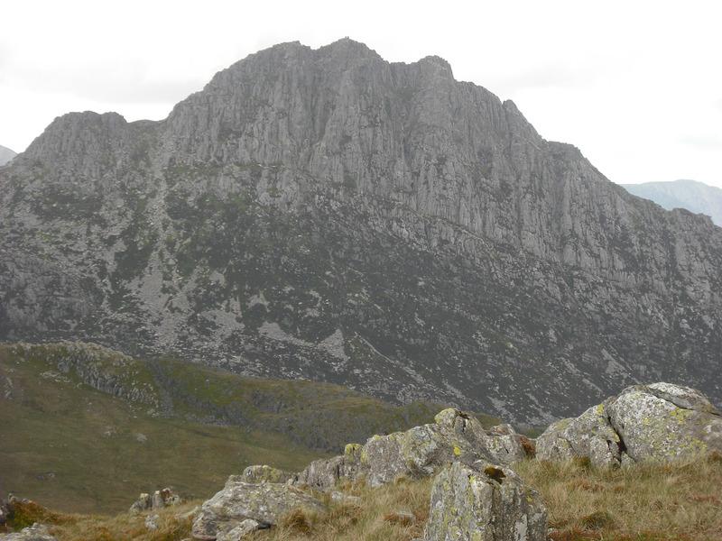
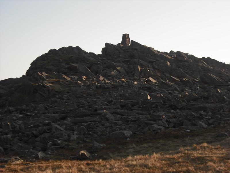
Summit of Glyder Fach from Castle of the Winds
Note to see more photographs from the walk click here
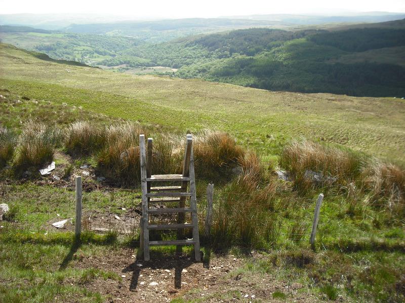
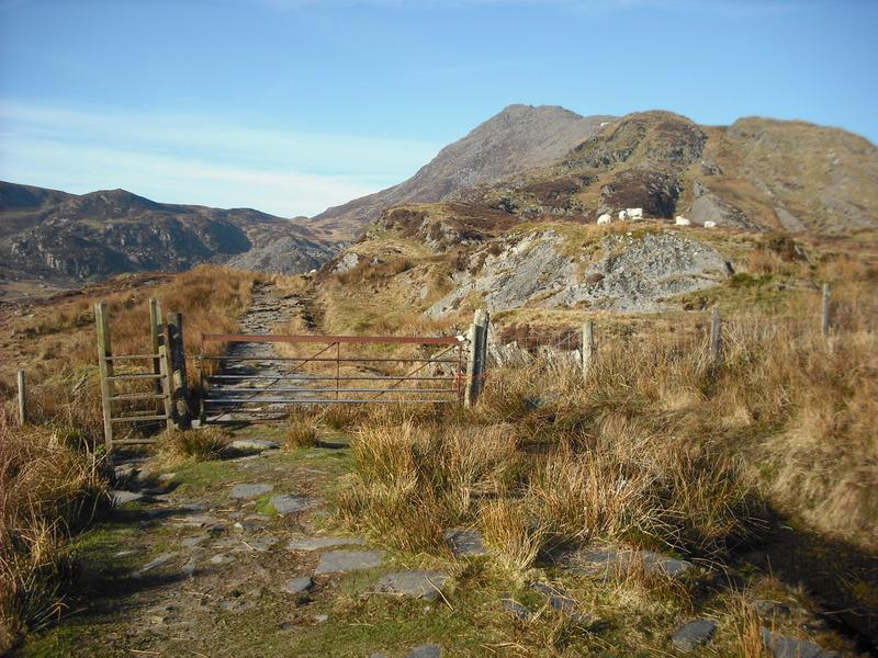
It was going to be hot and sunny, so I stopped at the shop in Capel to buy some flavoured water and a couple of slabs of flapjack. Walking from West to East (Nant Peris to Capel), finding the route from the end of the Glyders down over Y Foel Goch into Capel Curig is straightforward, as you can see exactly where you are going. However, the route finding when starting from Capel was a bit more of a challenge. I walked up the track behind Joe Brown's shop and after a few hundred yards passed a farm on my left. I walked along the track for another few hundred yards and then struck up the hill to the left of the track. There are several indistinct tracks around here, but if you walk roughly parallel to the summit ridge of Moel Siabod, while trending up hill, you should arrive at a ladder style where various tracks converge.
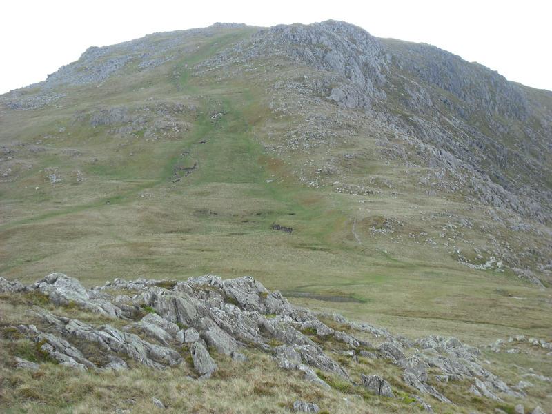
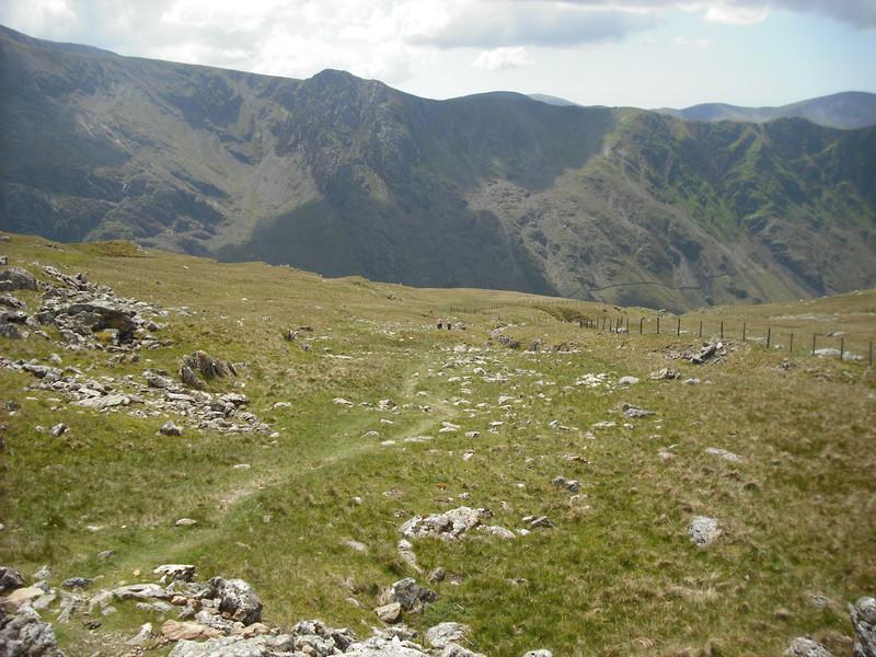
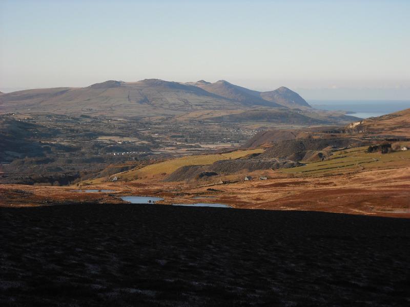
Once over the style the track is much more distinct and crosses a broad grassy plateau towards the summit of Gallt yr Ogof. It is possible to contour below the summit by following the path to the left, but I scrambled up via various subsidiary tops to the summit cairn. The views from here are spectacular. You are more or less right in the middle of the Snowdonia range, with views towards the Carneddeau, Snowdon plus views of the mountains to the south and west. Almost all of the significant Snowdonia peaks are visible from here.
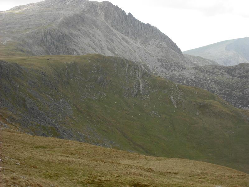
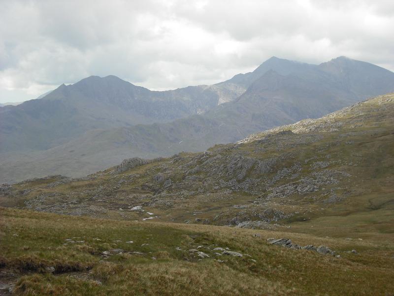
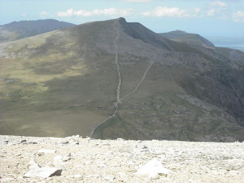
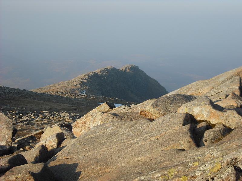
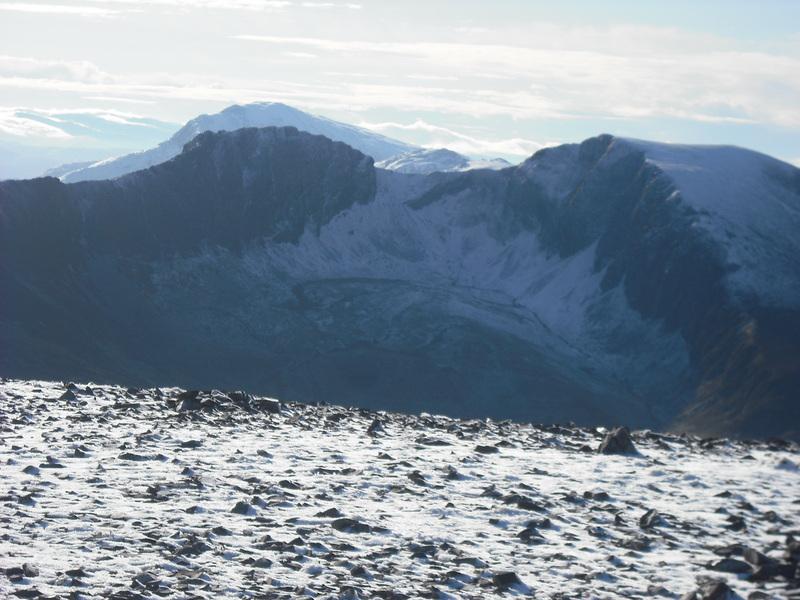
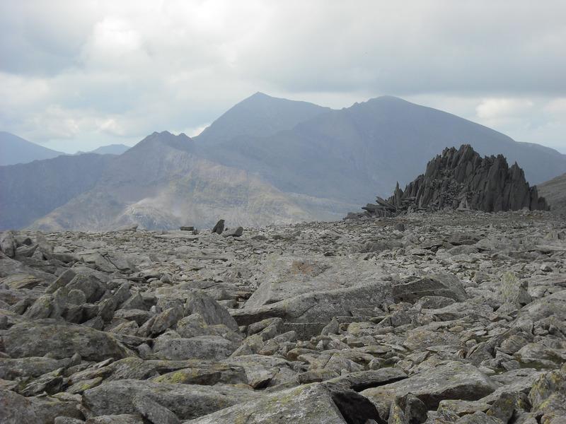
Snowdon and the Castle of the Winds
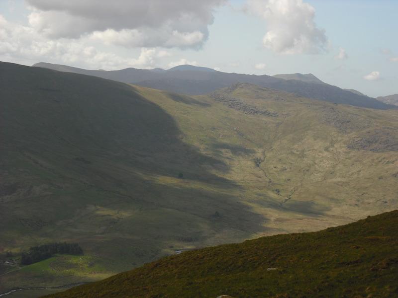
From Gallt yr Ogof there is a slight descent to a damp col, which contains a lovely small llyn, then a short climb to the flat summit of Y Foel Goch. In my old (1979) version of Pouchers "The Welsh Peaks" Y Foel Goch is described as the "Nameless Peak" and it was only very recently I discovered its name. Although it was a half term weekend, I hadn't seen another person on this part of the walk all morning.
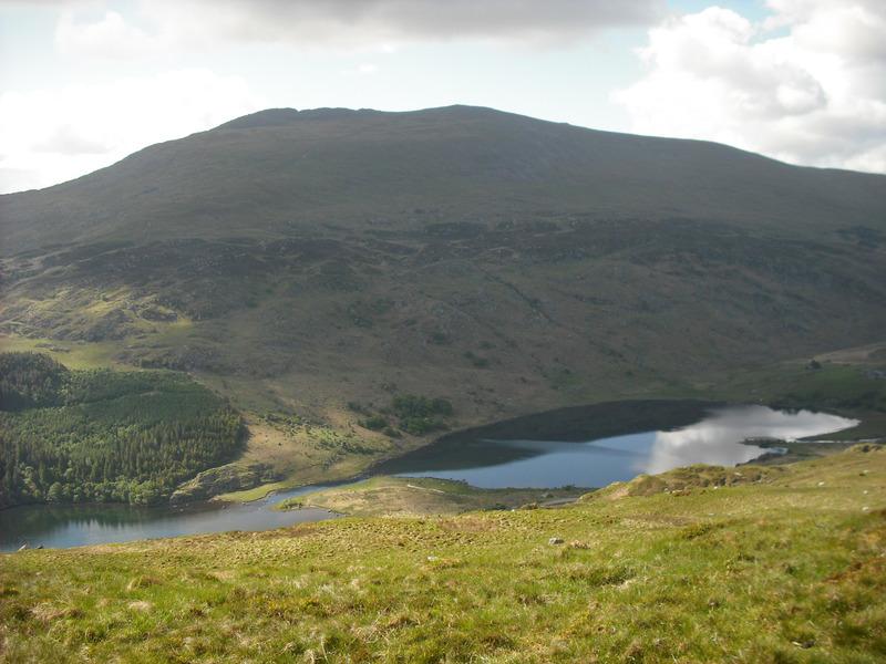
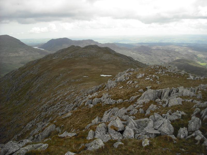
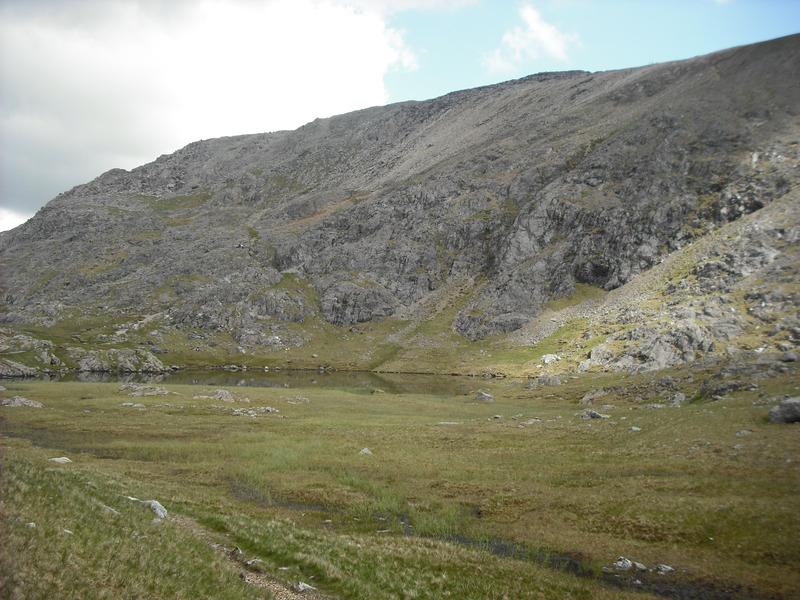
From the summit of Y Foel Goch the track drops down towards the shores of Llyn Caseg Ffraith. The ground round here can be very boggy in all but the driest of conditions. Many years ago when the ground was covered in snow I remember wandering about up here wondering where the lake was, when I suddenly broke through the ice and went in up to my knees.
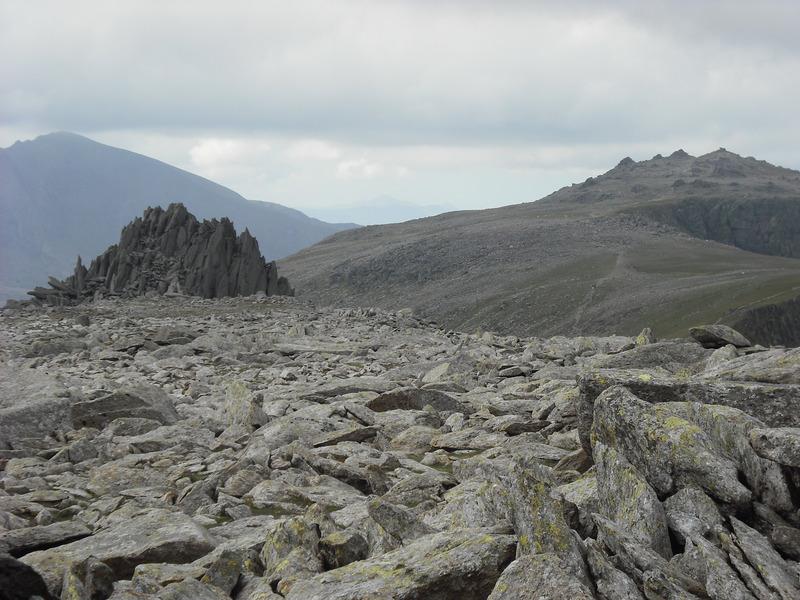
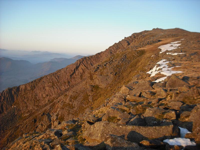
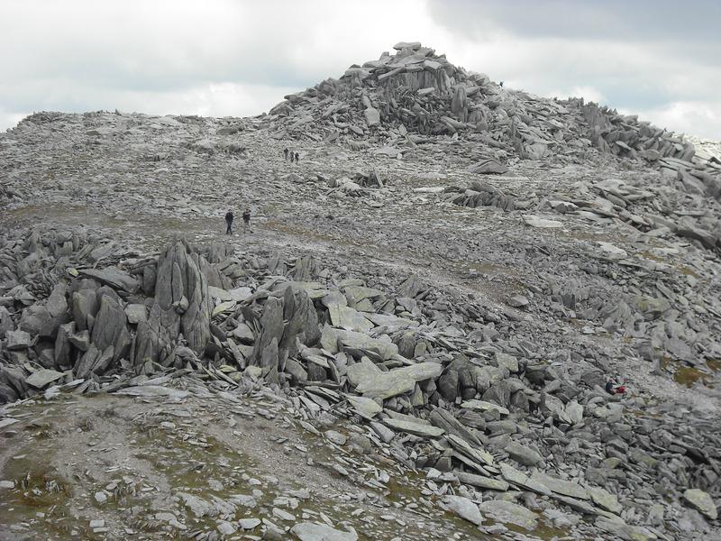
There were great views of the East Face of Tryfan and Bristly Ridge as I climbed up the scree slope towards Glyder Fach. Many years ago I remember descending this slope in a white out after climbing one of the gullies on Glyder Fach. It was so windy that we had to lean a long way forwards as we forced our way down the slope. Today I was sweating buckets as climbed up towards the point where Bristly Ridge emerges onto the summit plateau. I continued up the Cantilever, where I took the obligatory photos of someone standing on it. Continuing over the large pile of blocks that form the summit of Glyder Fach, I made my way towards the Castle of the Winds. I scrambled up to the top and ate my lunch. Although there were now plenty of other people around, I was the only one who scrambled up to the top of the Castle. Maybe it was the large cloud of midges up there that had discouraged others from climbing up.
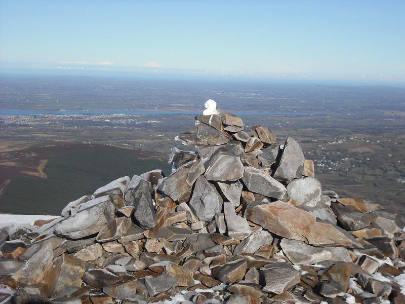
After eating my flapjack and having a short rest I scrambled down to the path and on to the col between Glyder Fawr and Glyder Fach. From here you can clearly see where the Gribin Ridge emerges onto the summit plateau and a little further on there are good views of the cliffs at the back of Cwm Cneifon (Nameless Cwm). It's difficult to say exactly which pile of stones atop Glyder Fawr is the summit, but soon the path begins its descent to Llyn y Cwn. This is a really unpleasant slither down loose scree, which in many places has been completely eroded into a muddy path. The only good thing that can be said about it, is that it better descending than ascending it. A couple of years ago in February I started up this slope, having completely a couple of winter climbs on the Devil's Kitchen. I fancied carrying on up to the summit of Glyder Fawr, but after wading about half way up in bottomless powder snow I gave up and turned back.
Today I was glad of a rest when I reached Llyn y Cwn. I was starting to get dehydrated. I had only bought about 500ml of water and really I needed far more. I didn't fancy drinking the water directly from the lake and there were no sources of running water close by.
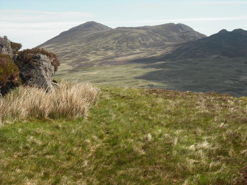
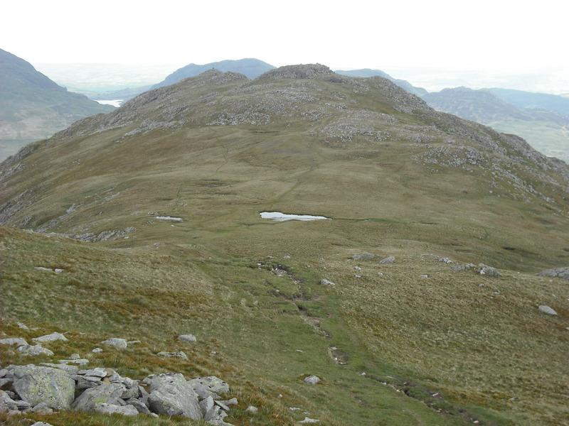
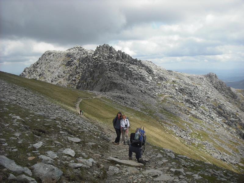
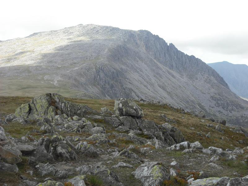
Glyder fach from Y Foel Goch
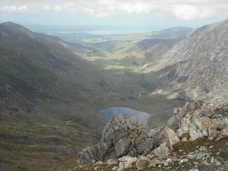
Time was pressing, as I had arranged to meet the family outside the Vaynol Arms at 3:15pm. Also given the lack of water, I decided not to climb Y Garn, but to descend to the Llanberis Pass via the path that follows the Afon Las into Cwm Padrig. The path descends easily at first and then steeply, with a couple of scrambly sections. Just above the road there is a metal bridge (not shown on my map) over the stream.
Once down in Gwastadant I followed the new wooden footpath, which runs along the far side of the stone wall to Nant Peris. I don't know who was responsible for installing the path, but it certainly makes walking along this section of road much easier and safer. I arrived back at the car about 3:45pm, half an hour later than anticipated. By this time I was really dehydrated with a headache and feeling dizzy. However, a quick trip to Pete's Eats and a pint of tea made me feel much better.