Solar Maximum And Minimum Thermometer

I have often wondered how cold it got inside and outside my tent during the night. My Casio Protrek watch has a thermometer. However, this has a couple of disadvantages. Firstly the sensor is on the side of the watch, so if you are wearing it on your wrist it just measures your external body temperature. Secondly, it only shows the current temperature and not the maximum or minimum.

Solar Thermometer

If you have a greenhouse, you are probably familiar with the "U" shaped spirit thermometer, which has a metal cylinder on each column to indicate the min and max temperature. These aren't very practical to carry around in your rucksack.

Recently I saw a Digital Solar Thermometer on Amazon. This displays the current temperature and the minimum and maximum. It's small and only weighs 15g. You can choose to display the temperature in either Celsius or Fahrenheit and there is a reset button, which resets the min and max display. As far as I can tell, the min and max will be reset after 24hrs automatically. Checking the temperature against another digital thermometer it seems to be accurate.

Tryfan Glyders Photos

Here are some of the photos from my Tryfan scramble and camping trip in October 2011. You can read the trip report itself here

Y Garn from Tryfan

Sunrise over Moel Siabod

Cefyn y Capel

Snowdon Horseshoe

Tryfan and the Carneddeau

View from y Foel Goch

Gallt yr Ogof from y Foel Goch

View towards Cefyn y Capel from Gallt yr Ogof

Looking back towards Gallt yr Ogof from Cefyn y Capel

Glyders Wild Camp

Day One - a Scramble on Tryfan.

You can see more photos from the trip here

For some time I had wanted to do a two day backpack around the Arans, starting from Cwm Cyarch and climbing Aran Fawddwy, then making my way along the duck boards and climbing Glasgwm to camp near Llyn y Fign.

After a spell of settled weather the rain had arrived. However, the MWIS site was predicting decent weather over Snowdonia. I left home shortly after 7:00am in a steady drizzle and headed towards Welshpool. As I started heading up the Tanat Valley, I could see the hills on either side covered in cloud, while the rain didn't show any signs of stopping. I decided to carry on driving through Cwm Hirnant to Bala. This would give me the option of continuing onto Capel Curig if the weather was still bad, or ascend the Arans from the Bala side. As I dropped down towards Bala, the weather was less awful, but both the Arans and Arenigs were submerged in cloud, so I continued onto the A5 towards Capel Curig.

When I arrived in Capel Curig, the weather was much better and most of the tops were clear of cloud. I parked in the small car park behind Joe Brown's shop and studied the map. I needed to be back home early on the next morning, so wanted an overnight camp on a summit not too far from the car. I had already camped on the Carnedds twice this year, so planned a route over Glyders. I decided to leave the car where it was and walk along the old A5 towards Ogwen, then traverse the summits back to my starting point.

I have done day walks from Ogwen over the Glyders to Capel Curig several times, but never camped overnight on the summits. My plan was to scramble up the Gribin Ridge, traverse Glyder Fach and then camp somewhere near Llyn Caseg y Fraith. However, it was already 10:30am and it would be completely dark around 6:00pm. Also, I was carrying a load so the plan might be too ambitious.

I set off along the old A5 towards Ogwen enjoying the views from the track. When I got to the foot of Tryfan it was obvious that I didn't have time to complete my original route. I decided on a scramble up Tryfan, followed by Bristly Ridge if I had time. I have never climbed the West face all the way to the summit and have done the North Ridge loads of times in the past. So I decided to try and make up a scrambling route up the West face. I didn't have either my scambles guide or the climbing guide, but didn't anticipate any insurmountable problems.

I climbed up towards the far end of Milestone Buttress where I started up Pulpit Route, which is an easy rock climb on big holds. The rock seemed very greasy, which is unusual for Tryfan, as the rock on the popular routes is very clean. I avoided Ivy Chimney, which would have proved problematic with a big sack and continued up what is the normal descent gully from the top of Milestone. Near the top there were a series of rocky steps, which didn't look too hard. People had obviously been this way before and it didn't look too far to easier ground above. However, the rock was like soap bars and the climbing felt very insecure. About 60 feet above the scree was a short wall. This didn't appear too hard, but all the holds were outward sloping. The wall was situated above a decent size ledge, so I wasn't too worried about trying to climb it. About ten feet above the ledge I had to make a high step onto a big sloping hold. As I was pushing up on the hold my foot skated off and I started to fall. I flattened myself against the rock, so there would be less chance of me bouncing off the ledge, as that would send me down the 60ft drop into the gully below. Unfortunately, as I slithered down my left foot caught on a nubbin of rock and got bent right up. There was a sharp pain in my calf muscle and I dropped in a heap on the ledge.

I got myself into a sitting position and moved my foot gingerly. Luckily, I hadn't done any serious damage. I considered going down, but reversing the slippery rock below me while carrying a heavy pack didn't appeal. I could see a traverse line to the left, which lead to a quartzite band, which didn't look hard. However, the section above this was hidden from view round a corner. It appeared as though I was only a short distance from where the steep ground merged into the North ridge, so I decided to go and have a look. I teetered across the grassy traverse onto a ledge. Gaining the quartz band, I could see that there weren't any serious difficulties above it. Finally I emerged onto the crest of the buttress, where I met an Irishman trying to descend. I told him that I didn't think that it was a good idea, but he seemed to try anyway. Later on, making my way up towards the North Ridge, I was pleased to see that he had abandoned his attempt and was climbing back up.

Y Garn from Tryfan

By this time the clag had descended and the rest of the ridge was misted out. The rock on Tryfan, especially on the popular routes, is very clean and not normally slippy when wet. However, today the whole mountain was like a skating rink and it wasn't just me who was slipping and sliding. I stopped on the summit for a few minutes where I took a group photo for three men.

I had hoped to continue up Bristly Ridge. However, it was now mid afternoon and given the slimy rock on the North Ridge, plus my heavy sack. I decided to change my plans yet again. I descended the steep screen slope from Bwlch Tryfan into Cwm Tryfan. There was plentiful water supplies down there and I thought I might set up camp in the Cwm. It was shortly after 4:00pm by the time I reached the stream and I was now below the clag. Looking up I decided that I had just about enough time to climb up the track to the col and camp somewhere near Llyn Caseg y Fraith. I filled my water bottles and after a short rest, I plodded slowly upwards, reaching the col around 5:00pm. I was now back in the clag and given the poor visibility and rapid approach of darkness decided to set up the tent a couple of hundred yards from the edge.

I had just managed to get the tent set up and all my stuff inside when it started to rain. The rain blown by a strong gusty wind continued for several hours. After it had stopped I unzipped the tent door and looking outside I could see the sky was almost completely clear. The wind was gradually dropping and I had a peaceful night.

Day 2 - Llyn Caseg y Fraith to Capel Curig.

One disadvantage of camping at the end of October is it's dark for about 12 hours. I cooked and listened to a couple of podcasts on my phone before drifting off to sleep. As there was almost no wind, I slept quite well, waking around 6:00am. Sunrise was shortly after 8:00am and it doesn't really get light enough to do much before 7:00am, so I spent an hour making drinks and eating breakfast.

Sunrise over Moel Siabod

* *

The weather was perfect. There was only some high cirrus and a slight breeze. I was ready to go shortly before 8:00am. I was walking almost due East, so had perfect views of the rising sun. I was a bit concerned about how my leg would be. Luckily, apart from some muscle pain my leg was fine. The main summits of the Glyders are justifiably very popular. However, it's unusual to see anyone on the section between Glyder Fach and Capel Curig.

Snowdon Horseshoe

There is a small rock outcrop near to the lake, which provides a great viewpoint over the east face of Tryfan. Readers of Poucher's guide will recognise this as the site of the photo on the frontispiece. I made my way past Llyn Caseg y Fraith and up to the summit of Y Foel Goch. For many years this was known as the "Nameless Peak" (see Poucher's Guide). It wasn't given a name on the OS maps, but in recent years the OS have shown it as Y Foel Goch. The summit is a great view point, for both the Glyders and the Carnedds. After spending a few minutes taking photographs, I made my way over towards Galtt yr Ogof. It's possible to bypass this summit, but it's well worth the short detour for the excellent views.

Glyder fach and Bristly Ridge

Leaving the summit of Galtt yr OgofI, I began the long descent towards Cefyn y Capel. This is a long flat ridge which ends above Capel Curig. There are good views of the Snowdon Horseshoe and directly in front of you Moel Siabod. This section is usually boggy, but after the long dry summer I had expected it to be fairly dry. However, there must have been some heavy rain in Snowdonia recently, as it was indeed very boggy. My old Hi Trek boots are distinctly non waterproof and my feet were soon very damp. I was glad that I hadn't decided to wear trail shoes.

Cefyn y Capel

There are a number of paths you could follow, but essentially you just follow the crest of the ridge to its end. Finally the path drops down and emerges just behind the farm next to the track leading to the car park. I hadn't met a single person all morning, until I got back to the car park.

After getting out of my wet boots and socks, I drove round to Pete's Eats for a fry up.

You can see more photos from the trip here .

Carneddeau Summit Camp

After another summer of indifferent weather, following the hot spring, the Snowdonia weather forecast was predicting a couple of days of cloud free summits. Not deterred by our very windy camp on the summit of Moel Siabod, Ella was keen to go on another summit camp.

Wild ponies

The plan was to climb Carnedd Llewelyn via the road up to Fyffon Lllugwy and traversing Craig yr Ysfa, camping on or near to the summit. On day two we would traverse the ridge to Pen yr Ole Wen and descend the South East ridge back to the valley.

Ffynnon Llugwy

We arrived at Capel Curig at lunch time and went into the Pinnacle Cafe to eat and fortify ourselves for the haul up to the summit. Driving round towards Ogwen after lunch it was apparent that the MWIS forecast was wrong, as the main Carneddeau ridge was covered in cloud. Hoping that the tops would clear later on and that the forecast for clear tops tomorrow would be correct, we decided to proceed with our plan.

Zephyros on C. Llewelyn

I had planned to leave the car at one of the two camp sites in the valley, as I was a bit concerned that leaving the car on the A5 overnight might lead to the mountain rescue being called out. However, whilst both camp sites are happy for you to park your car there during the day, for a small fee, neither of them will allow overnight parking unless you are camping there. So, I ended up leaving the car on the hard shoulder just down the road from Gwern y Gof Uchaf, which was almost opposite to the path down from the SE ridge of Pen yr Ole Wen.

I packed almost all the gear into my POD Black Ice, leaving Ella to carry just her sleeping bag and the two camping mats in my Osprey Talon 33. The Osprey was miles too big for her, but she insisted on using it and since she was carrying very little weight I thought she would be OK.

We set off back along the old A5 and emerged almost opposite the start of the road up to Fyffon Llugwy. This is quite a steep sloge and I am sure that the road has got longer since the last time I walked up it! However, the tedium was relieved by watching a wild pony and its foal near to the track. When we arrived at the reservoir the cloud had descended even further and was just brushing Bwlch Eryl Farchog. As there is no water up on the summit plateau, I filled up our three one litre Platypus bottles from the reservoir.

After a short rest, we made our way back to the path that leads up towards Bwlch Eryl Farchog. I remember this path as being very eroded the last time I cam this way, which was probably in the early 1990's. However, it looks as though quite a bit of work has been done on the lower section and it's only the steep final section which is unpleasant to climb. Ella seemed tired, so when I reached Bwlch Eryl Farchog I dumped my rucksack and descended about half way to carry her sack for her.

From the col we set out to scramble up Craig yr Ysfa. A runner with a dog passed us. When he reached the short scrambling section the dog decided it didn't want to climb and had to be manhandled up the short rocky step. We were now surrounded by swirling mist and rather than climb all the way up to the summit of Carnedd Llewelyn I decided to camp on the grassy shelf a couple of hundred feet below the summit, where I had stayed on my last trip. Luckily I had saved the location as a waypoint in my eTrex, which made locating it much easier in the mist. The nearby cairn, overlooking Cwm Eigau, which I remember being huge, turned out to be just a small pile of rock.

Ella in the tent

Moel Siabod appears from the mist

It was only about 5:00pm when I set up the tent. Although it was very misty, there was no breeze, so I was able to cook in the open on the rocks just behind the tent. After we had eaten we settled down in the tent for a snooze. Around 7:00pm I unzipped the flysheet just as the clouds around us started to disperse. We clambered out of the tent and soon we could see all the surrounding tops. A small patch of cloud was flowing over the summit of Pen hyr Helgi Ddu below us. It was as if someone was pouring a thick white liquid over the summit. However, once the cloud had flowed over the summit, it dispersed into nothing. We spent some time wandering around admiring the views. I pointed out tomorrow's route to Ella, so she could see that there was only a small amount of ascent with most of the day being a traverse over the summits. We tuned in finally just before it got dark around 9:00pm.

Ella on the summit of Carnedd Llewelyn

Unlike our trip up Moel Siabod we slept well and it was after 6:00am when I woke up. Looking out of the tent I could see most of the sky was clouded over, but it was well above the summits. After a breakfast of hot cereal start and hot chocolate, we packed the tent away and started up the ridge towards the summit of Carnedd Llewelyn. After a brief pause on the summit we started descending towards Bwlch Cyfryw drum. As we began the descent we were exposed to a strong south westerly wind, which was to buffet us all along the ridge. We made our way over the Black Ladders and up to the summit of Carnedd Dafydd, where we sheltered in one of the many stone shelters. After a brief rest we dropped down a short way before the ascent to the final summit of Pen yr Ole Wen, where we saw the first person of the day.

The Black Ladders

Pen yr Ole Wen and Snowdon

Once we had crossed the summit we were sheltered from the wind as we wound our way down the south east ridge. We scrambled down the final section which lead to some boggy ground at the entrance to Cwm Lloer. I was wearing my Inov8's, so had to perform a few jumps between stones to avoid getting wet feet. Since our last trip up Moel Siabod, where Ella's boots had let in water like sieves, we had bought her some new Hi-Tec boots. Her new boots performed well, being both comfortable and waterproof. We followed the path down next to the stream passing the MAM hut at Glan Dena. We stopped to chat with a couple of MAM members who were busy filling in holes in the track up to the hut.

After short walk along the road, we arrived back at the car. I chucked all the gear into the back and we set off to Pete's Eats for an early lunch.

I had worn my Inov-8 Roclite 295 shoes for the walk. I wasn't sure how they would perform as I was carrying a heavy sack over steep and rocky terrain. In the event they were really comfortable and I was able to scramble up and down steep ground while carrying a heavy sack with no problems. Ella's new Hi-Tec boots were comfy and waterproof. I was pleased that we had reasonable conditions for the walk. Although Ella found the wind a bit of a problem, it was nothing like as bad as on our Moel Siabod trip. The low cloud of the previous day had cleared in the evening and we had enjoyed great views from the tent and during our walk along the ridge.

Exped Synmat Ultralite

I am a big fan of my Thermarest Neoair, which is very comfortable, light and packs down small. However, I find that I tend to roll off it when I am asleep. Recently I needed to buy another light weight mat for one of the family. Rather than just buy another Neoair, I did some research and discovered the Exped Synmat Ultralite .

Like the Neoair the Synmat is an inflatable, but there are significant differences. The Neoair relies on internal baffles, which prevent convection, to achieve its insulation. The Synmat is filled with Primaloft, which is laminated to the walls. This prevents the filling from migrating and allows for greater loft.

The Neoair uses a single valve for both inflation and deflation, but the Synmat has two separate one way valves. Most people inflate the Neoair by mouth. You can inflate the Synmat the same way, but moisture from your breath will eventually compromise the effectiveness of the Primaloft. Exped sell a pillow pump , which functions both as a pillow filled with expanding foam and an air pump. I decided to buy a pillow pump, which works well both as a pump and a very comfortable pillow.

There is one other important difference in construction between the Synmat and the Neoair. The inflatable tubes in the Neoair run horizontally, whilst those in the Synmat run vertically along the length of the mat. The outer tubes of the Synmat are slightly larger than the inner tubes, which makes it harder to roll off the mat.

So how do the two mats compare for sleeping on? I haven't tested either mat in really cold conditions, but both kept me warm. Note the Synmat has a slightly higher R value, so in theory should provide better insulation. Both mats require about the same effort to inflate and pack down to a very similar size. However, I did find the Synmat slightly more comfortable than the Neoair and more importantly I didn't roll off the Synmat during the night.

The Neoair feels quite flimsy compared to the Synmat, but I haven't had a problem with punctures. A nice detail is that the Synmat comes with a repair kit, whereas you have to buy one for the Neoair.

So which do I prefer? It's a very close call, I like both mats and compared to other types of sleeping mat like my old Karrimat, or self inflating mats, they are streets ahead in terms of comfort, lightness and pack size. I marginally prefer the Synmat as I find it slightly more comfortable and so far I haven't rolled off it.

Comparison of Weights, Size and Insulation.

Mat Size Weight R Value
Synmat (medium) 183 x 52 x 7 474g 3.5
Neoair (regular) 183 x 51 x 6.3 396g 2.5

Dimensions are the manufacturer's stated ones. Weights were measured on my scales and include the stuff sack.

Zephyros On Moel Siabod

I had wanted to try my Zephyros for some time, but hadn't had an opportunity to take it into the mountains. The weather had settled into the pattern of recent years, with a dry Spring, but wet and unsettled weather throughout the Summer. However, a brief window of opportunity was forecast mid-week with bad weather clearing in the afternoon, followed by a brighter day.

Llyn y Foel

I had hoped to use one of the routes over the Arans from v-g's site. However, it didn't look as though the good weather would last long enough. So, I decided on a late afternoon ascent of Moel Siabod from Capel Curig, camping near to the summit and returning to Capel early the next morning. It was school holidays (which probably explains the bad weather), so I persuaded one of my daughters (Ella) that camping on top of a mountain in dodgy weather was a good idea.

View from Ddear Ddu

Driving over the Llandegla Moors, rain began to pour down from the grey skies, so much for the promised clear weather in the afternoon. When we reached the A5, it had stopped raining, but the sky was entirely covered in low grey clouds. Driving up from Betwys y Coed I caught occasional glimpses of the summit of Siabod trough the cloud. It wasn't raining continuously, but there were frequent heavy showers. We had tea in the Pinnacle cafe in Capel Curig before driving back to the car park near to the Bryn y Glo cafe.

Ella at the top of the Ddear Ddu ridge

Ella sat in the car while I packed the rucksack in the rain. When we set off the sky was covered in low grey cloud and it was raining intermittently. I glanced over the bridge at Pont y ??? and noticed that the level of water in the river was well up for the time of year. After a short distance we turned right and started up the steep farm track, following the diversion that takes the path away from the farm buildings. As we made our way along the track over the moors, I could see that the summit of Siabod was covered in cloud. Rather than try and camp on the summit, I decided that we would be better off camping next to Llyn y Foel and hope that the weather was better in the morning..

Looking towards the Rhinogs

This was Ella's first trip up Siabod and I was regretting not waiting for better conditions. Also, her boots were leaking badly and since the path was running with water, her feet were soon soaked. We made our way up through the old quarry workings and stopped to stare into a couple of the flooded workings. On a sunny day the water appears in vivid colours, caused by the different dissolved minerals. However, today it just looked grey, like the sky above.

Looking NE along the summit ridge

As we approached Llyn y Foel a few breaks appeared in the clouds and the summit cleared. After a bit of deliberation we decided to continue over the Ddear Ddu ridge to the summit. Unfortunately, the path past Llyn y Foel was very boggy and Ella's feet got even wetter. The Ddear Ddu ridge was a pleasant scramble, but needed care as the rock was quite greasy. Also I was hampered by carrying a heavy pack. I made my way slowly up the ridge, with Ella skipping along behind like a faun.

Zephyros below the summit

I could see the clouds racing over the summit and wondered how windy it was going to be on top. The forecast was for winds gusting up to 45mph, but falling back to 25mph later in the day. By the time we had reached the final rocks below the summit, the cloud had risen some way above the summit and there were some large patches of blue sky appearing. Once we got onto the summit ridge it was very windy and Ella sat in the summit shelter, covered by my bothy bag, while I went in search of a suitable spot to pitch the tent.

Cloudy early morning

There is a nice flat area to the North of the summit, which has great views over Snowdon and the Glyders, where I pitched the tent on my last trip. However, it was exposed to the full force of the westerly wind, which was blowing me about and was definitely not the place to pitch the tent. I back tracked to the area on the southern slope, just below the summit ridge, where I found a nice flat area close to the summit cairn.

The SE ridge

I unpacked the Zephyros and had it pitched in less than 10 minutes. I climbed back up to the summit shelter and fetched Ella and we put all our gear into the tent. The Zephyros 2 is very cosy for two and you can only just fit two sleeping mats side by side. It was now about 8:30pm and the light was fading. I found it was possible to cook in the porch, but you really need to have the flysheet open to avoid setting light to the tent! After a cup of hot chocolate and some porridge and sultanas, we settled down for the night. Contrary to the forecast the wind didn't drop at all during the night. We could hear the roar of the gale on the other side of the summit ridge and blasts of wind that made it over the ridge rattled the Zephyros. However, the tent stood up to the wind and sharp showers during the night without any problems.

Early morning storm clouds

The wind kept us awake most of the night and we dropped off to sleep about 4:00pm, waking again about 6:30am. Wisps of cloud were blowing over the summit and the wind hadn't dropped at all during the night. After a cup of hot chocolate we decide to pack up and go down to the valley for breakfast. We crossed over to the northern side of the summit ridge and dropped down below the crest, to avoid scrambling over the rocks. We were now exposed to the full force of the wind. I was being buffeted and Ella was struggling to stay on her feet. I could see sheets of rain blowing along the Ogwen Valley over Capel Curig. Luckily, although we were exposed to the gale, the rain showers passed us by. It felt much more like Autumn than early August.

Finally out of the gale

Once we started dropping down the southern slopes we were sheltered from the wind and made quick progress down the eroded path back to the end of the track. We got back to the car about 9:00am and went straight round to Pete's Eats for breakfast!

You can read my account and see some photos of a much better night's camping on the summit in April 2010 by clicking here .

Inov8 Roclite 295

I spend most of my time wearing trainers. Over the last couple of years I have bought various Karrimor trainers/trail shoes from Sportsdirect. These have been OK for just knocking about in, but not particularly good for mountain walking. The main problem was the soles of my feet got sore and I could feel almost every sharp stone digging into my feet. So for mountain walking, I bought some moderately priced Hi-Tec walking boots, which were very comfortable, but the soles weren't great on wet rock, or for scrambling.

Recently I noticed that the soles of my feet were hurting almost all of the time in my Karrimors. A quick look at the soles revealed that they were paper thin and I was almost walking barefoot. I had read various blog posts about Inov8's range of trail/running shoes. Unfortunately, there aren't any local stockists who keep a decent range actually in stock. Since I didn't want to keep wandering around in my karrimors with paper thin soles, I visited my local GoOutdoors, who did have a small number of different Inov8's in stock.

When I got there it turned out that the only pair I had in my size were the Roclite 295. I had no idea what their intended use was (running, walking), but as soon as I tried them on I felt at home in them. A brief walk around the shop confirmed that they fitted me and were indeed very comfortable. I bought them and chucked out my old pair of trainers immediately.

Fast forward a couple of weeks and we were going on holiday to Chamonix. Since I was taking a load of climbing gear and we were up against our weight limit for checked baggage, I decided to leave my Meindl boots at home and use the Roclite 295's for walking.

On the first trip up to Lac Blanc in damp weather with a thin layer of snow, they were perfect. Although they aren't fully waterproof, the toe section is. Despite the snow my feet didn't get wet. Even better, although I was carrying a reasonably loaded sack with everyone's gear in it, my feet were comfortable. I was able to clamber over wet rocks without slipping. A couple more walks, involving some scrambling over rough terrain only increased my appreciation of these boots. The cushioning worked really well on rocky trails.

You can see INOV8's specification for these boots here .

Adventures In Kvm Land

For a couple of years I have been using Xen on my file server to run various Linux virtual computers. Initially I started by running it on Ubuntu, but when Ubuntu dropped support for Xen kernels, I moved to Debian Lenny and then Debian Squeeze.

Recently I bought a couple of HP Proliant Microservers . One of these was to replace my current server and the other to use as a firewall and run a couple of VM's. Transferring my main Xen server to the new box was easy. However, have been having problems setting up my firewall box.

My firewall box has two wthernet cards. One connected to my internal network and the other connected to an ADSL modem. Installing Squeeze and Xen worked fine, up to the point when I tried to configure pppoe. The configuration went OK, but when I rebooted Xen complained about eth1 (my internal interface) being busy or unavailable. The Xen wiki suggests removing all non essential ipv4 settings from your /etc/network/interfaces. However, mine was already pretty bare and basically identical to that on my other Microserver, which was working fine.

After re-installs I established that booting with the standard debian kernel worked fine. Both eth1 and my ADSL interface were initialized correctly. However, rebooting into the Xen kernel gave the same problem with errors about eth1 being busy or unavailable. he thing that caused the errors was configuring the pppoe interface. if I left it unconfigured everything worked correctly. Finally I decided that for whatever reason I wasn't going to be able to get Xen to work in this configuration.

I have never tried the virtualization already built into the Linux kernel (KVM), but decided to experiment to see how it worked for my requirements. Initially I tried installing Lucid, but ran into a problem where the installer couldn't install grub2 on my RAID1 boot disks. Rather fed up with problems by now I went with the latest Natty server, which installed without a problem.

There are several good documents about setting up KVM in Ubuntu:

After correcting an initial configuration error, I soon had bridged networking and a test VM with Ubuntu Lucid up and running.

Having successfully set up KVM, I think that I shall probably migrate my Debain Xen server to Ubuntu using KVM. Although Xen is working fine on that server, I don't really want to have to maintain two different network virtualization technologies.

New Thermos Flasks

Over the years I have had quite a few vacuum flasks. Whilst the ones with the glass insides keep the liquid hot for a long time, they are rather fragile for outdoor use. There's nothing worse than slogging up to a summit, getting out your flask for a nice hot drink and finding your drink full of pieces of glass! We do have a few stainless steel flasks, but these are heavy and don't keep drinks hot for a full days walking.

Thermos Ultimate

Recently I heard about the Thermos Ultimate stainless steel flask, which claims to keep liquids hot for 24hrs. It is a proper vacuum flask. In other words there is a vacuum between the two walls of the flask. Most cheaper flasks fill the gap between the walls with some sort of insulating material, as it's much cheaper to produce.

The Thermos Ultimate is available in 0.5l and 0.8l sizes and costs around £20 from Tesco Direct. This isn't cheap, but the flask has a 10 year guarantee. I ordered the 0.5l size, as it's about the right size for bike rides in the winter.

When it arrived I wanted to test it out. First I filled it with boiling water from the kettle and left it to stand for 10 minutes. Next I poured the water out and refilled the flask with boiling water from the kettle. Unfortunately, I don't have an accurate thermometer that will read up to 100 Centrigade, so my test wasn't very scientific. After six hours, the longest I would expect to keep a liquid hot during a normal day out, I poured out a cup of water from the flask. I stuck my finger in and immediately removed it, as the water was so hot. So probably well over 60C. I left the remainder of the water in the flask overnight and repeated the test the next morning, about 19 hours after I had first filled the flask. The water was still too hot to keep my finger in for more than a second.

So overall I was very impressed with the flask. It's not particularly heavy, the 0.5l version is 310g. In fact I was so impressed that I ended up ordering the 0.8l version.

Carneddau Backpack

It was the week of the Royal Wedding, which I wasn't interested in watching. The weather, which had been warm and sunny for weeks, looked as though it would hold out for at least two more days, so I decided to go to North Wales for a couple of days.

I intended to follow one of v-g two day routes over the Southern Carneddau. I had done the section traversing the main ridge, from Pen yr Ole Wen to Carnedd Llewelyn and then on over Pen yr Helgi Du, as a day walk several times in the past.

I arrived in Capel Curig about 10:00am and easily found a space in the car park behind Joe Browns. I wasn't sure about leaving the car there overnight, but couldn't find any signs forbidding overnight parking. Before setting off on the walk, I called in at the Pinnacle store to get a sandwich for lunch and buy a bottle of Sprite.

When I had finished packing my sack, I set off down the old A5 towards Ogwen. I walked past Gallt yr Ogof and soon the East face of Tryfan appeared round the side of the hill. The walk along the valley seemed further than I remembered, but soon I was passing through the two camp sites of Gwern Gof Isaf and Gwern Gof Uchaf. The track emerges onto the A5 nearly opposite to the Glan Dena path. The footpath is waymarked and proceeds uphill next to the wall of ???. After a short distance the wall is crossed via a ladder style and the path carries on uphill. This section can be wet, but the month of dry weather ensured that the ground was bone dry. The path follows the Afon Lloer up towards Ffynnon Lloer, which remains invisible until you are on the south ridge of Pen yr Ole Wen.

The south ridge is a pleasant easy scramble and much preferable to the horrible slog of the normal route from Ogwen. It was while I was making my way up the steep slope to the bottom of the south ridge that I began to realize how heavy my sack felt. It had been fine in the valley, but was really slowing me down going uphill. Usually, I am quick going uphill, but slow on descents. This time I was really struggling going up.

I stopped to refill my two Platypus one litre bottles and the 600ml Sorite bottle from the Afon Lloer. I was aware that I wasn't going to find any more water from here until I reached Llyn Colwyd the next day. In his book "Backpacking in Wales", Showell Styles describes finding a spring near ????, but I didn't think I would be so lucky. I needed to cook at least one dehydrated meal, have a couple of hot drinks and also have water to drink for the rest of today. I had worked out that two and a half litres would probably be enough, but ideally I would have liked a bit more, especially as it was a hot day.

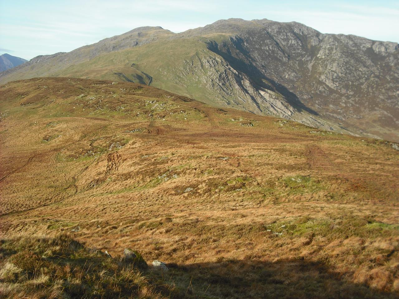
The South ridge seemed to go on for a very long way, but eventually I 
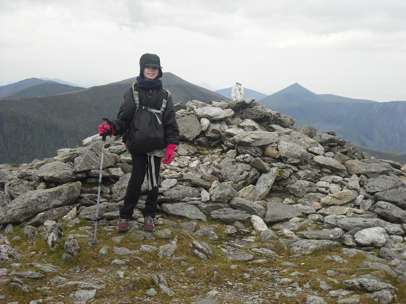
arrived at the summit of Pen yr Ole Wen, where I flopped down by the cairn. I ate a couple of Kellogs bars and drank some of my water and began to feel a bit better. Now I had gained the plateau most of the ascent was over and my heavy rucksack didn't seem quite as heavy.

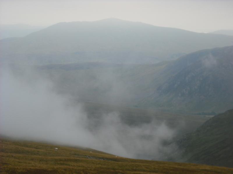
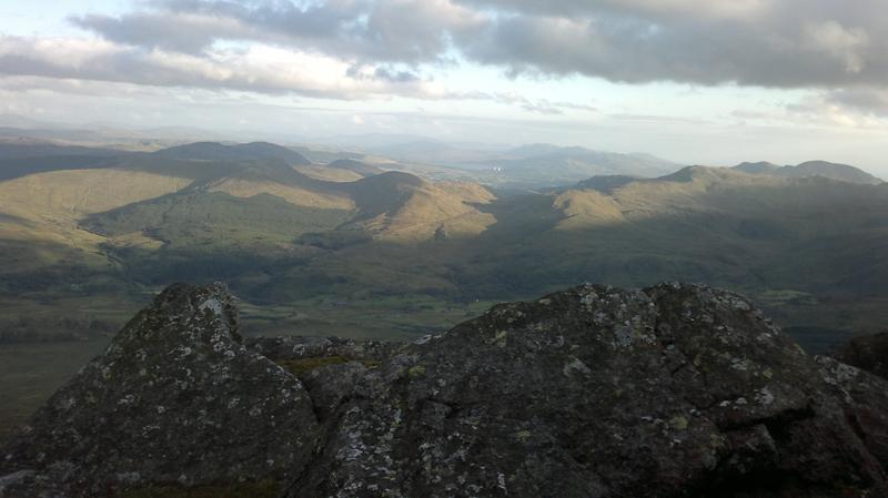
I set off towards Carnedd Dafydd over the stony ground. The views were spectacular, with no clouds and very little haze. Although it was half term week, there weren't that many people about. I stopped for another rest at the huge cairn just below the summit of Carnedd Dafydd, then made the short descent towards the top of Ysgolion Duon. The last time I had passed this way was after my winter ascent of Western Gully in 1986. We had emerged on the summit in the dark, it was a cloudless night and the moon was out. Stupidly I didn't use the compass and we ended up descending back to Ogwen, rather than Gerlan.

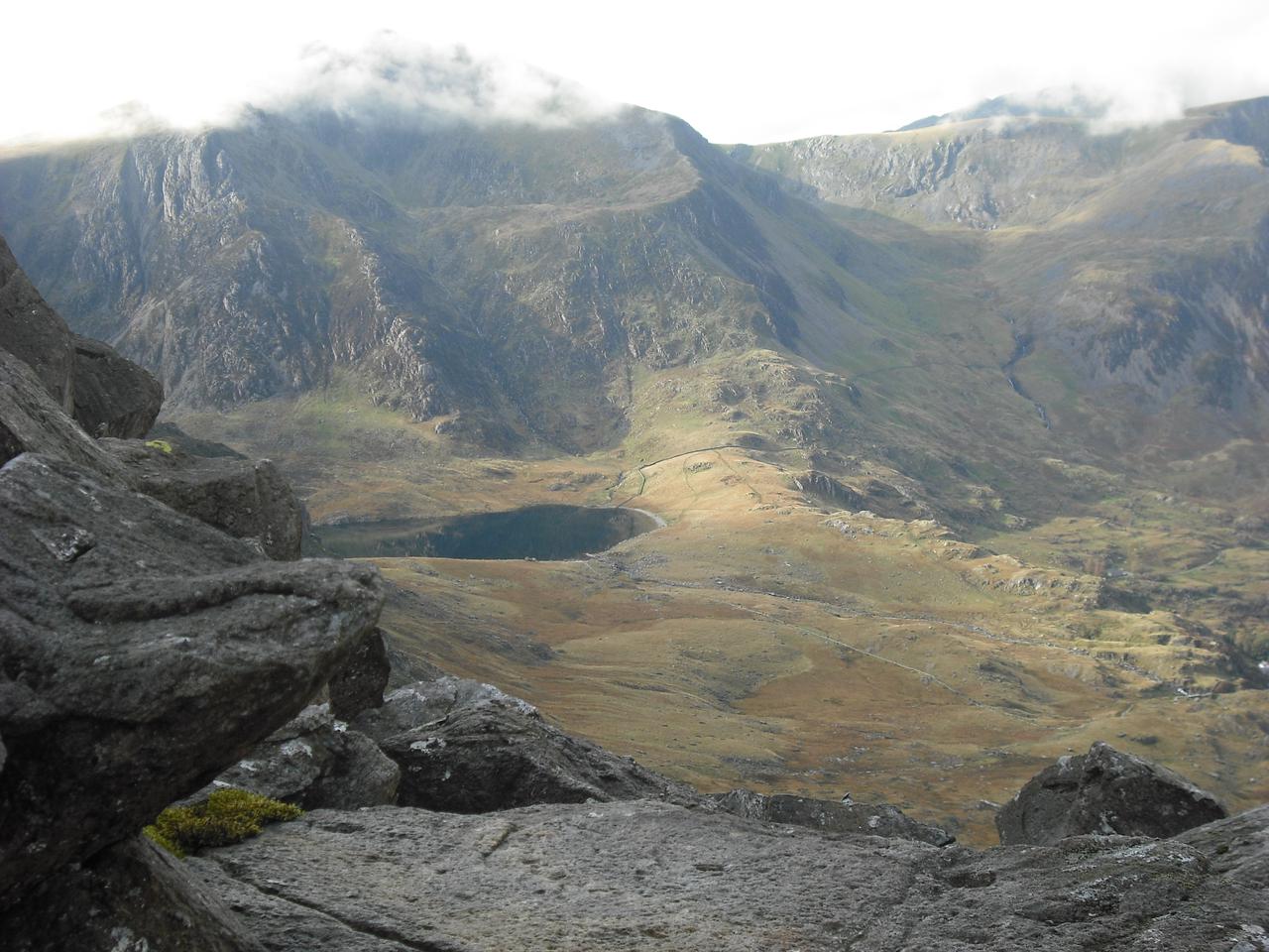
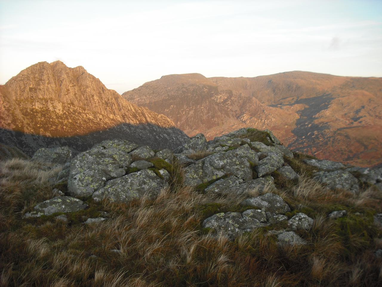
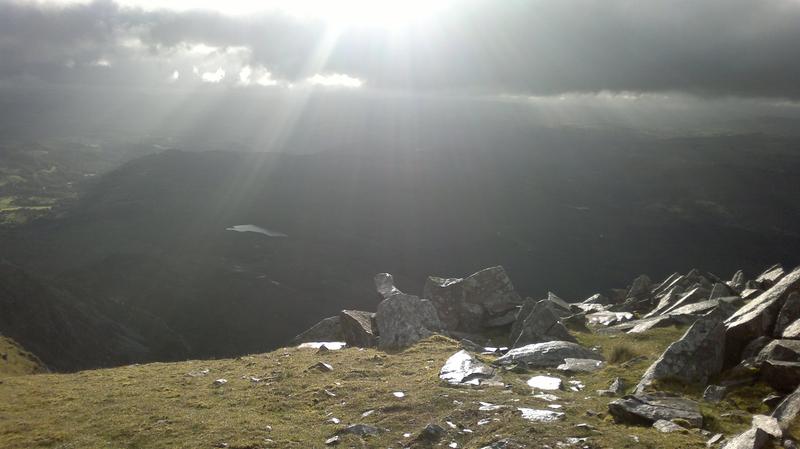
This time I could see my objective, Carnedd Llewelyn clearly in front 
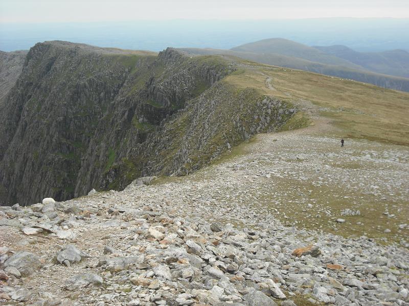
of me, so there would be no excuse for getting lost! As I walked along the edge of the cliffs I began to feel a cold breeze from the East. By the time I had reached to foot of the SE ridge of Carnedd Llewelyn it was strong enough to buffet me about. Luckily I was sheltered on the ascent of the ridge, but on the summit I was once again exposed to the full force of the wind. Time was getting on and I was quite tired, so I abandoned my idea of going to look at the refuge on Foel Goch and set off down the descent towards Craig yr Ysfa.

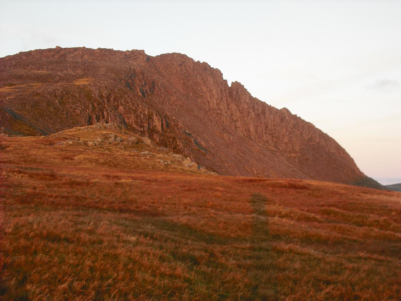
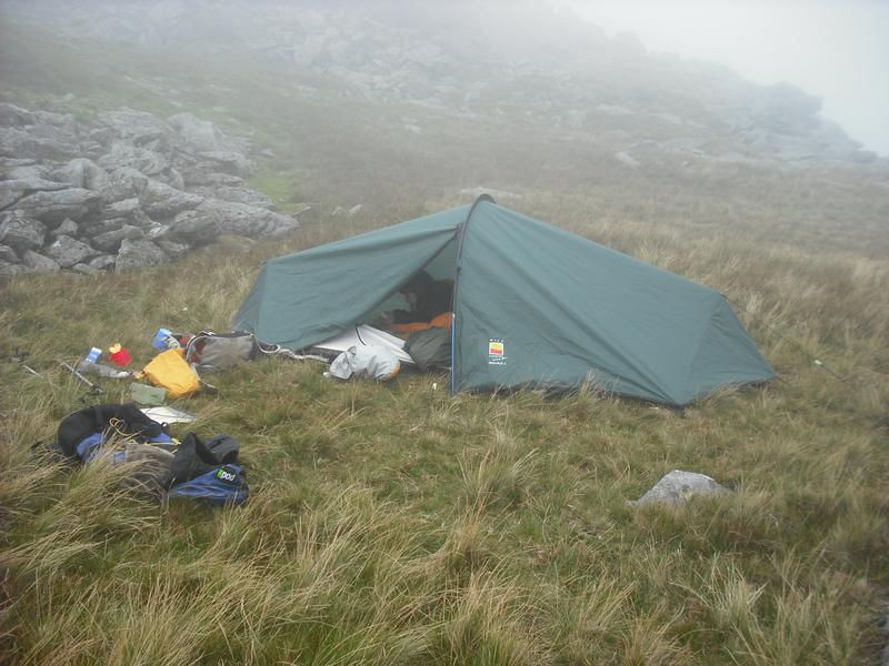
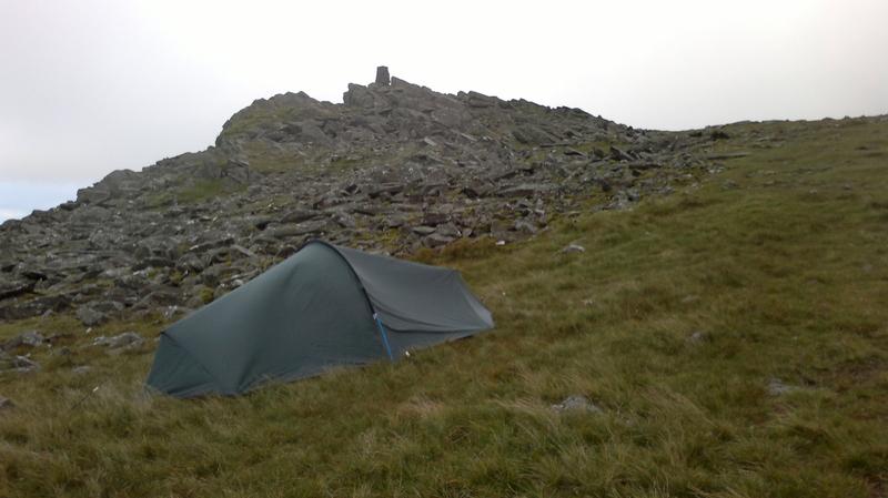
A few hundred feet below the summit of Carnedd Llewelyn there was a flat grassy area away from the path. It was in a hollow sheltered from the strong easterly wind, with a jumble of rocks behind to give more shelter. I soon had the tent up and got the stove going so I could have a hot chocolate. I had to be careful how I moved, as I kept getting cramp in my legs. More worryingly my left calf muscle was quite swollen, although not painful. Eighteen months ago I had suffered a DVT in my right leg and I was fairly certain that I now had one in my left leg.

I didn't feel like a big meal, so finished off the remains of the sandwich I had bought in Capel Curig for lunch. Reviewing the water situation, I had enough to make a hot breakfast cereal and a couple more mugs of hot chocolate, whilst still having a bit more than a quarter of a litre to last me until I reached Llyn Colwyd. I settled 
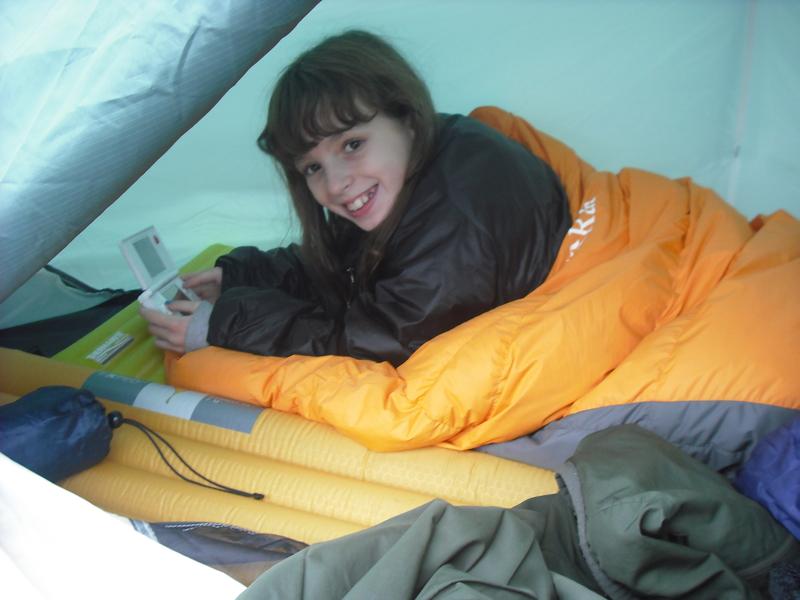
into my sleeping bag and started listening to a few Podcasts on the iPod. A couple of times during the night I nipped outside to look at the stars and watch the light of the coastal towns. It was quite cold outside and according to my watch the temperature inside the tent was 2.7C, so it was probably about freezing outside.

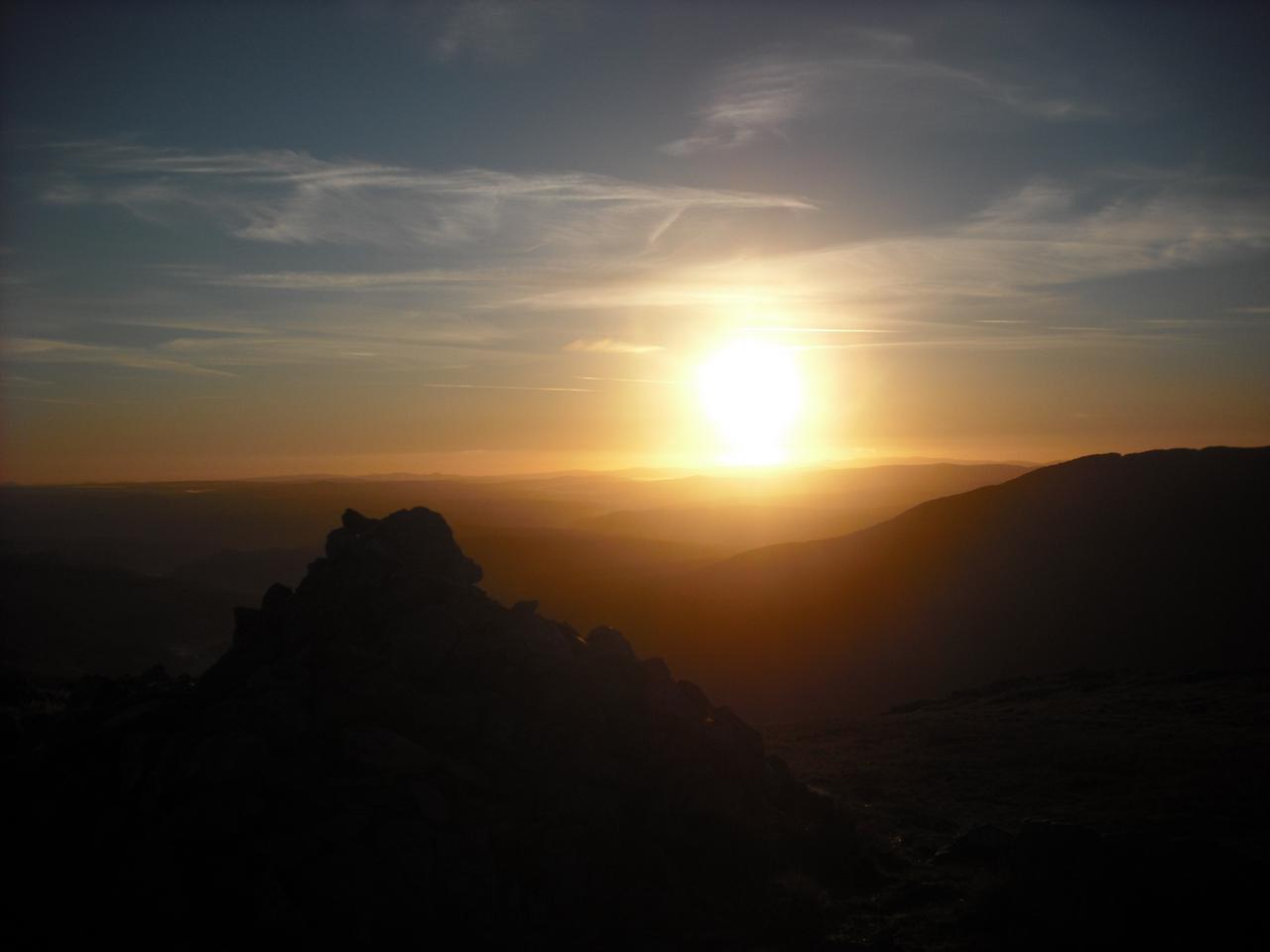
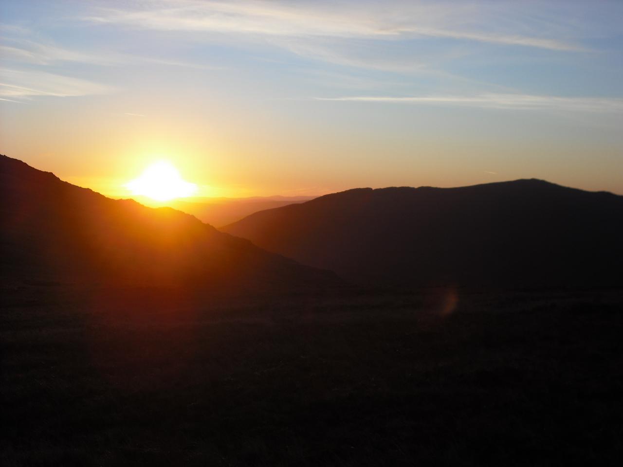
I slept quite well, but was awake when it started to get light around 5:00am, although the sun didn't come up until nearly 6:00am. I made myself another hot chocolate and had a hot breakfast cereal, which I hoped would set me up for the day. My legs didn't feel too bad and most of the swelling around my left calf had gone down overnight.

I was packed up and ready to go shortly before 7:00am. I made my way down past Craig yr Ysfa stopping to look down at the top part of Amphitheatre Buttress and Pinnacle Wall. I met an early riser coming up the rock step on my way down to the col. Once I reached the col, I had another quick look at my left calf, which was now swollen up again, but not painful. I toyed with the idea of descending to the forestry road below and returning to Capel Curig along the valley. However, I didn't fancy the descent down the loose slope and 
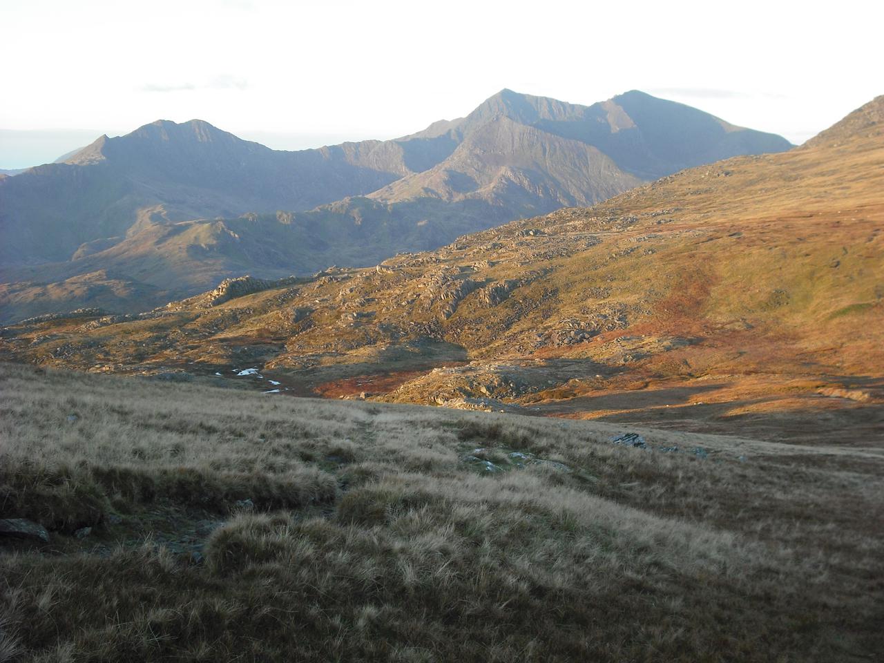
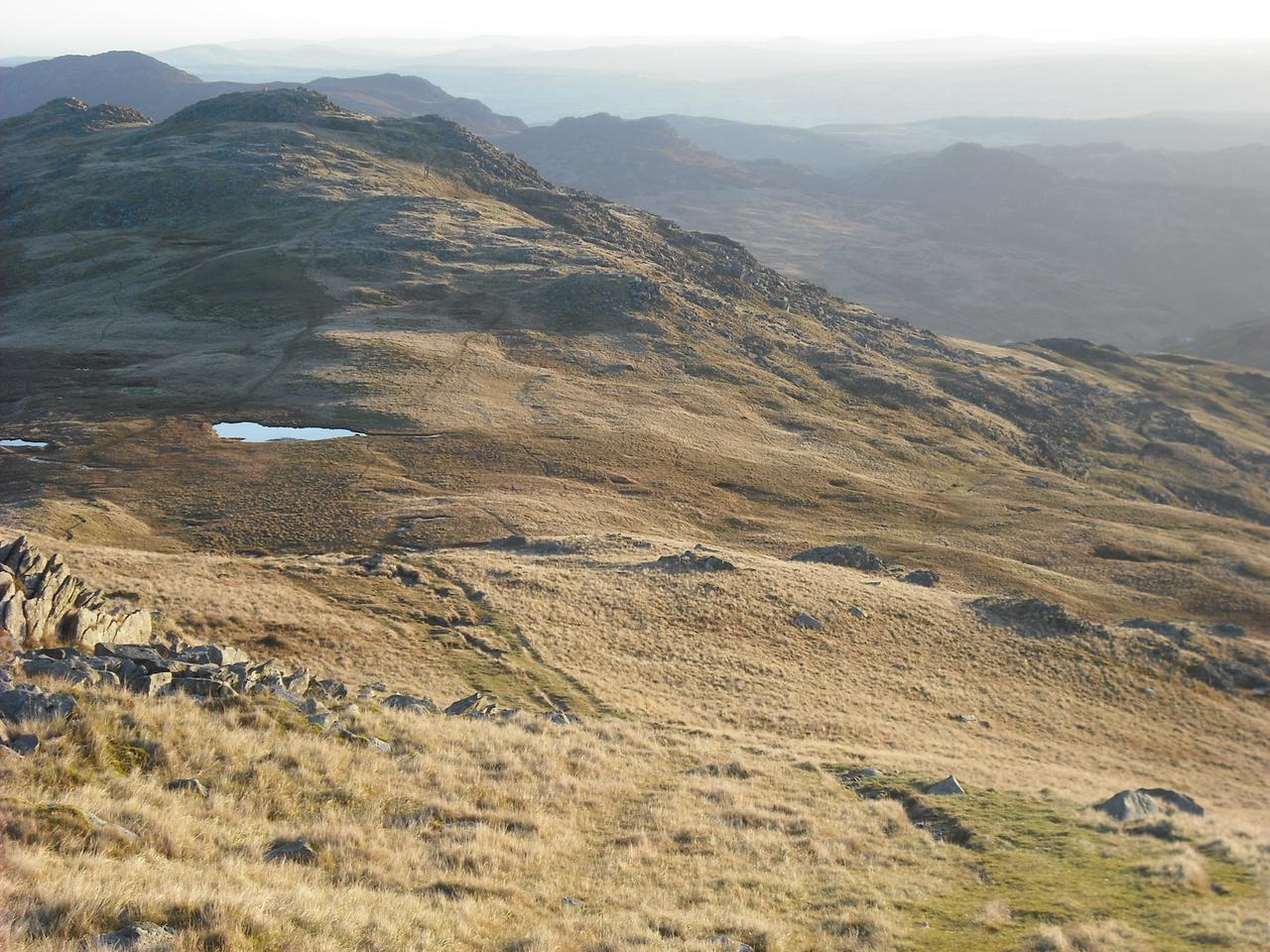
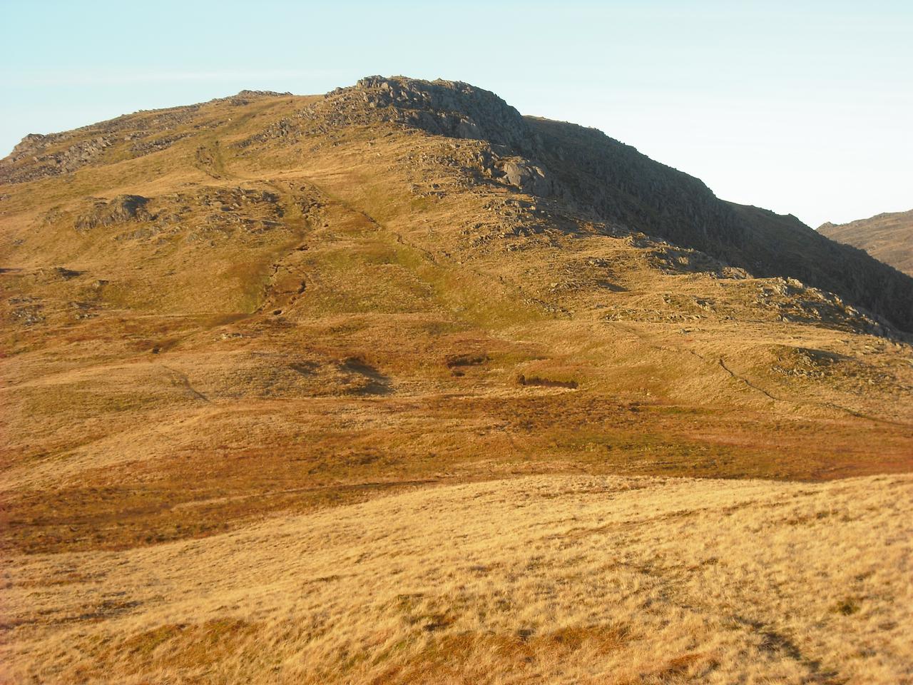
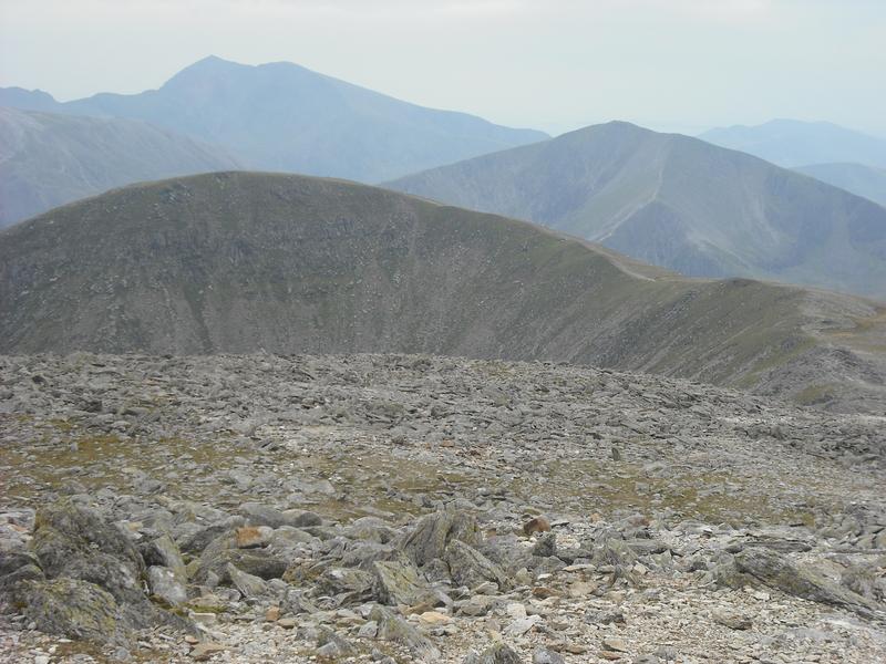
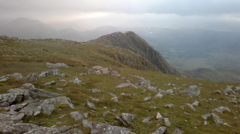
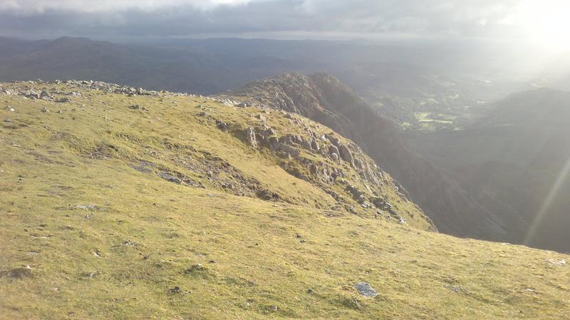
decided to climb up to Pen yr Helgi Du and see how I felt. I always enjoy the scramble up this ridge and although there were a couple of low clouds blowing past, most of the sky was clear. The summit was closer to the top of the ridge than I remembered, which was a pleasant surprise. However, it was shrouded in mist when I arrived.

I had another look at my swollen leg and decided that I may as well continue over Pen yr Helgi Du and see how things went. I got out the map and took a bearing and of course as soon as I had done this the mist cleared and I could see exactly where I wanted to go. It's quite a long descent to ???? and I wasn't looking forward to the re-ascent up Pen Llithrig y Wrach. However, the slope wasn't as bad as it looked and I was soon over the steepest part. The summit was still some distance away, but it was easy going. I don't recall ever having climbed Pen Llithrig y Wrach before, it was a first for me. It was still early, so I had the summit to myself.

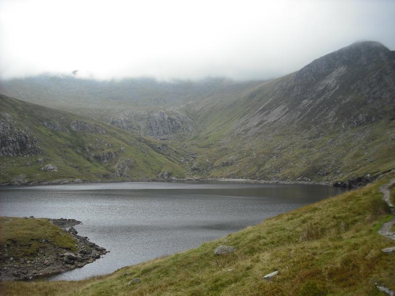
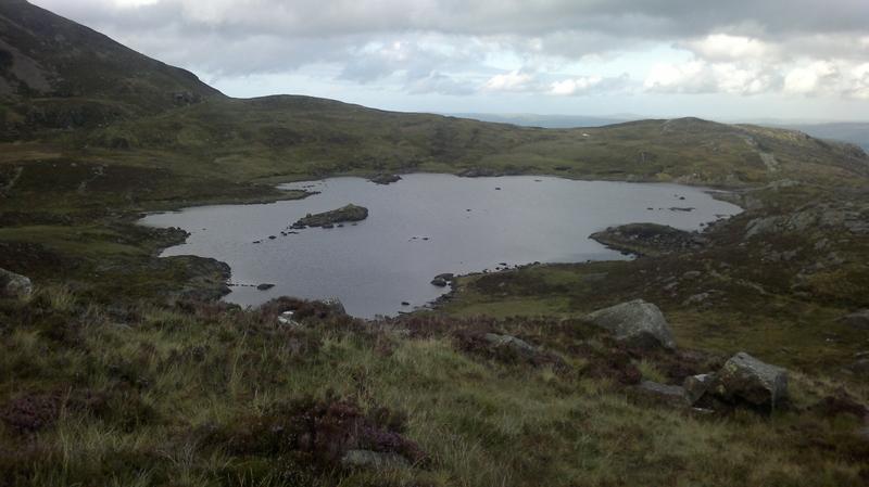
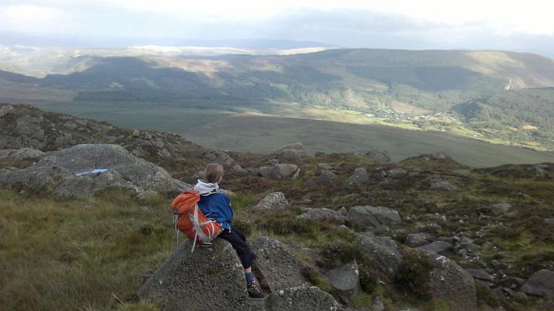
I drank the last of my water and began descending the South East ridge. On my way down I met three other people sweating up towards the summit. There is a small path most of the way down. However, I lost it a few hundred feet above the lake. I bush-whacked down the final descent through some tussocks and boulders to reach the path alongside 
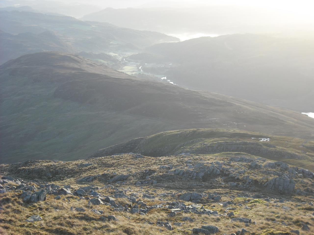
Llyn Colwyd. My original intention was to continue along the ridge of Creigiau Gleision before dropping back into Capel Curig. However, I was concerned about the state of my leg and decided to climb up to the col above Llyn Colwyd and follow the path along leading South East past the end of Creigiau Gleision, back towards Capel Curig.

I had to cross the stream that runs into Llyn Colwyd, but the first bridge I came to was blocked off with wire. Looking at the map, I could see there was another bridge a short distance away. I filled my water bottle from the stream and set off. In a few hundred yards I came to the bridge and crossed over the stream. Once on the other side the path drops gently towards the A5 coming out near to a house called Bron Heulog. There remained a half mile walk along the road back to the car.

I made myself a couple of brews and set off for Pete's Eats in Llanberis for a fry up. A trip to the hospital the next day confirmed that I had another DVT, so back to taking the rat poison!