Circular Ride From Whitchurch

The route is described starting from Whitchurch, but since it's circular, you could start from anywhere. There is only one short steep hill between Tittenley and Calverhall. Apart from Whitchurch, which does have some cycle lanes, most of the route is on quiet country lanes.

From Whitchurch turn up Claypit Street, which is just before the new Sainsbury. Alternatively, you can follow Sustrans Route 45. The road leads slowly uphill past a cemetary and the ??? camping farm. A downhill section leads to a left hand bend, where you take the road (Ossmere Lane) on the right. Shortly after crossing the railway you will join Sustrans Route 45, which comes in from the right. If you look in the hedge on the left hand side your will see ???? Mercian statue.

At the T junction turn right into Hollyhurst road. You will be able to see and obelisk to your right, which is a war memorial in the grounds of Combermere Abbey. Shortly before you go underneath he railway, there is a style and a grassy area on the right, which provides a convenient stopping place to eat and drink. Immediately after you go under the railway bridge turn right and then a short distance further on turn right again at a fork in the road. You are now on Sustrnas route 70. This will lead you through Aston, past the corn mills, to the main Whitchurch - Nantwich road. Cross this and head off along Shepenhall Lane. Ignore all the turnings to the left and right. Just after you cross over a brook Shepenhall Lane changes into Rookery Lane.

Cross over the main road to Audlem and follow Royals Green Lane. After half a mile or so, you will come to a T junction opposite the end of Wilkesley Wood. Turn left along Wilkesley Lane and cycle through the hamlet of Wilkesley. After about a mile and a half, at the end of a long red brick wall you will pass the two lodges which were one of the entrances to the Shavington Estate. Carry on along the road until it bends sharply to the left. At this point you need to take the lane to the right, which leads past the large pool at Tittenley, on your left hand side.

Shortly after passing the Tittenley pool there are another two lodges, which mark what used to be another entrance to the Shavington Estate. Turn up the lane to the right, which is the only real climb on this route. It doesn't last very long and leads you to another T junction. Turn right here (signposted Calverhall). After half a mile of so you will pass the grand iron gates, which were the main entrance to the Shavington Estate. Carry on until you reach the small village of Calverhall. The Jack pub on the left is well worth a visit and serves good food and beer.

Turn right at the T junction and cycle into Ightfield. There is a convenient brick bus shelter here, which is a good place to eat your sandwiches if it's raining. Follow the bend round to the left. Just on the right there is a large grassy playground, with a couple of benches. This is a nice place to eat your sandwiches in good weather!

The road continues on into the two villages of Ash. It's a short easy climb and there is a nice duck pond where you can linger. From Ash the road descends to meet the Whitchurch bypass. Cross straight over the roundabout and enter a small industrial estate. Carry straight on at the apex of the sharp left hand bend which allows you to regain the old main road into Whitchurch, via a short stretch of footpath. From here it's only a short ride back to the town centre.

Cafes and Pubs.

  • Jones Coffee House, House Green End, Whitchurch
  • Juan Cafe, Watergate St, Whitchurch.
  • Dusty Miller (pub) Wrenbury Tel:
  • The Jack, Calverhall Tel:

Parking.

Free parking in Whitchurch, Aston and Wrenbury. If you know the area there are plenty of laybys on the route where you can park.

Stats.

  • Distance: 34km
  • Ascent: 302m

Website Makeover

One of my original goals in using Jekyll as a static site generator was to make it easier to write posts and thus increasing the number of my posts. However, I found Jekyll had a couple of idiosyncrasies with categorizing and tagging posts that made it awkward for me to use. It was also difficult to re-theme the site, without doing an almost ground up re-write.

I searched Google for another static site generator and tried a few out before I discovered Pelican .This seemed to fit in with all my requirements:

  • written in Python, which makes it easier for me to hack on.
  • good handling of categories, tags and static pages.
  • easy to use template language (Jinja2).
  • themes
  • it was simple to write a new reader that understood my existing YAML files, so I didn't have to rewrite all my old posts.
  • I can use Emacs to write my posts.

Sea To Summit Xmug

I managed to crack my plastic mug and was about to buy another one when I decided to investigate the alternatives. I don't like metal mugs of any sort. I end up burning my finger and lips whenever I use them. Mugs take up space in my rucksack. I can try to stuff things inside them to try and reduce the dead space, but this isn't always possible.

Sea to Summit X-Mug

I had read several reviews of Sea to Summits X-Mug . It's constructed from silicone with a rigid rim. Its unique selling point is that it collapses into a flat disc. It holds around 500ml and the rim around the top prevents scalded fingers. I had a couple of concerns about it. Firstly I wondered how stable it was, I didn't want it collapsing in the tent when it was full of a hot drink. Secondly some reviewers said that it retained the taste of the previous contents. However, several other people said that they hadn't found this to be a problem.

I nipped into my local Cotswold to have a look at one. After examining one I was happy that it wouldn't collapse accidentally. I decided to take a chance that it wouldn't retain the taste of any previous contents and bought one. When I got it home I tried several drink in it and confirm that after washing it doesn't retain the taste of the previous contents. It was find with hot drinks, I didn't scale either my fingers or my mouth. Drinks do cool down a bit faster than in my old plastic beaker. However, this is an advantage for me as I like to have my hot drink as soon as I have made it and it doesn't stay in the cup long enough to get cold!

Carneddau Horseshoe

At last the weather was showing signs of improving with good forecasts for today and for the next few days. I took my son to his rowing session in Chester and carried on towards North Wales along the A55.

I had decided to do a route from Cwm Eigiau. I have been walking over the Carneddau for many years, but never started from Cwm Eigiau. I took the windy single track road up from Tal-y-bont, which leads to a small car park in the heart of the Cwm. Luckily the only vehicle I met on the road was the farmer's Landrover at one of the gates. The car park was quite crowded, with several mini-buses and people milling about. I pulled in at the far end next to and old Post Office van, which had been converted into a camper van. By the time I had sorted out my rucsack it was 11:00am. I set off along the path from the car park to the NW leading to Clogwynyren. The plan was to gain the ridge somewhere around Foel Fras and continue towards Foel Grach.

Wild pony

I reached the bridge over Pant y Griafolen and followed the path to where it reached Afon Garreg-wen. The plan was to follow the stream uphill to meet another path shown on the map, which crossed it at about 707677. This path would lead me on the plateau. The slope alternated between boggy sphagnum and steep grass and bilberry. Steep sections were interspersed with short flat shelves. I couldn't see the top of the ridge above me, but I judge how far I had to go by looking over to the rocks on the summit of Foel Fras. The tedium of the ascent was relieved by a couple of wild ponies, who allowed me to approach quite close to them. I never found the path that is shown on the map, but eventually I arrived on the plateau just to the South of Foel Fras. I dumped the sack and did a quick there and back to the summit before continuing on to Carnedd Gwellian, where I stopped for lunch. Ahead of me I could see a cap of cloud over Foel Goch and Carnedd Llewelyn, but it looked as though it was slowly lifting. By the time I had eaten my lunch Foel Grach was clear.

Path to Foel Grach

I made my way along the plateau to Foel Grach and paused to have a look round the emergency shelter. The last time I can remember visiting Foel Grach was in September 1982. At that time there was a Visitors Book, which I had signed. I opened the door to the shelter and went inside for a look round. There is no longer a Visitors Book and inside it was quite damp, but tidy with several small benches. Whilst it is probably very useful in an emergency, I can't imagine wanting to stay there otherwise. It's also quite hard to find, being sort of hidden in the slope below the summit.

Refuge on Foel Grach

After taking a few photos I continued over to the summit of Carnedd Llewelyn. The top hundred feet or so were misted out. However, as I started dropping down the SE ridge I soon dropped out of the cloud. I paused briefly at a spot, just off the path, where I had camped on a couple of previous trips for a drink and to admire the views. Continuing on over Craig yr Ysfa there were fine views all around. Often at this time of year the atmosphere is hazy, but I could see the Moelwyns and Cader in the distance. I scrambled down the rocky step above Bwlch Erol Farchog and started up the short steep scramble to the summit of Pen yr Helgi Du. Behind me I could see a family group with two children struggling to find a way down the rock section to the col. However, eventually they managed it without incident.

Camp site at Pen yr Helgi Du

It was now 5:00pm. I had thought about continuing on to camp on Pen Llithrig y Wrach. However, on the scramble up the ridge I had began to get cramp in my legs, a sign that I needed to stop to rehydrate and eat something. Also I think that the summit of Pen yr Helgi Du is a better viewpoint.

Evening light.

There is no reliable water supply on the Carneddau ridge, so all water must be carried up. I tend to sweat a lot, so had dragged three litres up with me. This is just enough to last me through a hot day with an evening meal and a breakfast the next morning, leaving a small amount to drink on the route back to the car.

Just before sunrise

I soon had the tent up and after a drink and some food felt much better. It was a perfect evening. The cloud, which had been covering many summits, cleared leaving perfect views in all directions. The sun disappeared behind Carnedd Llewelyn about 8:00pm. There was a bright moon and the odd shooting star could be seen, perhaps the precursors to the Perseid showers.

Here comes the sun

About 4:00am the next morning I had to get out of the tent to answer a call of nature. Although the official sunrise was about 45 minutes away, The horizon to the East had a faint tinge of red. There was no wind and rather than clamber back into my sleeping bag I started to cook breakfast, so I could sit outside and enjoy the sunrise. By 6:00am I had packed up and was ready to start the day, with the sun now well above the horizon. I don't like heat, so wanted to get most of my walking done before it got too hot.

Looking East

The plan was to climb Pen Llithrig y Wrach and then somehow get back down to Cwm Eigiau. My Harvey's map didn't show any path down from Pen Llithrig y Wrach into Cwm Eigiau, but it looked easy enough to go along the NE ridge and drop off the end. Also I had some notion that there would be a path from Bwlych tri Marchog down into Cwm Eigiau. Descending the slope to the bwylch it was obvious that there was no path down into Cwm Eigiau. It didn't look too hard from above, but I presume that there must be hidden difficulties, as it would be the most obvious route between Ogwen and Cwm Eigiau.

Glyders at dawn

From the summit of Pen Llithrig y Wrach there was an obvious path leading to the NE down the ridge. However, once I had descended a few hundred feet the going became very boggy. I was wearing trail shoes and any idea of keeping my feet dry was abandoned as I splodged though the sphagnum. Further along the ridge the path became more indistinct, but was obviously heading for Moel Eilio. I didn't want to go that far, but hoped to meet the path shown on the map that crossed the ridge from Hafod y rhiw. However, I couldn't find the path, or maybe I just didn't go quite far enough.

Looking Back Towards Pen Llithrig y Wrach.

* *

I decided to cut down the side of the ridge above Hafod y rhiw. The going was very difficult, with waist high heather and lots of hidden rocks. At one point my left leg dropped into a hole between two rocks hidden under the heather. Luckily no there was no serious damage. An accident here would have been unfortunate as there is no phone signal and nobody knew where I was. Trying to crawl down would have been almost impossible. After a few hundred feet I came across what at first I thought was a sheep track. However, a bit further on I saw a couple of boot prints and eventually it turned into a path leading to Hafod y rhiw.

I trudged back along the track in the hot sunshine to the car park, where the couple in the red Post Office van kindly made me a cup of tea. Apparently, they used to be keen backpackers, but the woman had a back injury which meant she could no longer carry a load. They spent most of their time touring the country living in the camper van and going for day walks.

Pen Llithrig y Wrach and Pen yr Helgi Du from Cwm Eigiau.

* *

On the way back down the narrow lane to Tal y Bont, I met a tractor coming up to row some hay. Luckily there was just enough space to get past with a bit of toing and froing. I would like to do another trip from Cwm Eigiau. However, the range of possibilities is limited by the small number of ways of accessing the ridge, unlike the Ogwen side where there are countless possible variations.

Splashing About In The Arans

On Wednesday MWIS was promising 70% chance of clear summits on the Thursday and Friday. After months of rain, this looked like a chance for an overnight trip over the Arans. However, on Thursday morning the forecast was for only 10% chance of clear summits, but with a promise of clouds clearing in the evening with Friday still forecast as 70% clear.

Boards on N Ridge of Aran Benllyn

I decided on a late start from Llanuwchllyn on the Wednesday leaving the small car park at the end of the village about 2:00pm. The weather didn't look too promising. The summits of the Arenigs on the opposite side of the valley were covered in cloud and it looked as though the summits of the Arans were covered too. I set off up the long North ridge of Aran Benllyn. After months of very wet weather, I was expecting the ground to be completely sodden. However, it didn't seem much worse than usual, which is still very wet! As I splashed upwards through the bogs, I could see that the cloud was descending. I was soon in the mist, although it wasn't actually raining.

Summit of Aran Benllyn

For some reason the North ridge always seems an awfully long way to the summit (probably because it is). About 200m below the summit I met a group of people descending and stopped for a short chat. Finally the summit cairn of Aran Benllyn appeared out of the mist and I stopped for a rest. I had hoped to continue over the summit of Aran Fawddwy and continue round to the memorial cairn at Drws Bach camping near Gwaun Lydan. As the weather showed no signs of improving I decided to drop down from Erw y Ddafad-ddu to Creiglyn Dyfi. The only sensible way down is via a steep grassy spur, which cuts through very steep ground on the eastern face of the Arans. Finding the top of the spur and picking the correct line of descent in the very limited visibility could have proved very tricky. Anticipating this problem I had loaded up a track from v-g's web site into my Garmin GPS, which lead me safely down into the cwm.

Camp at Creiglyn Dyfi

The clag was well down and I only saw Creiglyn Dyfi when I was a couple of hundred feet above it. Casting around for a decent spot to camp, I settled on a very small level grassy area by the northern shore. There was a small stream only a few yards away, which looked as though it might flood my proposed site if there was a storm. However, I decided to take the chance. As soon as I got the tent out it started to rain. This was the first outing for my Terra Nova Voyager Superlite. I had bought this tent in one of Field and Trek's 30% discount, plus another 10% price matching from GoOutdoors. Although I am very happy with my Zephyros 2, it isn't really suitable for two people, whereas the Voyager has plenty of room. In fact it turns out that the Voyager is slightly lighter than the Zephyros. However, it does have one disadvantage. It's an inner pitch first and as I had only put it up once indoors, so wasn't the fastest pitch. Just to make life more difficult, there was only a very thin covering of grass over the stones, so getting the pegs in was hard work. There were several minutes of cursing before I finally got the tent up properly.

Camp at Creiglyn Dyfi

Of course as soon as I had got the tent up it stopped raining. As I was very wet, I decided to go for a bit of a wander round the lake before retiring to the tent and getting into some dry clothes. Creiglyn Dyfi is a very inspiring place to camp. The edge was somewhat taken off the experience by the persistent clag obscuring the views of the Arans. I crawled inside the tent, got into some dry clothes and cooked tea. For one the Voyager is super spacious and in the poor weather the large porch was great for cooking and storing my wet clothes.

Cwm Cynlwydd

During the night there were several heavy showers, but luckily the small stream next to me didn't burst its banks. Peering out of the tent at 5:30am the next morning I could see that the cloud had risen above the summit of Aran Fawddwy. I had planned on a quick descent back to the car via Cwm Llwydd and Talardd. However, the prospect of views from the summit ridge was enticing. I decided to retrace my route and savour the views up there.

View SE from Aran Benllyn

I packed away and began the long 1,000ft slog back up the grassy spur to Erw y Ddafad-ddu. Inevitably as I climbed back up the steep slope, the clag began to drop again. By the time I reached Erw y Ddafad-ddu the whole ridge was covered. On the plus side, I could see a bright patch where the sun was trying the break through and there was a steady breeze. Sure enough by the time I had reached Aran Benllyn the clag had mostly cleared the ridge, although Aran Fawddwy remained covered. The air was exceptionally clear, so I got great views through breaks in the mist. In some ways this was much better than unbroken horizon to horizon views. Every few minutes a different patch of mist would disperse and I would get a new view.

Cloud gathering over the Aran Ridge

Dropping down from the summit of Aran Benllyn, I emerged completely from the clag. Somehow the descent of the north ridge seemed even longer than the ascent. Eventually I arrived back to the car, where I got into some dry clothes and made a brew before setting off back . Although the weather was far from perfect it had been a very satisfying trip.

Bala from the ridge

Looking at the long descent back down the North ridge

Lake Vyrnwy in the distance

* *

Carneddau Traverse

Another outing over the Carneddau, coinciding with a window of one and a half days of decent weather in the current wet and cold. The trip had to be fitted around dropping my son off early on a Saturday and then collecting him late on the Sunday morning. As I drove along the A55, I wasn't sure what I was going to do. Arriving at Ogwen around 9:30am it was already busy and I ended up parking opposite the MAM hut at Glan Dena.

<div class="photofloatl"> <p><a class="fancybox-thumb" rel="fancybox-thumb" href="/images/2012-05-carned/DSCF2433.JPG" title="Pen yr Ole Wen SE Ridge"> <img src="/images/2012-05-carned/thumb.DSCF2433.JPG" width="200" alt="Pen yr Ole Wen SE Ridge"></a></p> <p>Pen yr Ole Wen SE Ridge</p>

</div>

Getting out of the car, I could see that the Glyders were clear, but there was a thin cap of cloud over Pen yr Ole Wen. I wanted to do a decent walk on the Saturday, with a camp on a summit, leaving a short walk on Sunday morning giving me plenty of time to get back to collect my son. MWIS had promised that most summits would be clear of cloud and the wind and rain wouldn't arrive until Sunday afternoon. On that basis I decided to do a traverse of the main Carneddau ridge and camp on Pen yr Helgi Du.

<div class="photofloatr"> <p><a class="fancybox-thumb" rel="fancybox-thumb" href="/images/2012-05-carned/DSCF2436.JPG" title="Carnedd Dafydd misted out"> <img src="/images/2012-05-carned/thumb.DSCF2436.JPG" width="200" alt="Carnedd Dafydd misted out"></a></p> <p>Carnedd Dafydd misted out</p>

</div>

I packed my sack and set off past the MAM hut to join the south east ridge of Pen yr Ole Wen. I had done the treverse the other way round last year with one of my daughters whilst wearing my Inov8 Roclite 295's. I had found these to be very comfortable, even when carrying a load. However, after all the wet weather I knew that I would probably get wet feet, but in the end decided the greater comfort of the Inov8's outweighed the dryer feet if I wore boots. I managed to get only slightly damp feet on the pull up to the foot of the south east ridge through several boggy patches.

<div class="photofloatl"> <p><a class="fancybox-thumb" rel="fancybox-thumb" href="/images/2012-05-carned/DSCF2441.JPG" title="Menai Straights appears briefly"> <img src="/images/2012-05-carned/thumb.DSCF2441.JPG" width="200" alt="Menai Straights appears briefly"></a></p> <p>Menai Straights appears briefly</p>

</div>

Before starting up the ridge I filled my water bottles from the stream. One disadvantage of the Carneddau is the lack of any reliable water supply on the summits. Showell Styles in his "Backpacking in Wales" describes the position of a spring on ????, but I have never located it, although to be honest I haven't looked that hard. I shouldered my rucksack, which had suddenly gone from "quite light" to "heavy" with the addition of 3 kilos of water.

At the foot of the rocky gully I passed someone going quite slowly, who said that he was part of a party walking over to Aber. Higher up I met his companions, who said that he had the keys for their car parked at Aber, so one way or another he was going to get there! The upper section of the south east ridge seems to go on for ever. Each small rise leading to yet another flatter section, which in turn leads to another small rise. You can't really see the summit until you emerge next to the cairn.

<div class="photofloatl"> <p><a class="fancybox-thumb" rel="fancybox-thumb" href="/images/2012-05-carned/DSCF2457.JPG" title="Looking West. Afon Llafar far below."> <img src="/images/2012-05-carned/thumb.DSCF2457.JPG" width="200" alt="Looking West. Afon Llafar far below."></a></p> <p>Looking West. Afon Llafar far below.</p>

</div>

The top couple of hundred feet were misted out, so I didn't stop, but continued down to the col between Pen yr Ole Wen and Carnedd Dafydd. This was just below the cloud and I caught tantalising glimpses of the sea to the west and the Ogwen valley to the east. Once I started to gain height on the way to Carnedd Dafydd, I was once again shrouded in mist. I stopped briefly on the summit to put on my wind shirt, as there was a very cold breeze. Dropping down towards the Black Ladders I emerged from the mist. In front of me I could see that only the top of Carnedd Llewelyn was misted out. As I began climbing the final slope to its summit a minor miracle happened and the mist lifted. The summit was just clear of the clag when I reached it.

<div class="photofloatl"> <p><a class="fancybox-thumb" rel="fancybox-thumb" href="/images/2012-05-carned/DSCF2461.JPG" title="Tent on Pen yr Helgi Du. Moel Siabod in Background."> <img src="/images/2012-05-carned/thumb.DSCF2461.JPG" width="200" alt="Tent on Pen yr Helgi Du. Moel Siabod in Background."></a></p> <p>Tent on Pen yr Helgi Du. Moel Siabod in Background.</p>

</div>

I thought I might wander over to Foel Grach. I wanted to have a look around the shelter just below the summit. At one time someone from down in the valley used to make weekly visits to the refuge to make sure it was kept tidy and in a good sate of repair. The last time I can remember visiting it was in 1982, when I signed the visitors book there. However, just as I began to set off over the plateau, the mist dropped again and the views disappeared. Decided to leave Foel Grach for another day, I retraced my steps to the summit of Carnedd Dafydd and began descending the ridge towards Craig yr Ysfa.

<div class="photofloatl"> <p><a class="fancybox-thumb" rel="fancybox-thumb" href="/images/2012-05-carned/DSCF2463.JPG" title="Summit of Pen yr Helgi Du. Carnedd Llewelyn beyond."> <img src="/images/2012-05-carned/thumb.DSCF2463.JPG" width="200" alt="Summit of Pen yr Helgi Du. Carnedd Llewelyn beyond."></a></p> <p>Summit of Pen yr Helgi Du. Carnedd Llewelyn beyond.</p>

</div>

I soon dropped out of the cloud and stopped for lunch just off the path, where I had camped with my daughter on my last visit up here. After finishing lunch and having a bit of a rest, I set off towards Craig yr Ysfa. Peering over the cliffs I could see two climbers high on Amphitheatre Buttress. If we ever get a warm settled spell, this is one route I want to take the children up. It's probably one of my favourite climbs. The climbing is generally easy, but it is a compelling natural line, which finishes right on the summit. A real "mountaineering" route.

<div class="photofloatl"> <p><a class="fancybox-thumb" rel="fancybox-thumb" href="/images/2012-05-carned/DSCF2478.JPG" title="Sunset."> <img src="/images/2012-05-carned/thumb.DSCF2478.JPG" width="200" alt="Sunset."></a></p> <p>Sunset.</p>

</div>

When I reached the awkward rock step just above Bwlch Eryl Farchog, there was a large party there. Fortunately, most of them had already climbed down, so I didn't have to wait long. At the Bwlch they discussed whether to descend directly to the reservoir track, or continue up to the summit of Pen yr Helgi du. In the end they decided to follow me up the short scramble that leads to the summit. It was only about 4:00pm when I reached the summit and I debated continuing on to Pen Llithrig y Wrach to camp there. However, I didn't fancy the trek back along the road the next morning. By descending from Pen yr Helgi Du I could avoid the road and walk along the old A5.

<div class="photofloatl"> <p><a class="fancybox-thumb" rel="fancybox-thumb" href="/images/2012-05-carned/DSCF2476.JPG" title="Dawn"> <img src="/images/2012-05-carned/thumb.DSCF2476.JPG" width="200" alt="Dawn."></a></p> <p>Dawn.</p>

</div>

I set up the tent and made tea. By this time the cloud had cleared from all the summits and the cold clear air meant that the views were spectacular. Despite seeing quite a number of people out walking during the day, I didn't see a single person after 6:00pm. Shortly after 9:00pm I was treated to a spectacular sunset. the temperature began to drop rapidly and I retreated to my sleeping bag. I had a quiet night with almost no wind. However, over on the Arans v-g was experiencing high winds around Creiglyn Dyfi. Just goes to show how much conditions can vary, even over a relatively short distance.

<div class="photofloatl"> <p><a class="fancybox-thumb" rel="fancybox-thumb" href="/images/2012-05-carned/DSCF2489.JPG" title="Gallt yr Ogof."> <img src="/images/2012-05-carned/thumb.DSCF2489.JPG" width="200" alt="Gallt yr Ogof."></a></p> <p>Gallt yr Ogof.</p>

</div>

I was up about 4:30am on the Sunday morning. Sunrise was due around 5:30am, but it was already light. Unlike my last camp up here the weather was good. It hadn't frozen during the night, but there was a very cold breeze. I had a quick cup of hot chocolate and some cereal bars before packing the tent up. I was away sometime before 6:00am and headed down the south ridge back towards the valley. The light from the rising sun made all sorts of interesting effects on the surrounding mountains. I was soon back by the road. I ended up getting the wettest feet of the whole trip in the short section of path between the road and the old A5, where I couldn't dodge a very boggy section, but had to wade through.

<div class="photofloatl"> <p><a class="fancybox-thumb" rel="fancybox-thumb" href="/images/2012-05-carned/DSCF2492.JPG" title="Early Morning Sun on Tryfan."> <img src="/images/2012-05-carned/thumb.DSCF2492.JPG" width="200" alt="Early Morning Sun on Tryfan."></a></p> <p>Early Morning Sun on Tryfan.</p>

</div>

After a short rest in the car, I drove round to Pete's Eats for breakfast and a short browse around Joe Brown's. This ended in a shopping "accident". I noticed that they had some Inov8 Roclite 295, the same as the pair I was wearing. These are probably the most comfortable shoes I have had, both for general wear and for walking. Thinking that Inov8 would either discontinue them, or bring out an "improved" version I didn't like, I ended up buying another pair to replace my current pair when they wear out.

Moel Siabod Summit Camp

I had planned to go for a walk in North Wales, but the MWIS forecast wasn't too good. There was supposed to be a good chance of clear summits, but with hail showers possibly merging into longer periods of continuous downpours. The weather at home wasn't too bad, so i decided to drive over without making any definite plans about my objective.

Storm Clouds Over Moel Siabod

As soon as I dropped down off the A5104 towards Corwen it looked as though the "showers merging to form longer periods of hail", was the most likely option. I decide to drive into Capel Curig and see what conditions looked like there. True to form its was pouring down and all the summits were covered in dense grey cloud. Thinking that the outlying summits might have better conditions I drove over to Llanberis and thence towards Waun Fawr. Dropping down into the village I could see that M. Mawr was misted out and it was still raining in the valley. Continuing along the road to Rhydd Ddu, I pulled into the car park to look at the Nantlle Ridge. This too was misted out, but there appeared to be faint hope as the ridge connecting ???? to Moel Hebog was partially clear.

Y Cribau and Yr Aran

* *

I drove on towards Beddgelert thinking that I might climb Moel Hebog, then continue along the connecting ridge towards ??? finally returning via the forestry tracks. However, when I parked in Beddgelert it was raining quite hard and the mist had descended even further. Clutching at straws I decide to continue my grand tour of Snowdonia and drove down towards Blaenau Ffestiniog, thinking that I might do another walk in the Moelwyns. I could see that Cnicht was clear, but when I arrived in Blaenau Ffestiniog it was raining even harder and all the surrounding peaks were covered in the thick grey clag. It was now after 2:00pm and I was considering doing a low level walk in the rain. Somehow I felt that the weather would improve later in the day, so to complete my circuit of Snowdonia I set off over the Crimea Pass towards talkytoaster. As I approached the summit of the pass, I could see that the cloud over Moel Siabod was starting to lift above the summit and the rain was slowly dying out. By the time I reached the car park outside Bryn y Glo in Capel Curig, the rain had stopped and the sky was brightening.

Snow on the Carneddau

* *

It was now 3:00pm and I decided on an overnighter on the summit of Siabod. This is one of my favourite mountains. It's isolated position gives it grand views over most of Snowdonia. This would be my third summit camp on Siabod. The first in May time was in perfect weather. The second with one of my daughters, was in very uncertain weather, with high winds on the summit. However, we were luck and despite the very high wind we had good views, but a very noisy night as the tent flapped in the wind.

Zephyros Pitched below the summit

* *

I packed my sack and was soon making my way past the water falls at Pont y Cyfnyg and up the farm track towards the mountain. As I gained height I could see the tops of the Carneddau were covered in snow. Earlier in the day I glimpsed a covering of snow on Siabod through breaks in the cloud. However, it appeared to have melted during the day. As I climbed up the huge grey clouds began to disperse and soon there ere large blue patches everywhere. Visibility was excellent, the rain and cold air ensuring there was no haze to obscure the views.

Sunset Over the Carneddau

* *

I intended to climb the Ddear Ddu ridge, so turned left at the ladder style at the end of the farm track. I mad my way through the old quarry workings and climbed up to the small col above llyn y Foel. Dropping down towards the lake the ground was very wet. By weaving about and some tussock hopping I avoided getting my feet too wet. I could see someone at the bottom of the Ddear Ddu ridge, but this was the only person I saw all day. I stopped to fill my Platypus bottles from the lake before beginning the ascent. Although the rock was wet, it didn't seem greasy. I kept close to the right hand side of the ridge, to enjoy the exposure. The ridge always seems longer than it looks from below. Not that it matters, as the climbing is so enjoyable. Eventually I arrived at the final rocks below the summit cairn and made my way onto the summit ridge so I could enjoy the views over the far side. There was a stiff breeze and it felt very cold.

Glyders at Sunset

I was keen to get the tent up quickly and chose to pitch on the slightly sloping grass platform on the South East side of the summit, where I had pitched with my daughter. Unfortunately, I pitched a little too far up the slope and wasn't able to get a good taut pitch, as the ground wasn't level enough. As it was very cold I didn't want to take the tent down and move it, so I decided it would do. I chucked all my gear into the tent and began to make tea. On overnighters I alternate between eating Bewell Hot Cereal Start and Porridge with Sultanas. Since it's only an evening meal and a breakfast it doesn't get too boring. Although dehydrated food has come a long way since my 1976 trip to Scandanavia, the only varieties I really enjoy are the porridge and Hot Cereal Start. Stupidly I had forgotten my pot cosy, so has to add a little extra hot water just before eating my meal, as it had cooled down quite a bit.

Snowy Summit at Dawn

* *

It was now almost sunset, so I had a walk around the summit and took some photos. The wind was very cold and I was only just warm enough with all the layers I had brought with me. I dived back into the tent, where my thermometer showed it was only 2.5C. The angle of the slope was just enough for me to slide down my Exped UL Synmat. Eventually, stuck a load of gear at the end of the tent and wedged my feet against it to stop me sliding. It brought back memories of a bivouac near to the summit of the Matterhorn many years ago. There are lots of ledges on the Matterhorn, but most of them slope outwards. During the night I kept sliding down the ledge and ending up being brought up sharp by the rope. At least this time I was warm. On the Matterhorn I had no sleeping bag and the night was spent shivering violently until that warmed me up and slithering down the ledge.

Clouds Blowing in From the West

Looking out of my tent at first light the ground was white over. At first it appeared as though the summit was misted out, but it was only a very thin layer and it soon dispersed to give excellent views. I had a feeling that the good weather might not last, so after a quick breakfast began to pack away. I was just taking the tent down when a brief snow storm blew in, to make the job more difficult. It soon cleared and I began to make my way back down towards the Eastern ridge. I traversed below the rocky crest, wanting to avoid the ice glazed rock while carrying a relatively heavy sack.

Stormy Sunrise

I was soon making my way down the series of depressions in the North East ridge, which lead back to the farm track. Part of the way down the track, I met a group of young people trudging up hill bent under the weight of huge rucksacks.

Looking Towards the Farm Track from the Descent

* *

Arriving back at the car I drove over to Llanberis for the traditional cholesterol overload at Pete's Eats. When I emerged from the cafe, I could see that I had been right about the weather and all the summits were again misted out and it was drizzling steadily. It had been a great trip and I was very lucky to get a short window of good weather in the current dreary conditions.

Descent Route on SE Face Moel Siabod

* *

Lake Vyrnwy

Lake Vyrnwy is an ideal route for children. Although the road around the lake is open to traffic, its winding nature and the presence of many other cyclists keeps motorists speeds down. The total distance around the lake is around 12 miles and the road is almost completely flat.

There are several parking places around the lake, and a cafe near the dam.

A More Challenging Ride.

For those wanting a harder ride there is an absolutely fantastic ride to Bala. It's usual to start the ride from Bala. There is around 600m of ascent and the total length of the ride is about 35 miles. From Bala the ride gains the col at Bwlch-y-Groes, which has fine views over the Arans. At 1800ft this is the highest pass in Wales. You can let your legs recover on the descent to the lake and have a well earned piece of cake in the cafe near the dam. The way back to Bala takes the other road from the end of the lake up through Cwm Hirnant before descending back to Bala.

A Trip Over The Moelwyns

Day One - Tanygrisiau to Moelwyn Mawr.

This was another trip shamelessly nicked from v-g's web site. I was hoping to do it with the children, but the weather forecast looked too dodgy to take them. The initial plan was either to do this trip, or another one over the Arans. Read on to see why I didn't do the Arans trip.

Moelwyn Mawr from Llyn Stwlan

MWIS forecast good chance of clear summits, but with heavy hail showers blowing in. I was hoping to complete my aborted trip over Aran Benllyn, camping at Creiglyn Dyfi and walking out the next day. As I drove through Whitchurch the heavens opened, but once I arrived at Wrexham the roads were dry and the sun was out. However, as I approached the A5 outside Corwen, I could see thick cloud in front. As I arrived at the traffic lights at the end of the A5104, it began pouring with rain. Hoping it might just be a heavy shower I turned off the A5 towards Bala. After three or four miles I could see that there were no breaks in the cloud and it was absolutely pouring down. There didn't seem to be any point in continuing, so I turned the car round at set off back along the A5 towards Capel Curig.

Giant hole in Moelwyn Mawr

After only a few miles along the A5 it had stopped raining. As I approached Pentrefoelas I could see that the most of the main summits were either cloud free, or only lightly covered. However, I didn't think that the weather would be suitable for camping on one of the higher summits around Capel Curig, so I turned off along the B4407 towards Blaenau Ffestiniog . I parked at the small car park at the end of the access road to Llyn Stwlan. The skies were very grey, but the summits of the Moelwyns were clear of cloud.

Moelwyn Mawr. Terrace at bottom

I packed my sack and glanced at my watch. It was now 4:00pm, but I reckoned that I would have more than enough time to get to the summit of Moelwyn Bach. I followed a man walking his dog up the road towards the resevoir, where I filled my water bottles. It's not possible to walk along the top of the wall to get to the far side, so I had to descend a short distance to get back to the start of the path. I didn't particularly want to go up to the col at Bwlch Stwlan between the two peaks, as I would have to descend from Moelwyn Bach over the same ground. So thought I would climb up the end of the South Ridge and traverse it to the summit of Molewyn Bach before descending to Bwlch Stwlan. I worked over to the left towards the base of the ridge, following a line of small concrete marker posts. As I gained height, I could see a huge hole in the hill, presumably some old quarry workings. Looking up at the ridge I could see that I would have to climb over a rocky section to gain the crest. From below this didn't look too hard, but I was conscious that I was pressed for time and I didn't want to waste time if I picked the wrong line up the hill. Luckily, there appeared to be a terrace that ran across the face of the hill, leading to the col. There was a distinct path along most of the terrace, with a couple of interesting sections where parts of the path had collapsed.

Moelwyn Mawr Summit

At Bwlch Stwlan I was exposed to the wind blowing in from the West. I thought of dumping my pack at the Bwlch while I climbed up to the summit of Moelwyn Bach. For some stupid reason I was worried that someone might take it, even though it was late in the day and there was nobody else about. Thus, I ended up carying it all the way to the top and back again. Most of the path up towards the summit is on the East face, which was sheltered from the wind. However, once I gained the summit ridge I was exposed to its full force. The clouds had been coming and going around the summit while I was climbing up, but when I reached the summit cairn there were good views in all directions. I tried to brace myself against the cairn to take some photos, but it was almost impossible in the buffeting wind.

After a couple of minutes on top, I retraced my steps to the col and began the ascent of Moelwyn Mawr via Craigysgafn. I could see sheets of "stuff" blowing in from the west. Within a few seconds I was being shot blasted by small hail stones. I was exposed to the full force of the wind for most of the climb and the layer of hail on the rock made the scrambling sections interesting. I was very relieved when the hail ceased just before I got to the summit cairn.

Tremadoc Bay from Moelwyn Mawr

There is a small grassy platform just below the summit cairn, which seemed quite sheltered. However, I was worried that the wind might shift round during the night and in any case the summit was completely misted out. I knew that somewhere there was an easy descent back towards Llyn Croesor, but in the clag I couldn't see an easy way down the steep ground. I pulled out the map and decided to descend the North West ridge and then traverse over towards Llyn Croesor. It was now well after 6:00pm and I wanted to find a good sport before it went dark.

I hurried down the North West ridge hoping to drop out of the clag. I wasn't entirely sure exactly where I was and in the words of the great HW Tilman "No one goes so far, or so fast, as the man who does not know where he is going". Eventually I dropped below the clag to fine views of Cwm Croesor. It didn't look as though I could traverse easily and the alternative was a long descent, followed by an equally long climb back up.

Summit Camp Moelwyn Bach

I made the decision to do what I should have done in the first place - camp on the summit. I had lost just over a hundred metres, so it was a bit of a slog back up. When I finally got back there, the wind seemed to have dropped considerably, but it was still misted out. I was wet through and my fingers were freezing as I struggled to get the tent up. I had just finished putting it up when suddenly the clag cleared and I could see from horizon to horizon. The sun was setting and it would be dark soon. Once I had thrown everything into the tent, I went for a short walk around the summit area. In the perfect visibility I now easily found the start of the descent path. I set a waypoint on my GPS, so I could find it again in the morning.

I made my way back to the tent to get into some dry gear and cook tea. The spot I had chosen turned out to be very sheltered and I had a quiet night.

Day Two Moel-yr-hydd and Cwm Orthin.

I was up around 6:30am. Looking out of the tent the summit was still shrouded in mist, but the wind had dropped and it wasn't hailing or raining. As I was packing away the tent, there were several spells of just a few seconds when the cloud would clear and I could see the views. I waited for a while, but it didn't seem as though the cloud would disperse for more than a few seconds at a time, so I set off. I found the start of the descent easily now I knew where it was and had soon dropped out of the clag.

Looking over Blaneau from Moel yr Hydd

I made my way over towards Moel yr Hydd and was treated to some mini cloud inversions in the valley over Blaneau. The summit of Moel yr Hydd was clear and I paused to take some photos before descending towards the old quarry workings. I made my way down through the levels towards Llyn Cwm Orthin. The weather was gradually getting worse as I descended. The clouds were dropping and the drizzle was turning into persistent rain. However, I managed to get back to the car before it got too bad.

Looking over Blaneau from Moel yr Hydd

Overall a very satisfying trip. I was lucky that the gaps in the bad weather came at just the right moments and on the second day I got back to the car just before it got really bad!

Some notes about gear:

Once again my Rab Vapour Rise trousers and jacket worked superbly. Although they absorbed water my skin was dry. In the morning the trousers were heavy with the water they had absorbed. As it wasn't far above freezing, I wasn't looking forward to putting them on. However, the inner fleece lining felt dry and far from having cold legs, I immediately felt warm.

Carneddau Overnighter

I had wanted to do an overnight trip since Christmas. I had planned to spend at least one night camping high in the snow. Unfortunately, this year the winter seems to have come and gone with almost no serious snow in North Wales. Not only has there been very little snow, but there has been lots of wind and rain, with almost no settled good weather.

Last Friday MWIS was predicting early fog in the valleys with the tops clearing later in the day. This looked like being my only opportunity to get out for a while. However, I had to be in Chester by midday on the Saturday to collect my son from his rowing training.
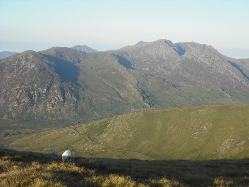
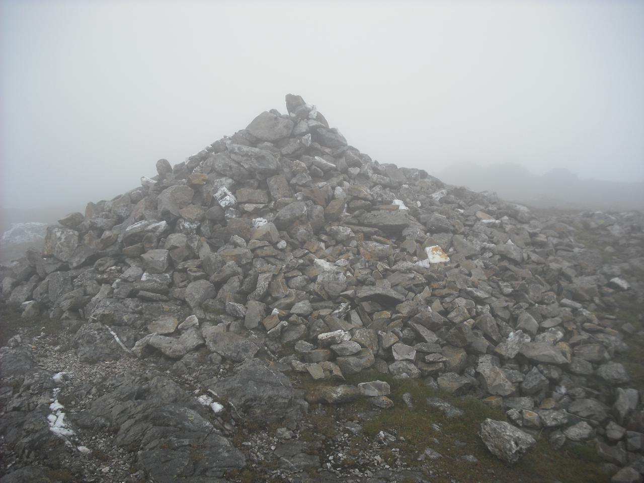
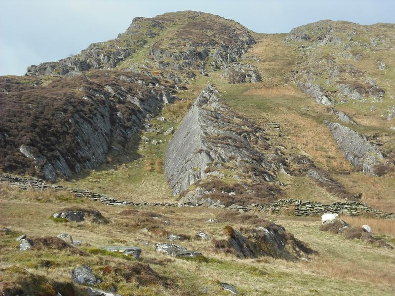
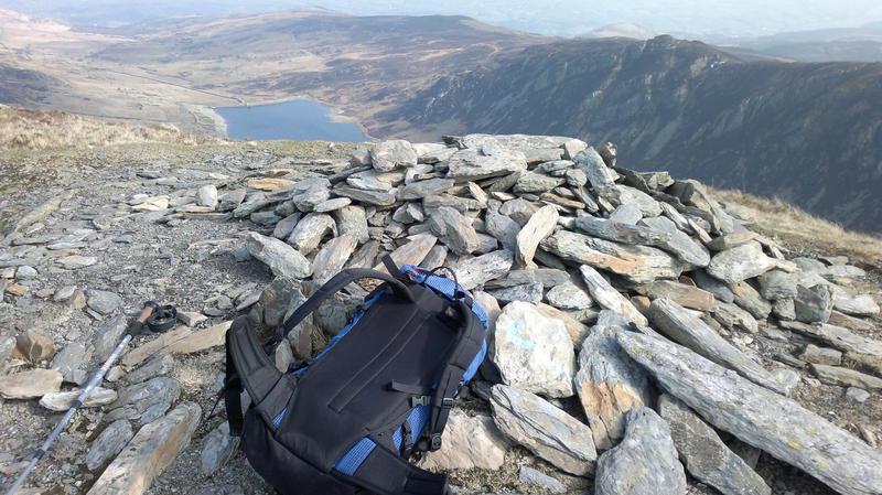
Gallt yr Ogof

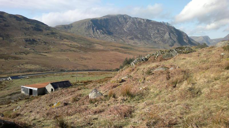
I packed the truck on Thursday night as I planned to make an early start. I dropped the children off to catch the school bus just after 7:30am and made my way over towards Capel Curig. As I dropped down from the A5104 towards Corwen I could see the predicted fog in the valley. Luckily, it was only a small patch and I soon ran into clearer weather.

I parked up behind Joe Browns in Capel Curig and began packing my sack. Amazingly I didn't seem to have forgotten anything, until I went to get my boots. In an instant Victor Meldrew moment, I realized that I had left them at home. Given the problems I have finding anything I like and the fact that I didn't need a new pair, I ruled out going into the shop to buy a new pair. I was wearing my Inov8 Roclite 295, which I often use on the mountains. As it was the beginning of March, the ground was going to be very wet and I don't really like getting wet feet. I didn't really have much choice, so I set off along Telford's old A5.

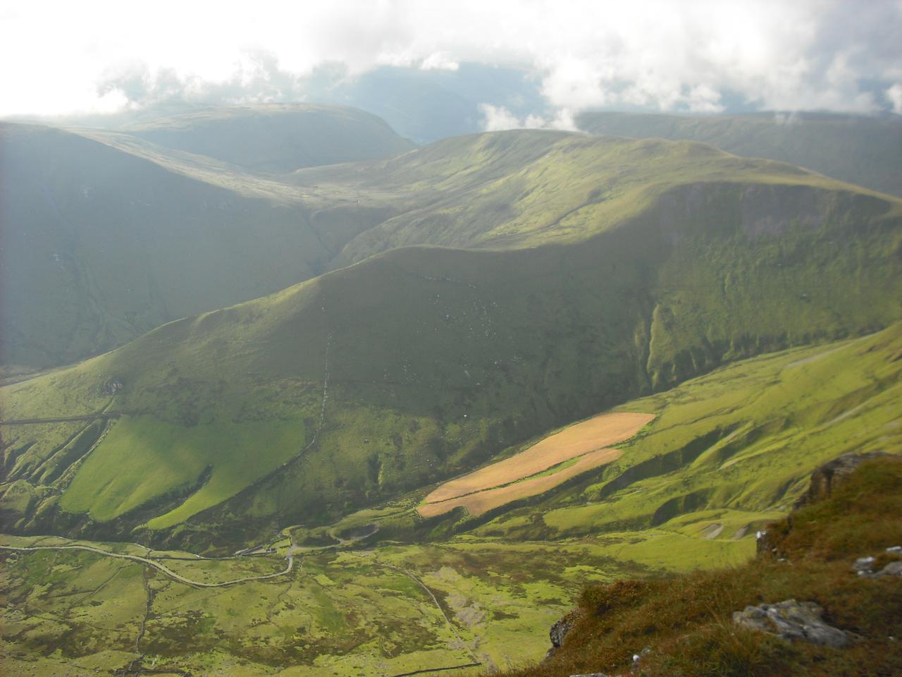
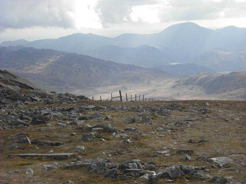
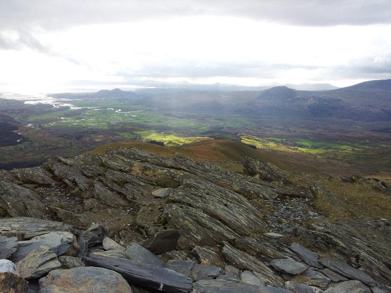
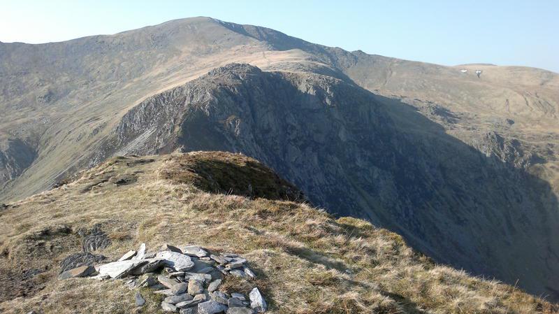
Cloud Clearing from Pen Llithrig y Wrach and Pen yr Helgi Du

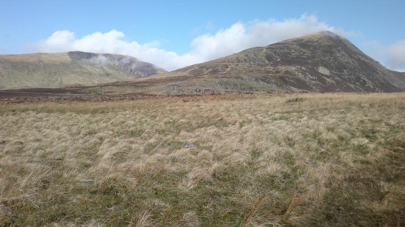
The plan was to repeat v-g's route over Pen Llithrig y Wrach and Pen yr Helgi Du. I am hopeless at estimating route times, but I was happy that I could make it back from the summit of Pen yr Helgi Du to the centre of Chester by twelve o'clock the next day. Thus the plan was to camp on the summit of Pen yr Helgi Du and make an early start on Saturday.

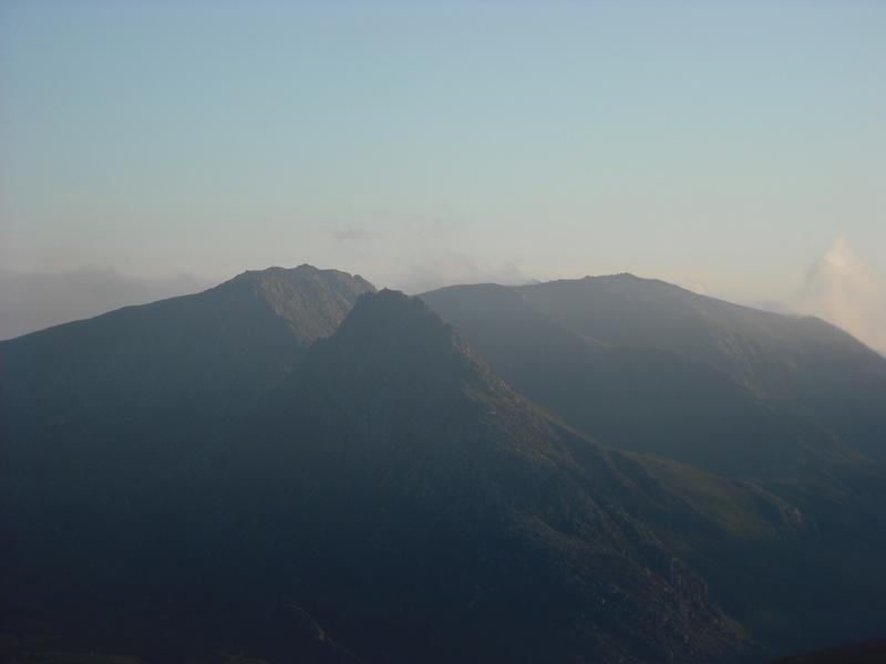
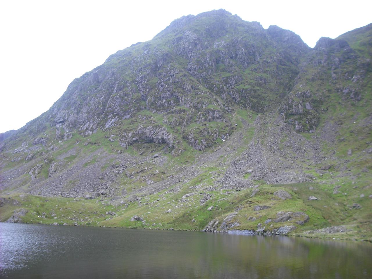
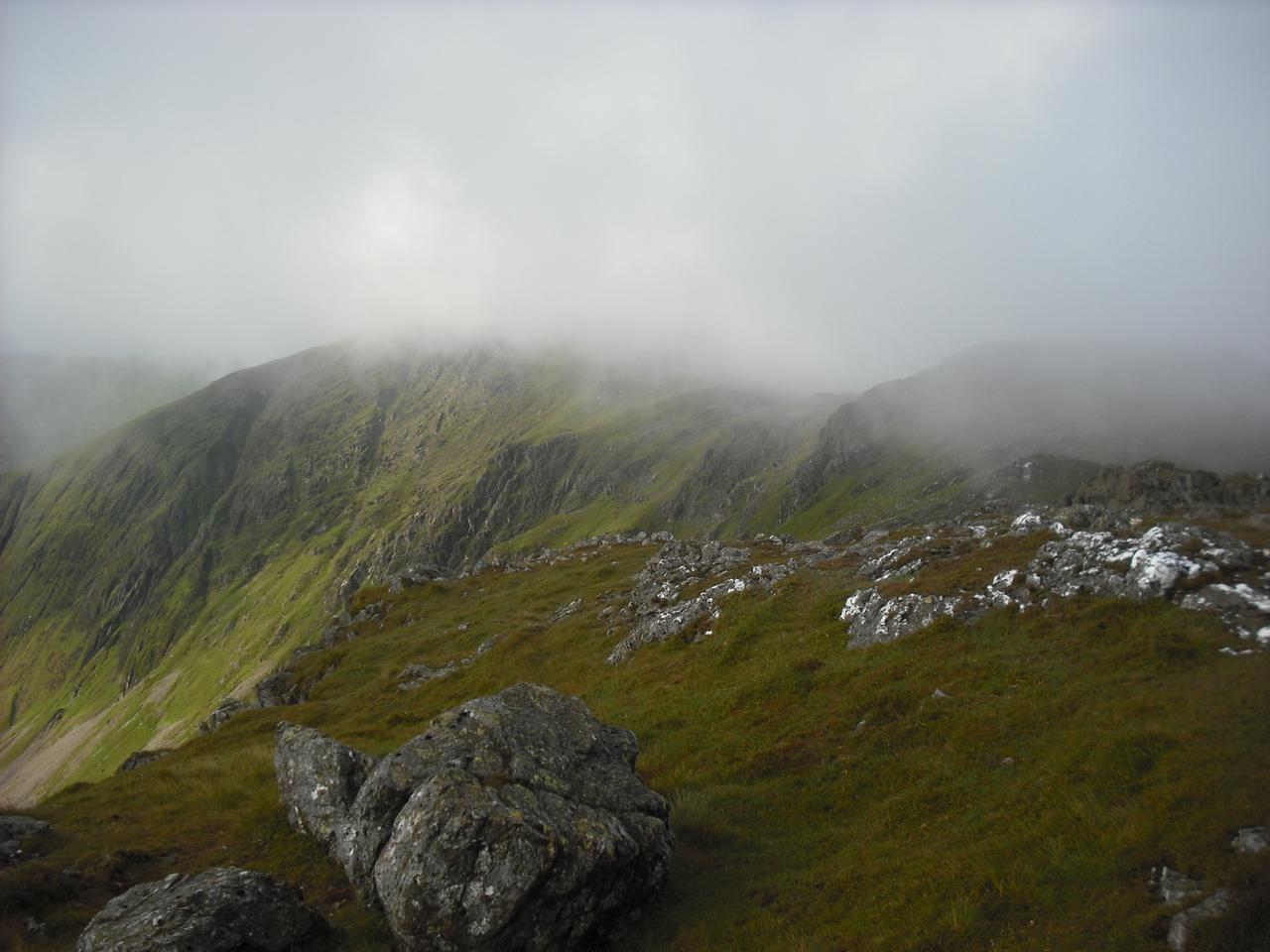
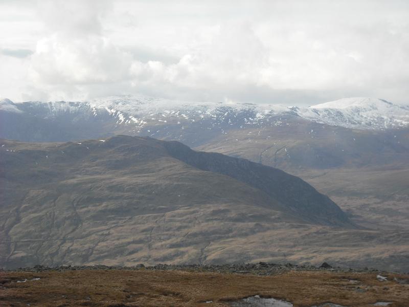
Tryfan and the Glyders

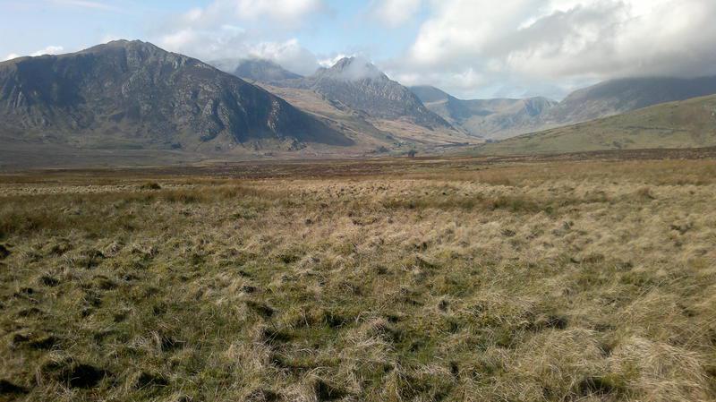
As I tramped down the road, MWIS was proving accurate and the clouds around the summits began to disperse. I crossed the A5 and began to climb up towards Llyn Colwyd. There were some wet areas, but by hopping about a bit I managed to keep my feet dry. I got the camera out to take some photos. I had checked the battery a couple of days ago, but in the intervening time Anne had been taking dozens of photos of stuff she wanted to sell on eBay. So when I switched the camera on the battery died immediately. Luckily, I had my phone, which has a reasonable camera.

Llyn Colwyd

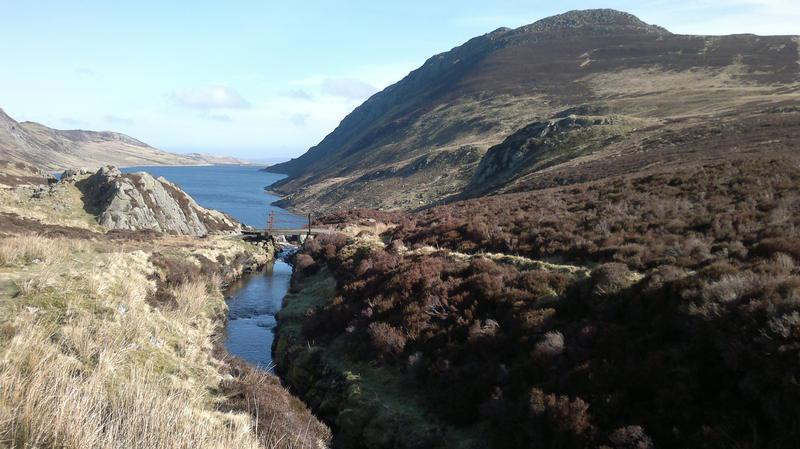
I stopped to fill my water bottles from the stream that runs down into the reservoir and began to make my way towards Pen Llithrig y 
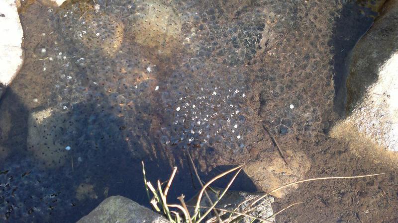
Wrach. On the way I noticed several big patches of frogspawn in pools on the path. I hope there aren't any severe frosts in the next few weeks.

Finding the start of the path up the south ridge of Pen Llithrig y Wrach was problematic. I chose a fairly direct route up the flank to join the ridge. Unfortunately, this involved crossing an area of quaking bog and my feet were soon soaked. No matter, it was a superb Spring morning with great views in all directions. I continued up steep grass and heather and I didn't really find the path until shortly below the summit plateau. It was then I spotted two people descending, who were actually on the path, so I joined it for the final hundred feet or so onto the plateau.

Frogspawn

I was planning to eat lunch at the summit, but there was a very cold breeze, so I munched on a Kit Kat while I descended towards Bwlch y Tri Marchog, where I found a sheltered spot to eat the other Kit Kat and some biscuits. Suitably fortified I began the slog up towards Pen yr Helgi Du.

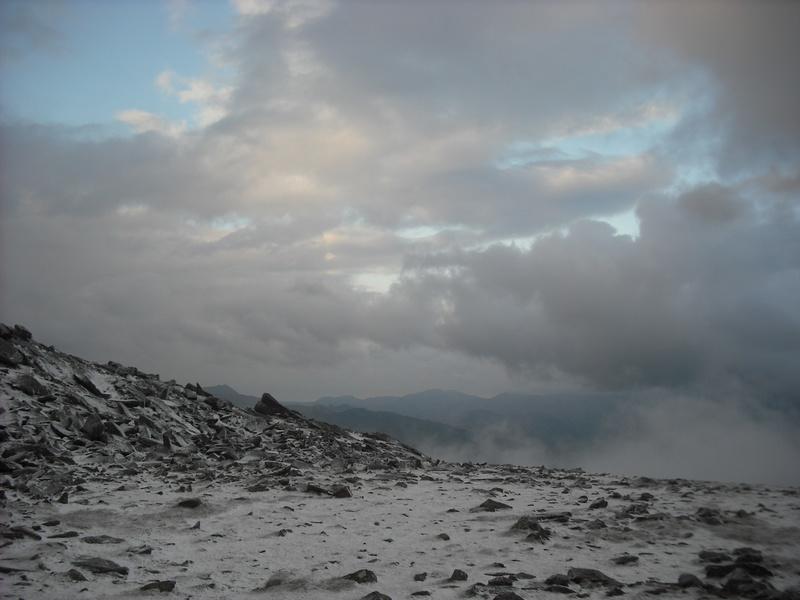
It was only about 1:30pm when I arrived at the summit and the whole of the Carneddau were bathed in the early afternoon sun. It was very tempting to carry on up towards Carnedd Llewelyn, but I knew if I did, I would have to make the early part of the descent in dark before dawn dark in order to get back to the car in time. As subsequent events proved, it was lucky that I decided not to carry on.
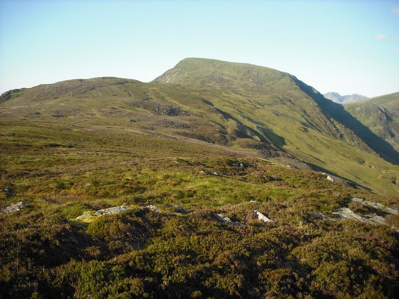
Pen Llithrig y Wrach

* *

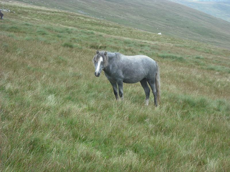
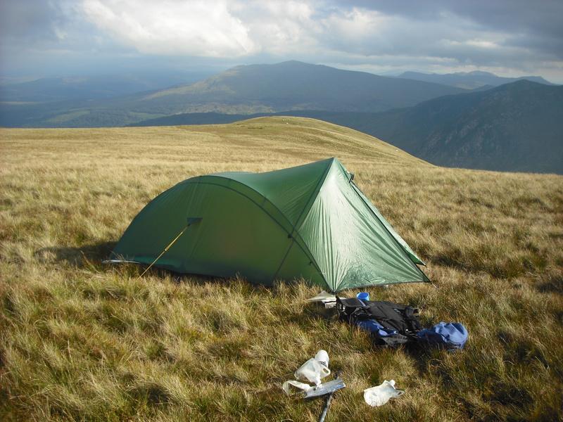
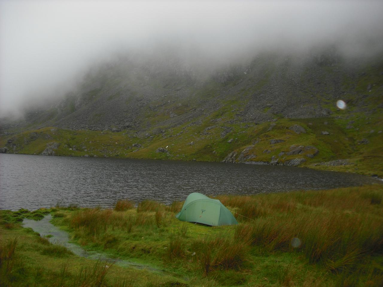
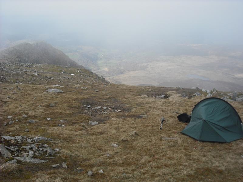
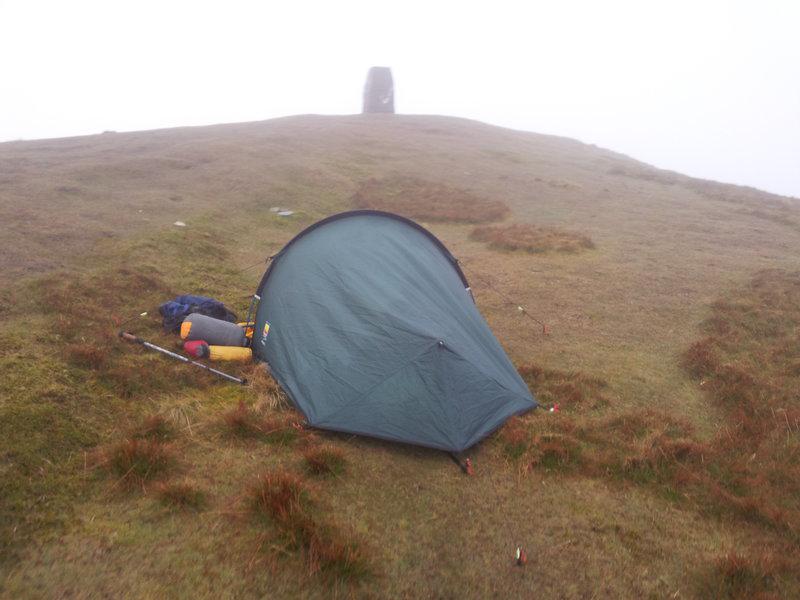
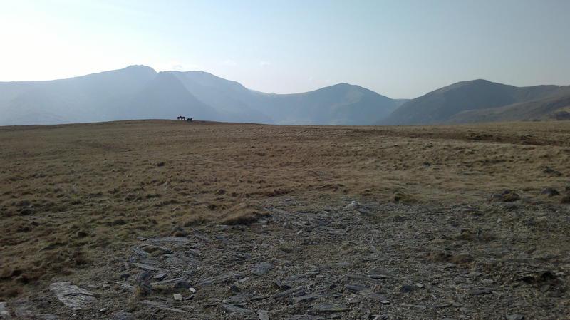
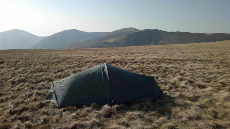
I pitched the tent near to the summit, while being watched by a group of wild ponies a few yards away. There was a bit of a breeze, but MWIS had predicted that there would be very little wind for the rest of today or on the Saturday morning. Once I had pitched the tent, I made up a Bewell hot porridge and sultanas and drank a big mug of hot chocolate. I spent the rest of the afternoon wandering round the summit area and enjoying the afternoon sun. Wandering towards a pool I saw what looked like a cairn. It seemed a funny colour and as there were no rocks nearby and I wondered why someone had bothered to build it there. When I got closer I realized that it was a pile of horse dung, in a perfect cairn shape.
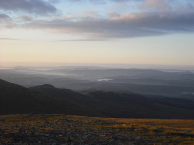
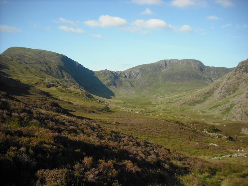
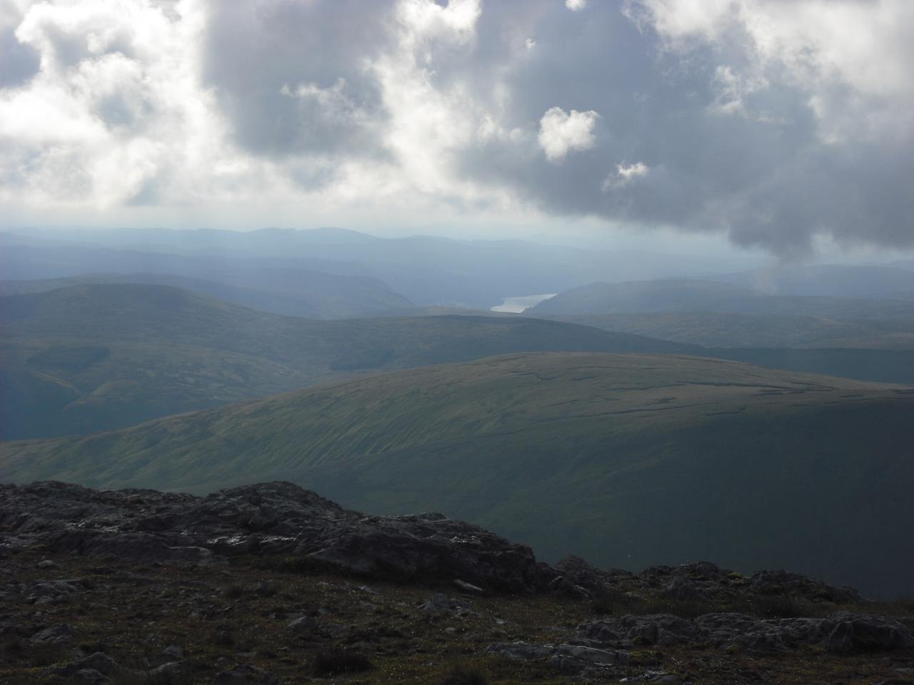
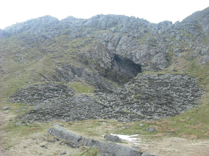
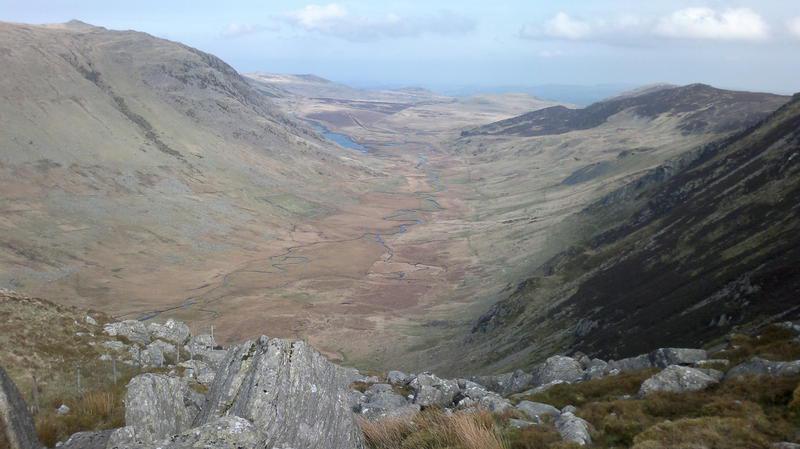
Cwm Eigiau

Often I arrive at the place where I am going to pitch my tent just before it goes dark and rush to get everything set up. So it was a real pleasure to have plenty of time to mooch about. I saw no one on the main Carneddau ridge and only two people Pen yr Helgi Du. Just 
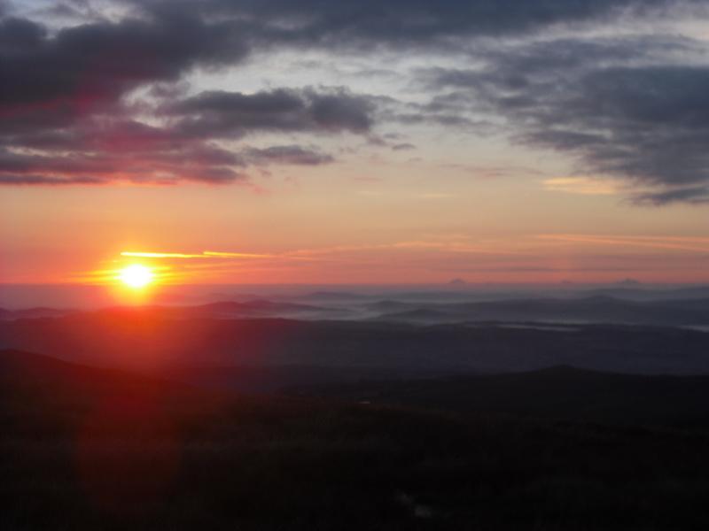
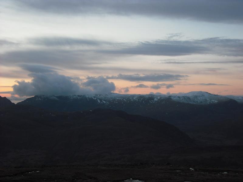
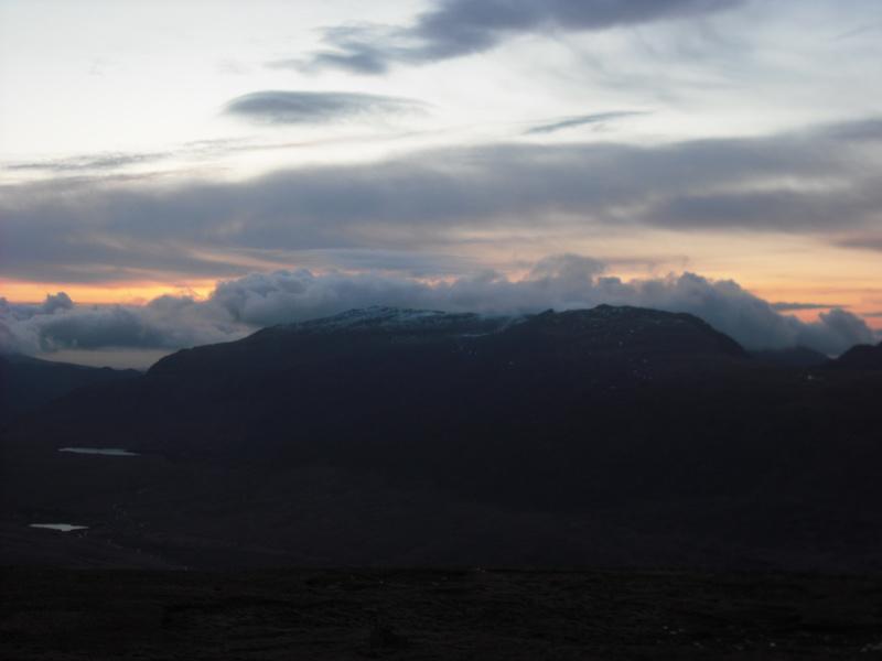
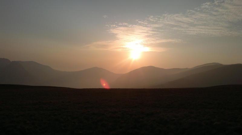
before 6:00pm I was treated to a spectacular sunset over Carnedd Dafydd.

I settled down in the tent to read on my Kindle and catch up with some podcasts. MWIS had predicted cloudy summits, but minimal wind and no precipitation for the next morning. Sure enough when I looked out of the tent later on the mist had come down.

Wild Ponies in the Distance

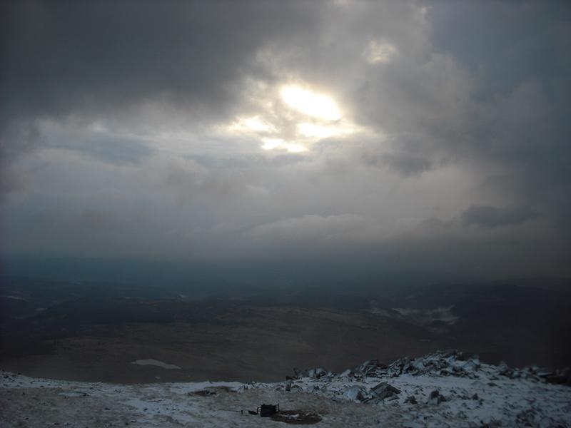
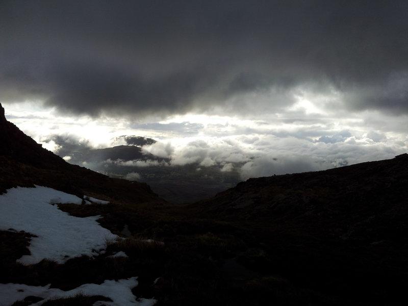
Sometime in the early hours of the morning, the wind got up and there was a heavy shower. As the night wore on the showers became more frequent and by 4:00am it was raining continuously. At 6:00am, in the pre-dawn light I decided that the best thing to do was to bail and return to the valley for some breakfast. I had a quick cup of hot chocolate and some biscuits and packed away the contents of the tent into my rucksack.

Zephyros on Pen yr Helgi Du

It was time to go outside. I only had my shirt, a Rab Generator pullon and my Marmot LiteSpeed, plus Mammut Base Jump trews. I pulled my Lowe Alpine hat down hard to stop it blowing away and got out of the tent. Outside the rain was just at the point where it begins to fall as sleet. Inside the tent it didn't sound too windy, but outside the rain was being blown in sheets. I collapsed the tent as fast as possible and stuffed the bits into my sack. Much as I like my Zephyros, the short vertical poles really get in the way when you want to pack it quickly. Within a couple of minutes I was completely soaked and starting to feel cold.

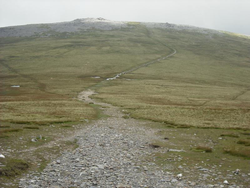
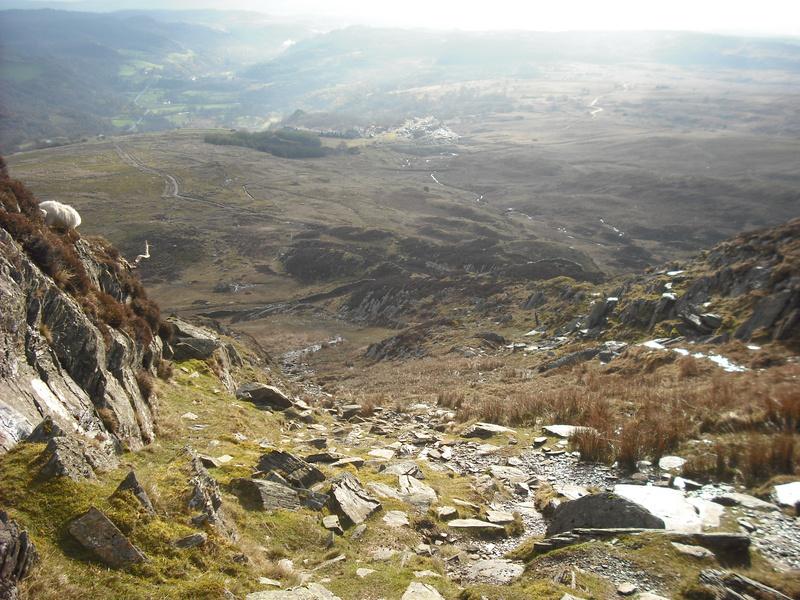
Luckily, the long south ridge of Pen yr Helgi Du is easy to navigate. I was just warm enough when I was moving, but had it been a few degrees colder it would have been very unpleasant. I was relieved that I hadn't decided to continue up to the summit of Carnedd Llewelyn the previous afternoon. Finally I dropped out of the clag and could see the valley below me. I hadn't really planned my descent, thinking that I could cut across back towards Llyn Colwyd and reverse my route of ascent.

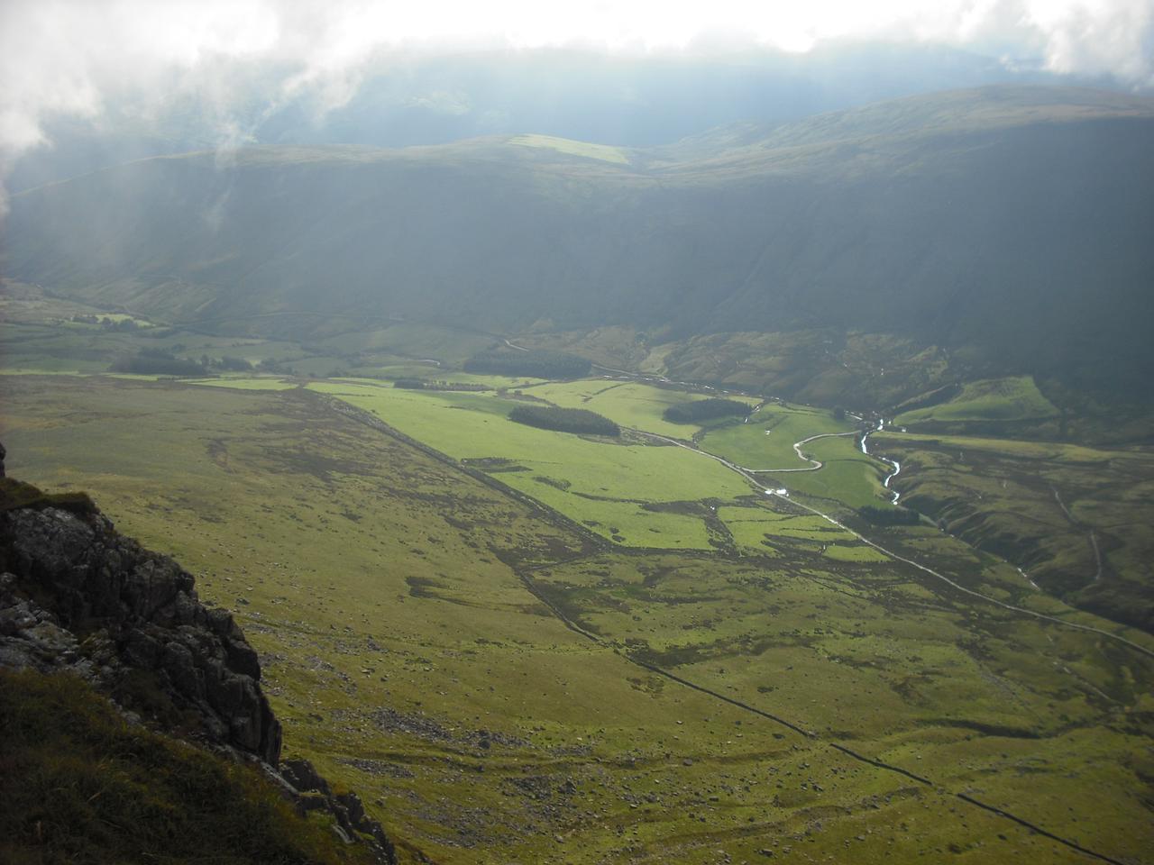
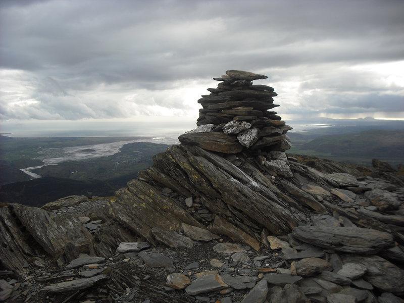
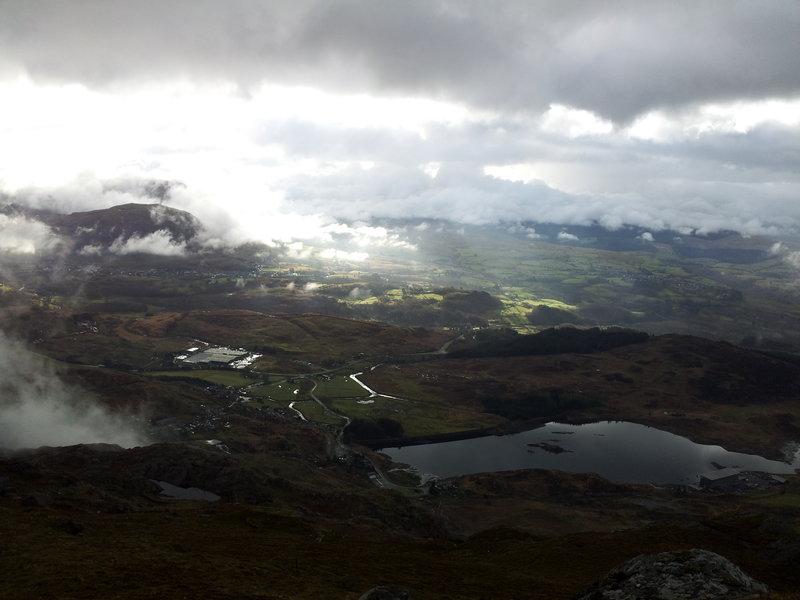
Craig yr Ysfa and Carnedd Llewelyn

However, I was now operating Plan "B" - get down to the road as fast as possible. It turns out that this was exactly the route followed by v-g. My main concern was how to cross the stream, so I could get back on the old A5, without going all the way down the road to the camp site. However, when I emerged onto the main A5 opposite Helyg, there was an obvious path with a couple of bridges to get over the stream and back onto the old road.

I arrived back in Capel Curig about 9:15am. As soon as I stopped walking I began to feel very, very cold. The car park was fairly crowded with people setting off for the day, but I just wanted to get into some dry stuff as fast as possible. I stripped off behind the truck and put on my dry clothes. Several old ladies fainted and the rest of the crowd grinned.

Sunset over Carnedd Dafydd

Once inside the truck, with dry clothes on, I still couldn't get warm, even with the heater on the "Chernobyl Meltdown" setting. I realized that in the last 24hrs I had only eaten two tea cakes, two Kit Kats, some porridge and half a packet of biscuits. The problem was lack of food, so I put the truck on auto-pilot and set off for Pete's Eats. After a large breakfast, I felt much better and I even made it to Chester just before midday.

I learnt a couple of things from the trip. First I don't mind wet feet anything like as much as I though I did. In fact most of the time they didn't feel wet, although my socks were still damp. I might try walking in trail shoes and giving up boots completely. Second, although I could have completed the trip as a day walk and avoided getting soaked, I really enjoyed the time I spent just mooching about near to the tent. As the days get longer, I would like to plan some trips where I spend less time walking and more time relaxing around the tent.